 An official website of the United States government.
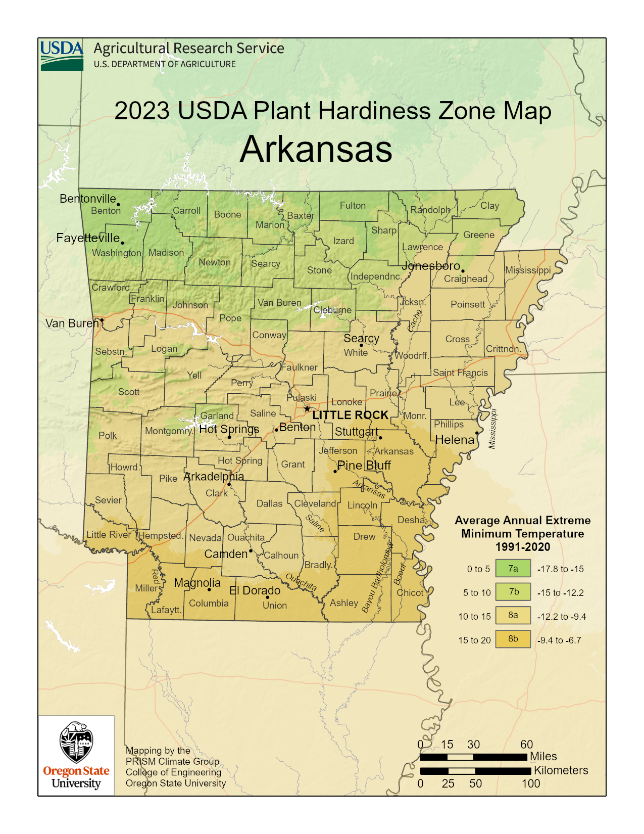
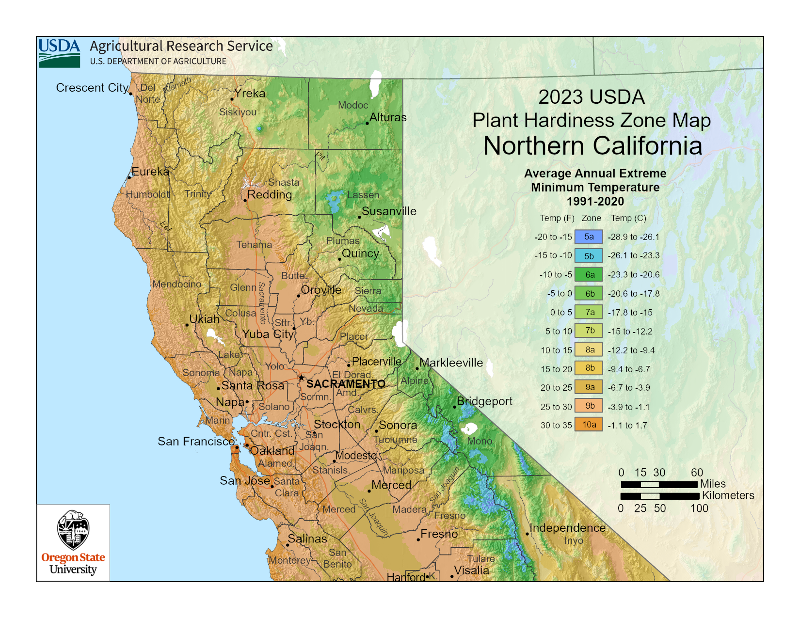
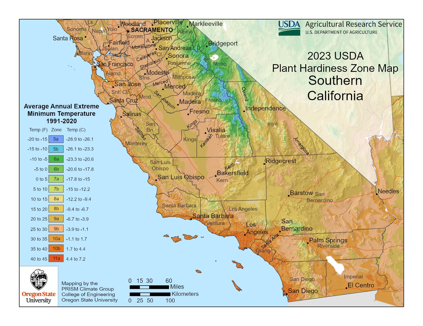
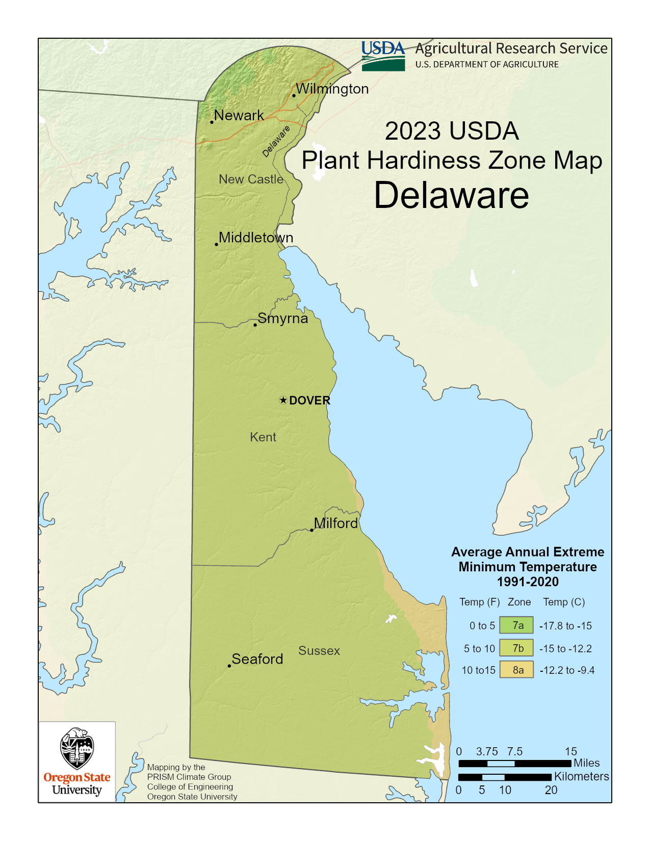
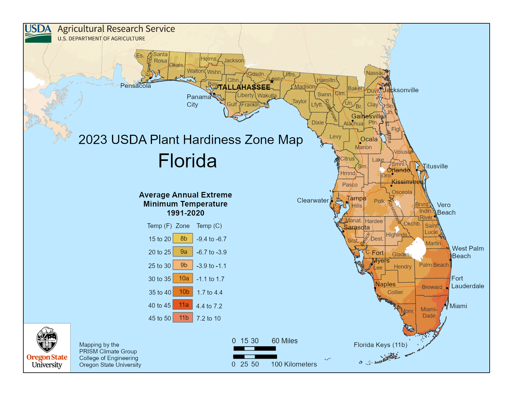
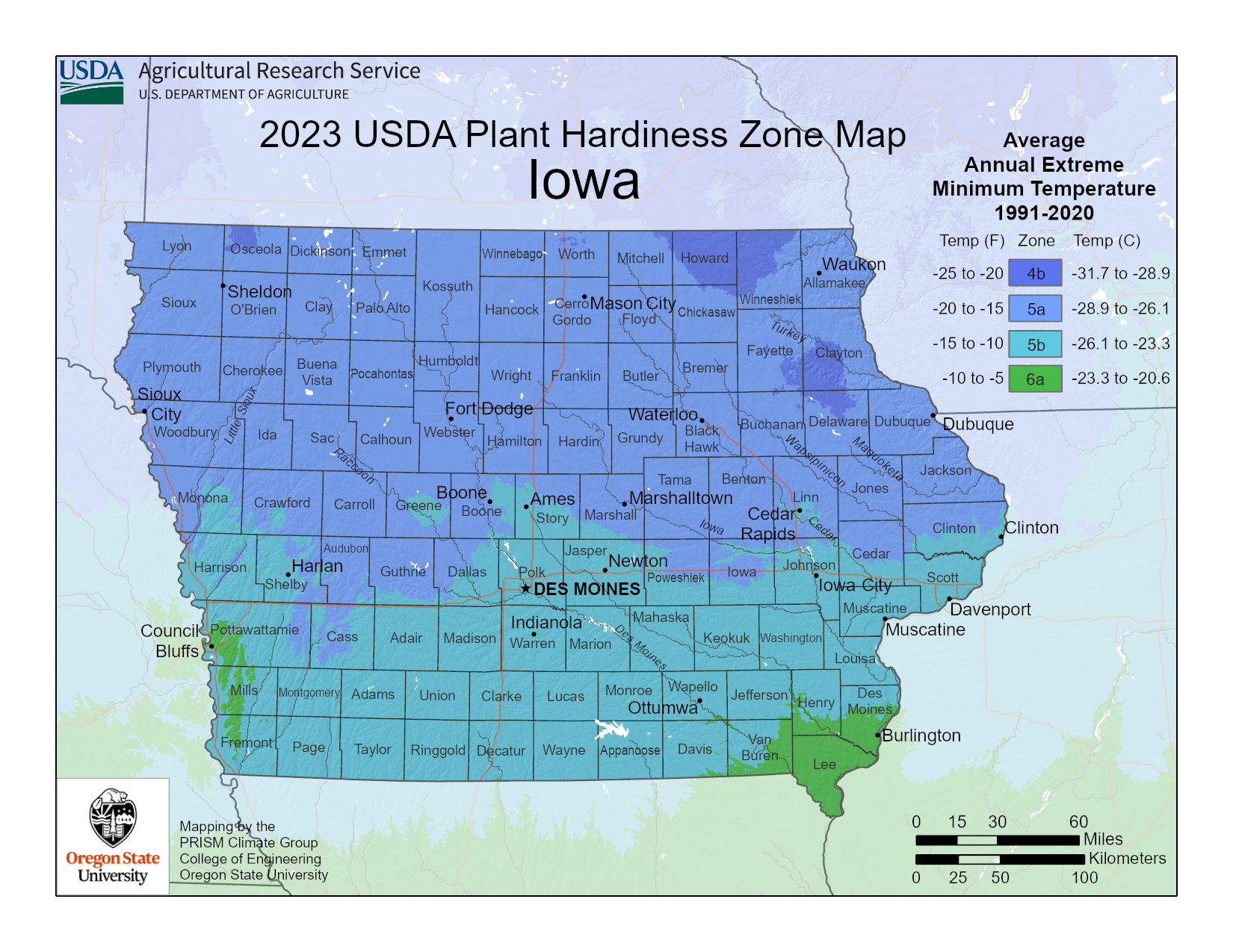
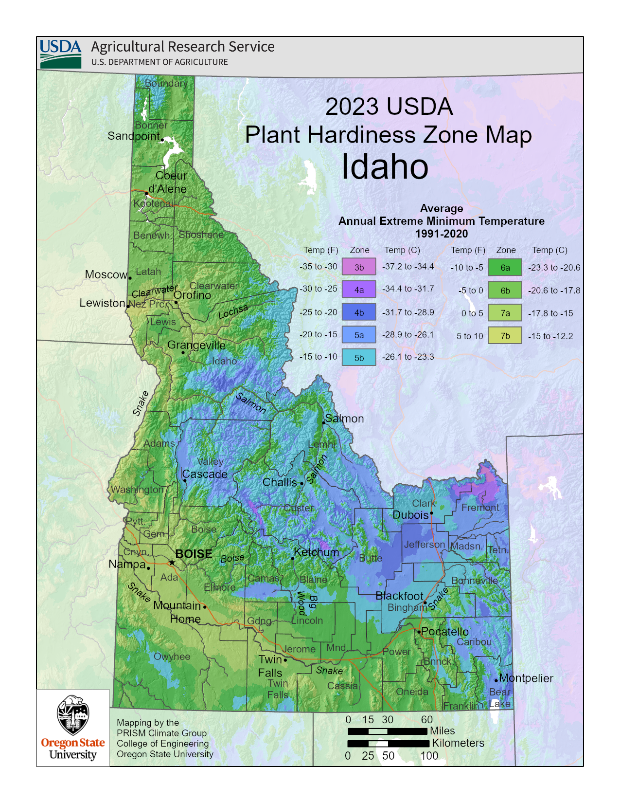
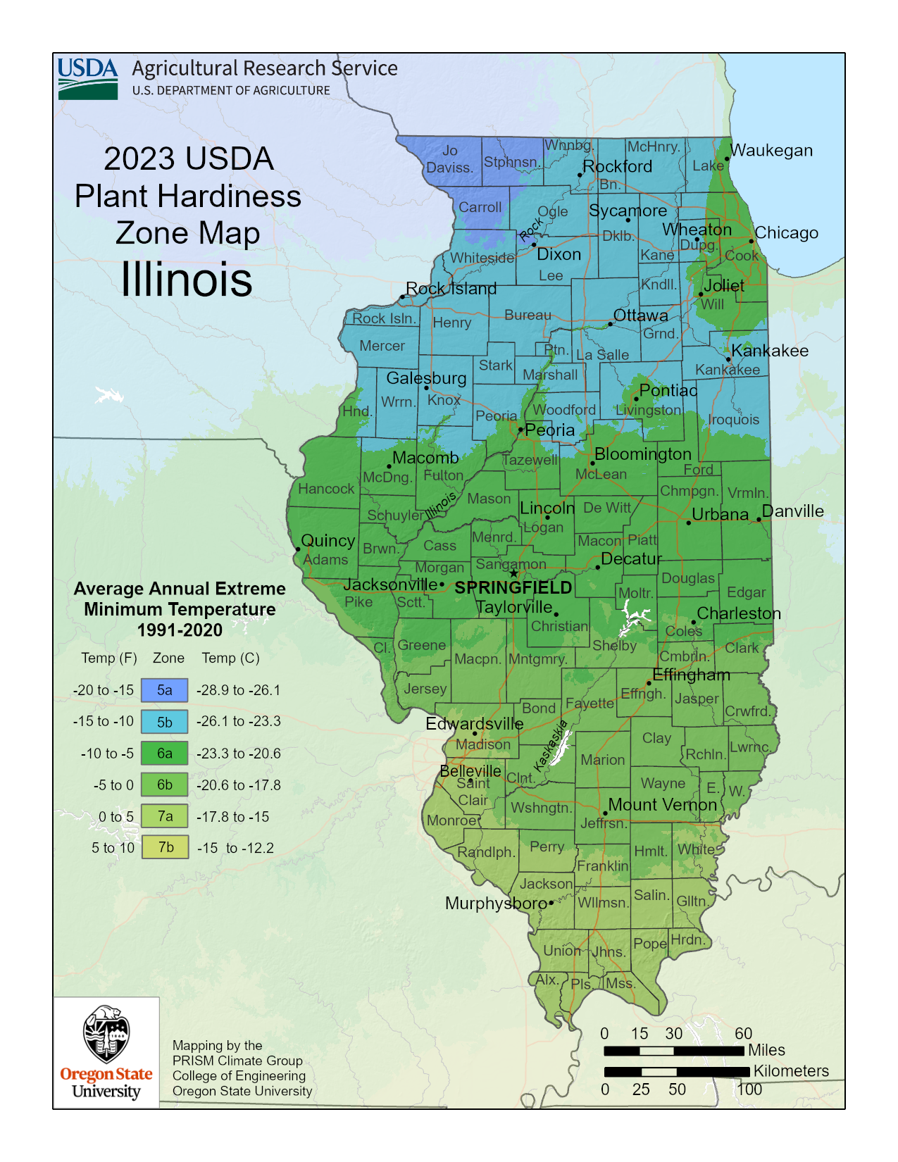
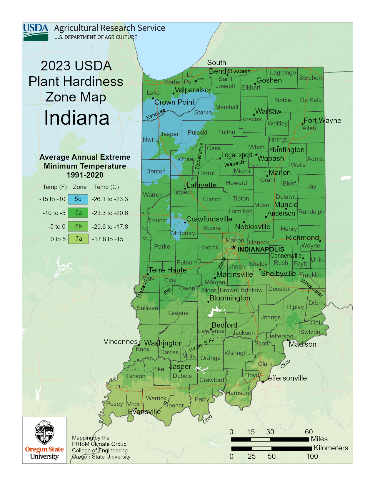
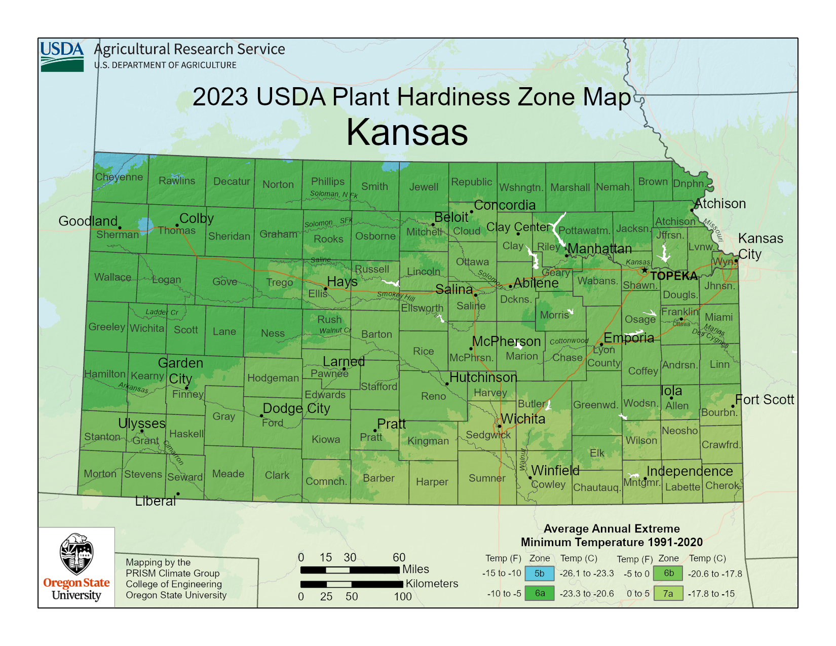
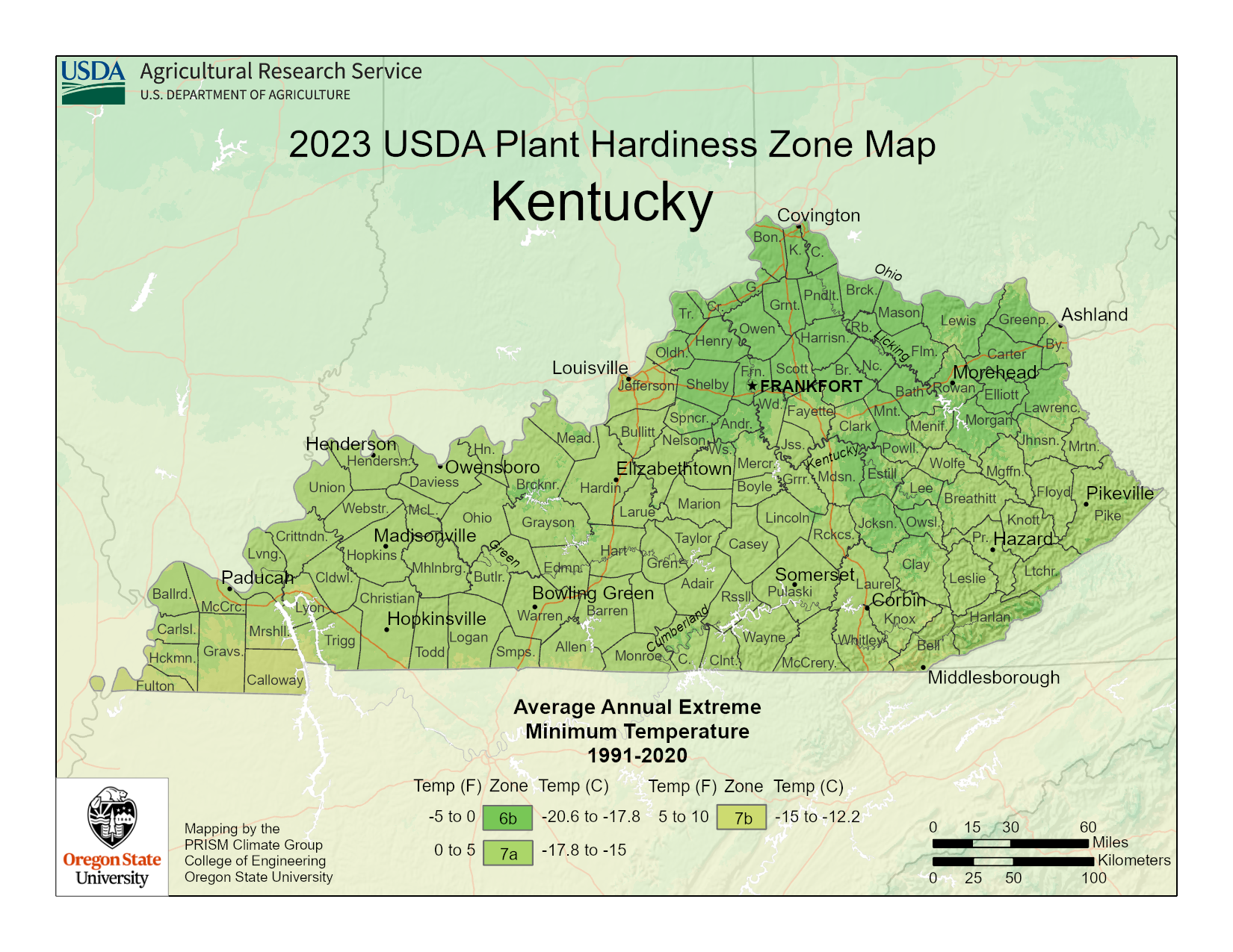
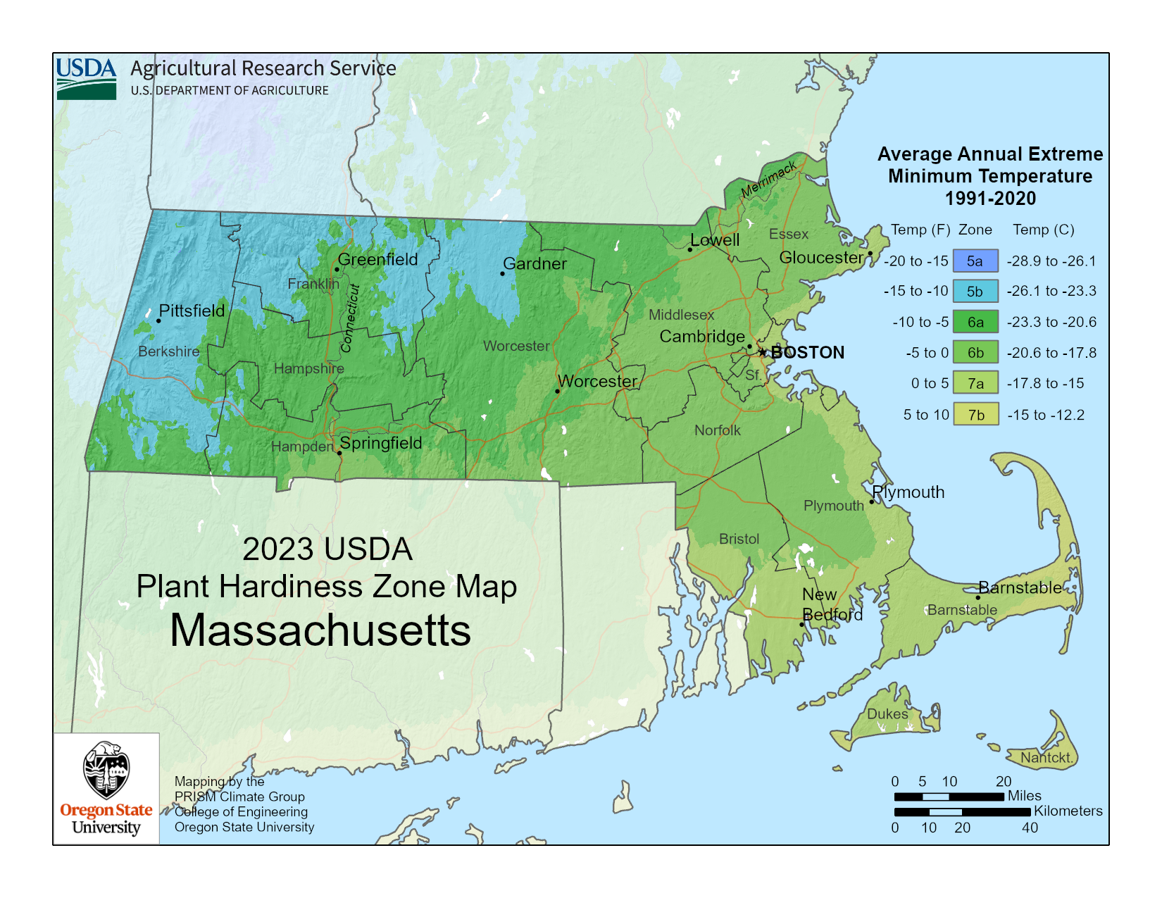
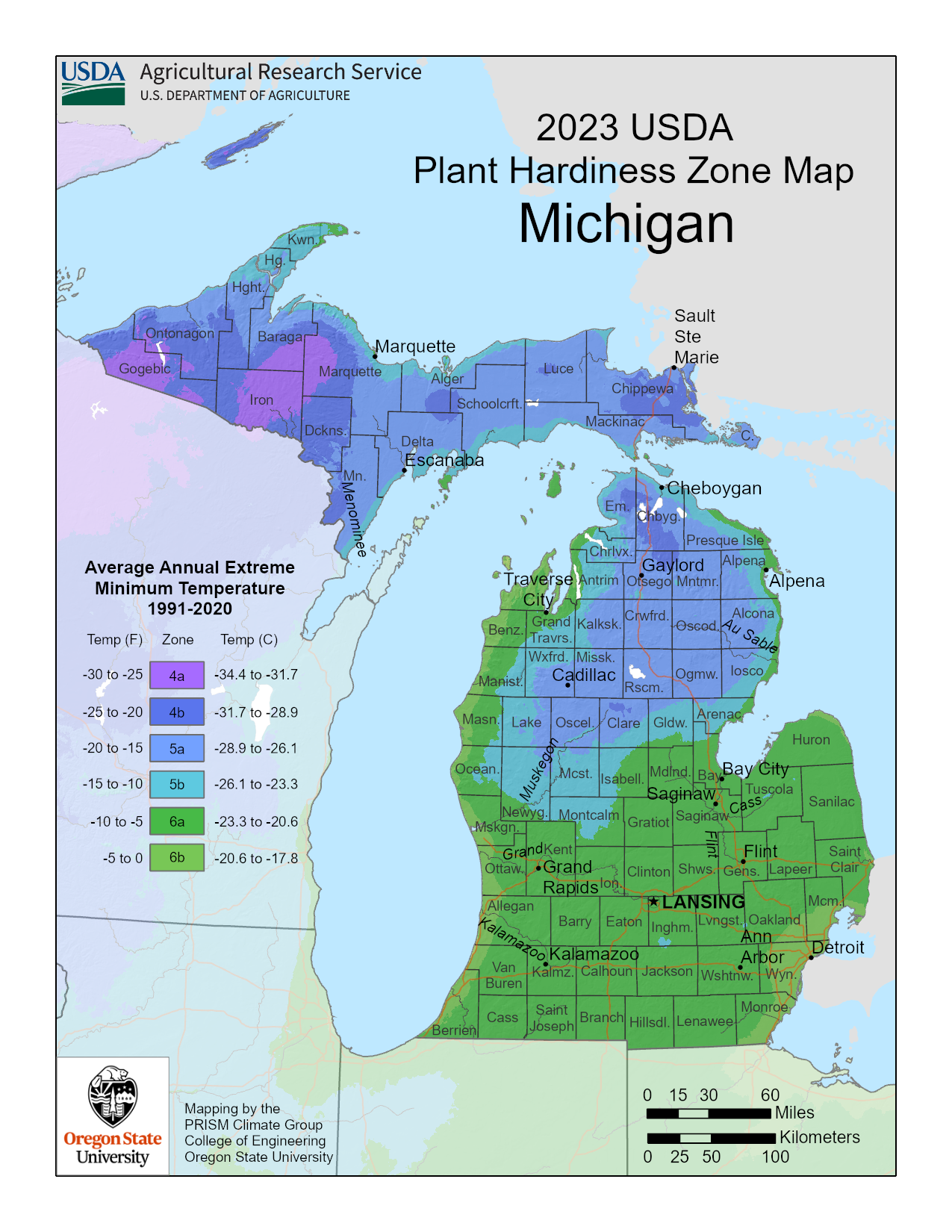
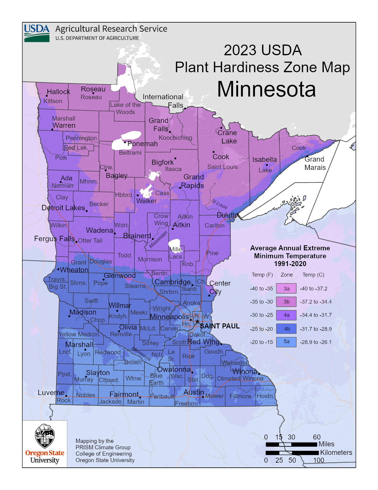
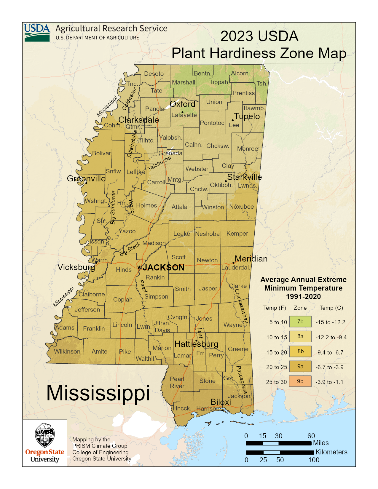
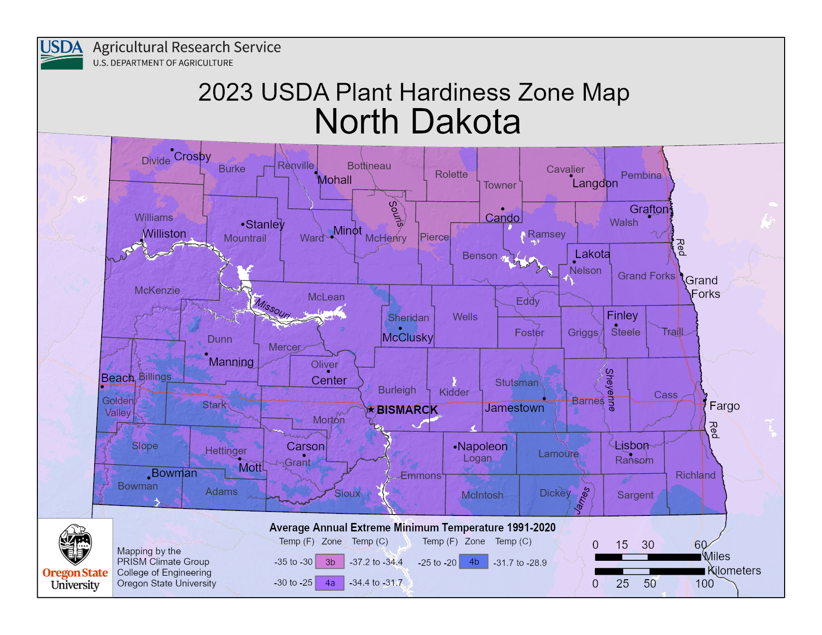
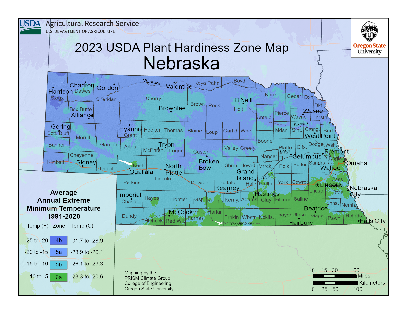
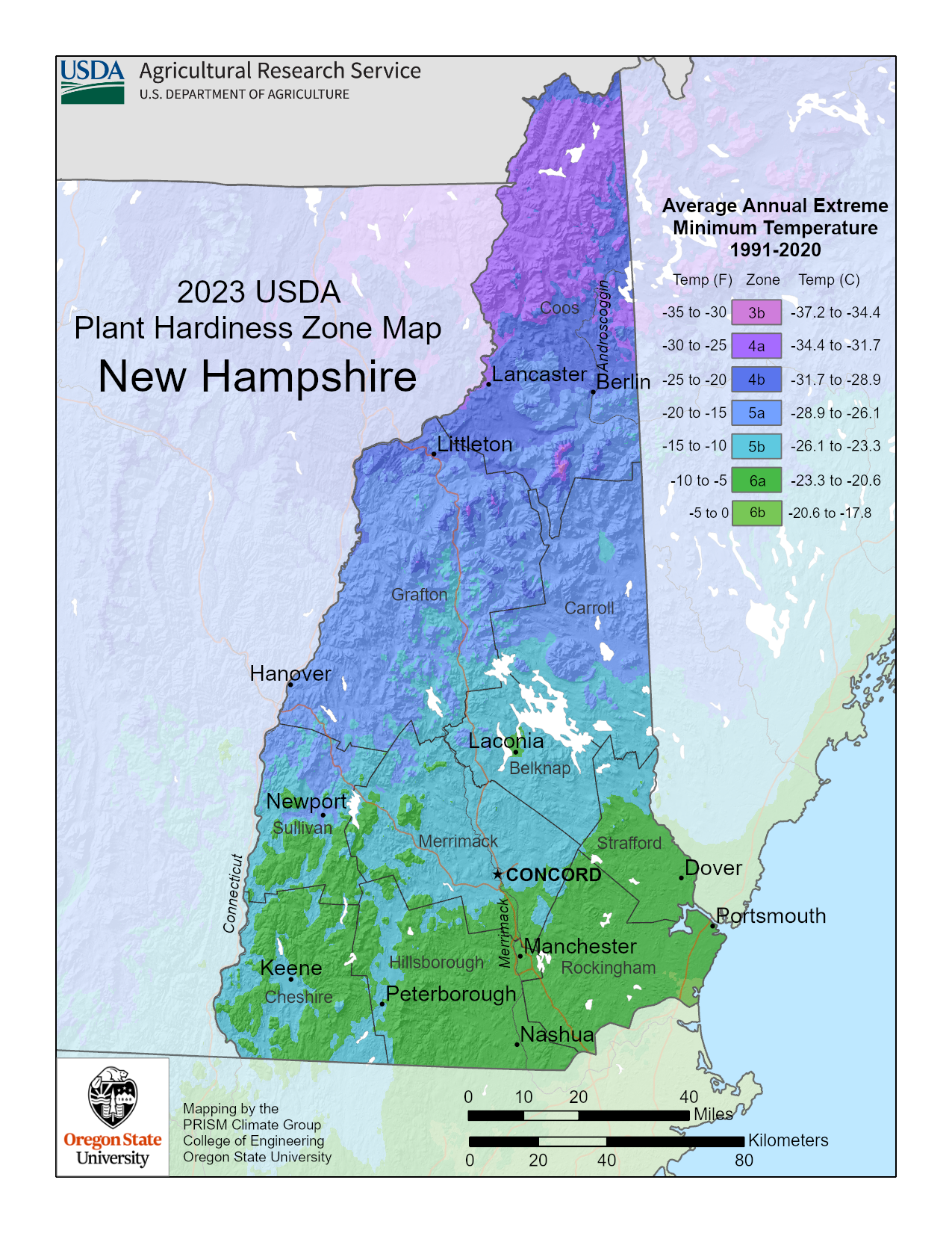
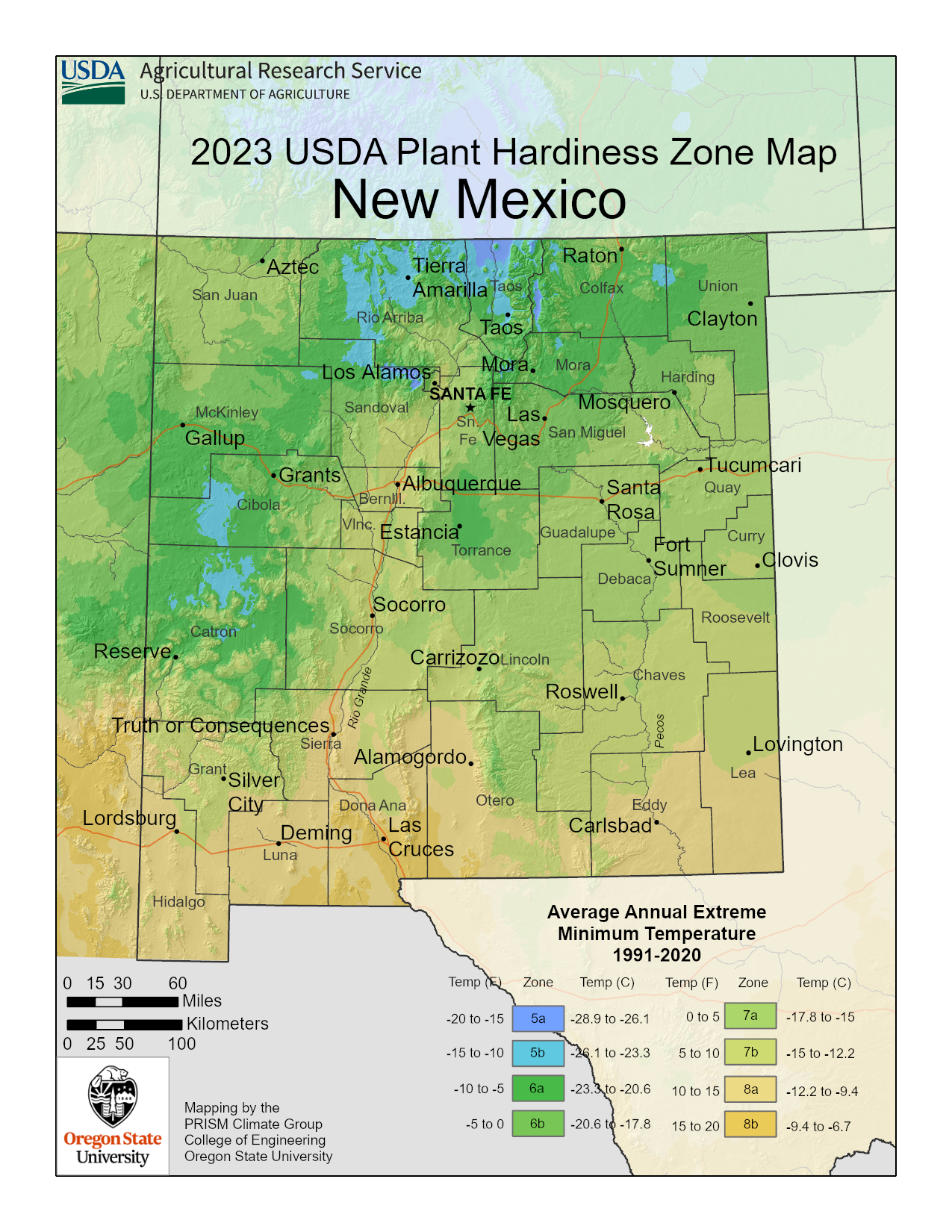
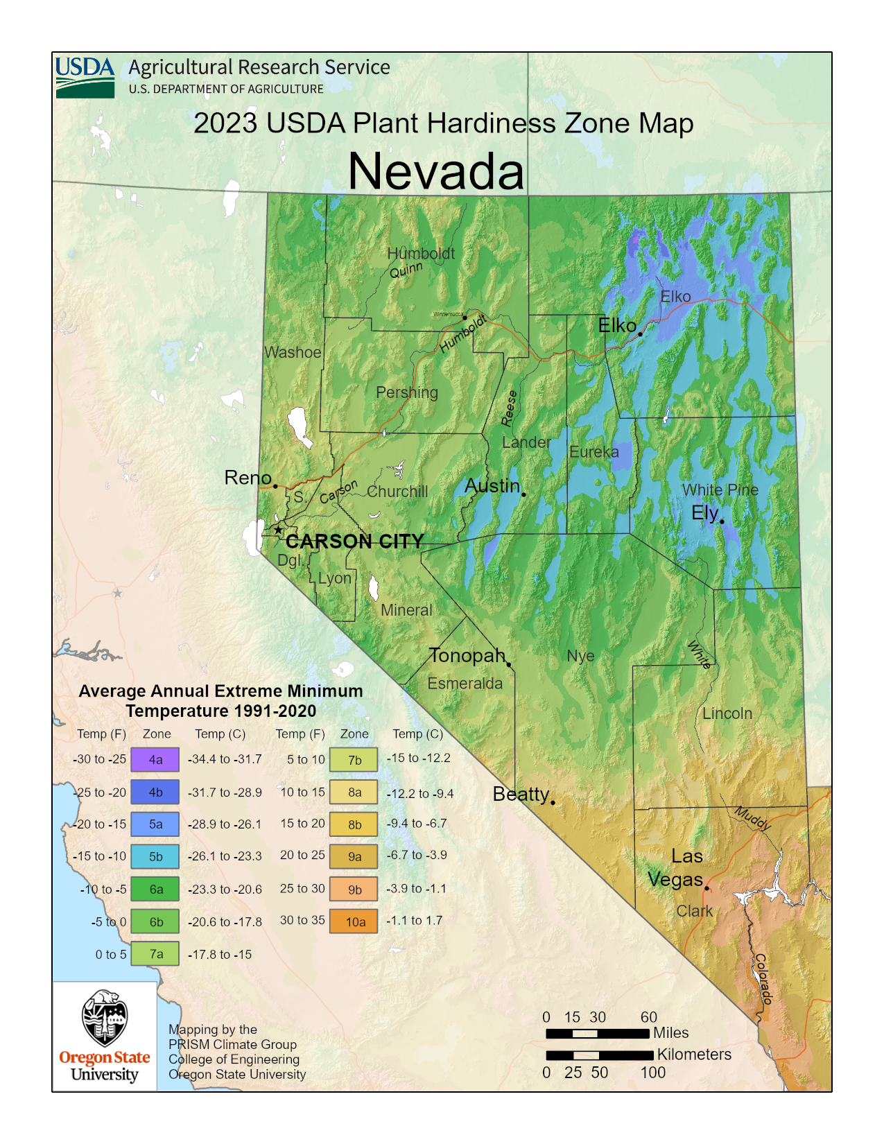
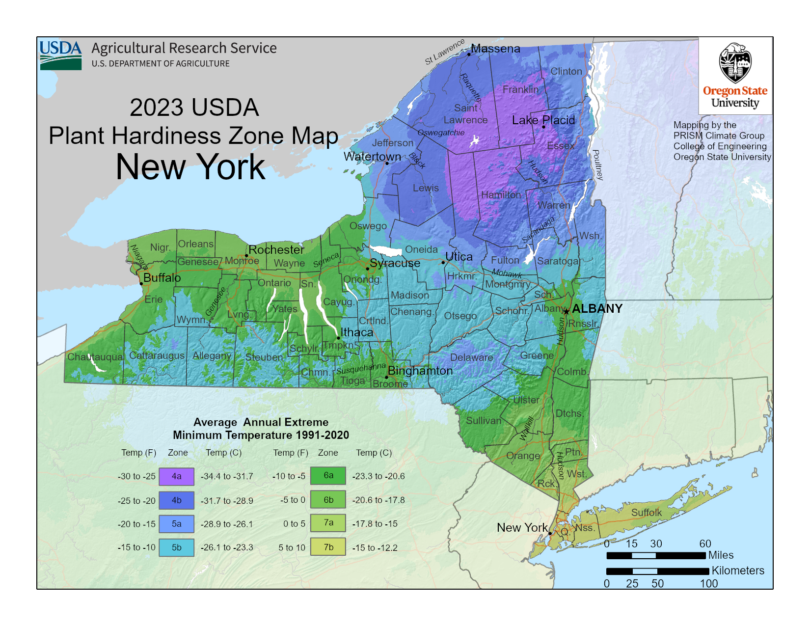
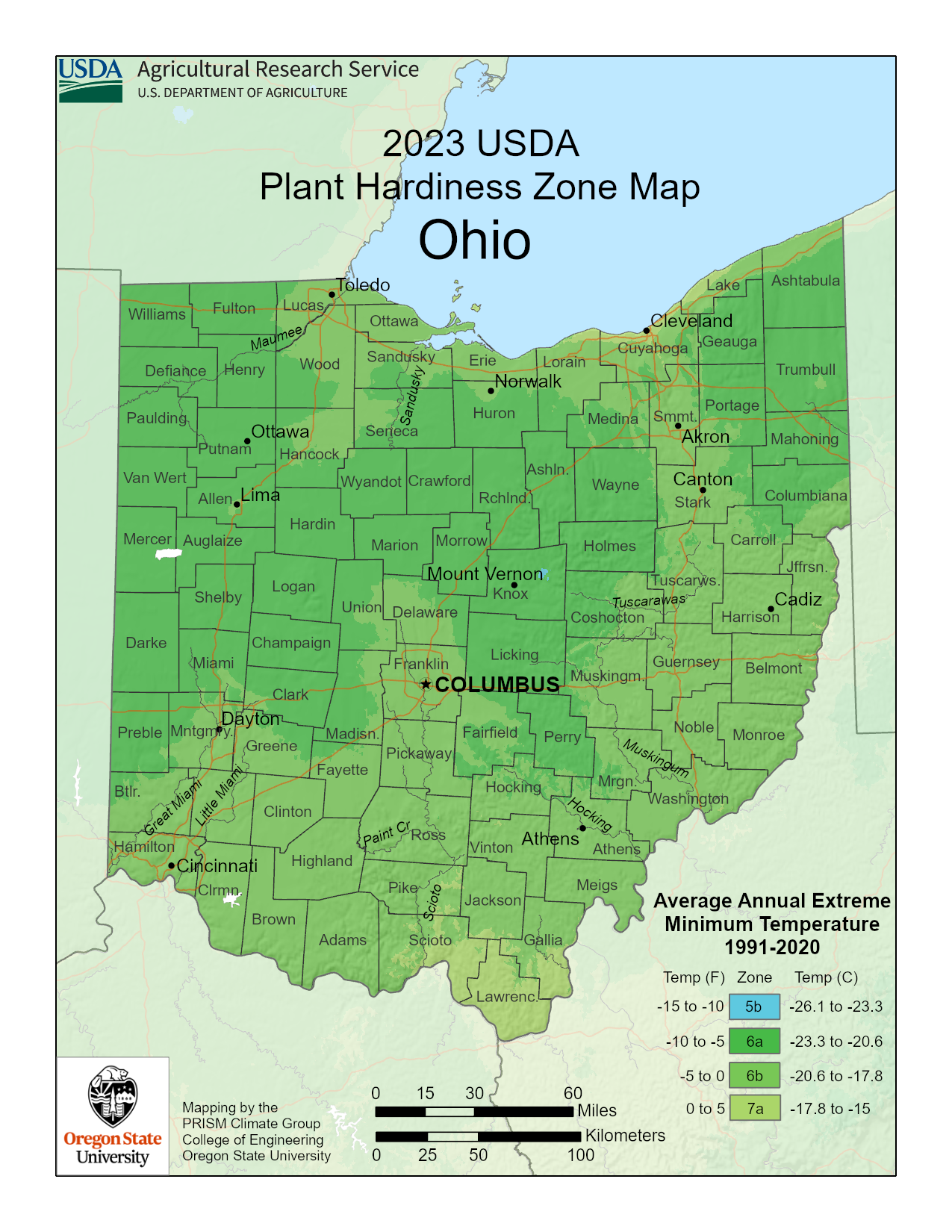
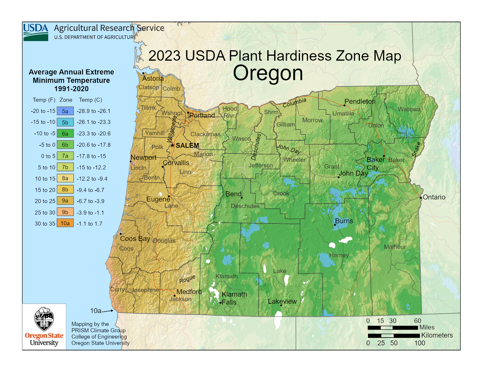
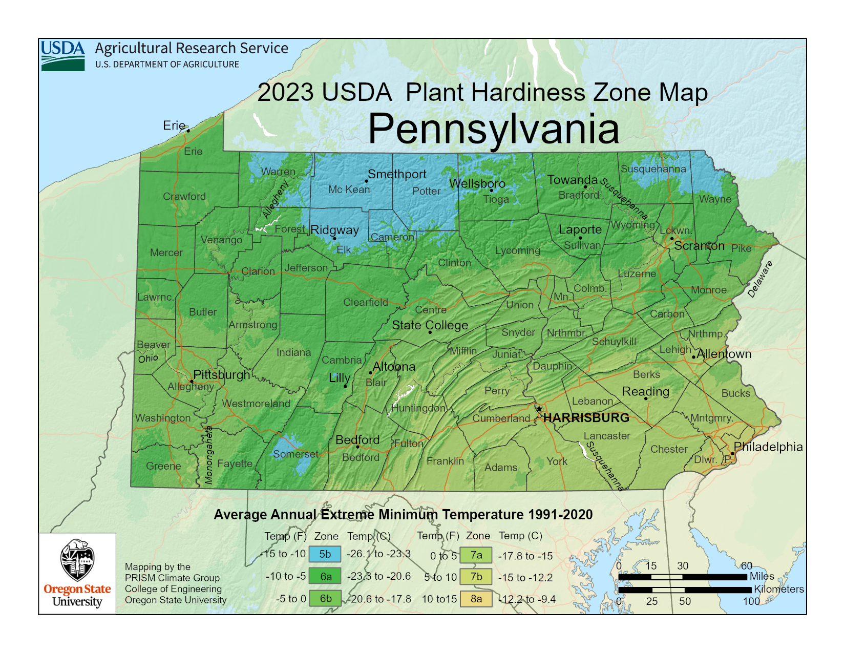
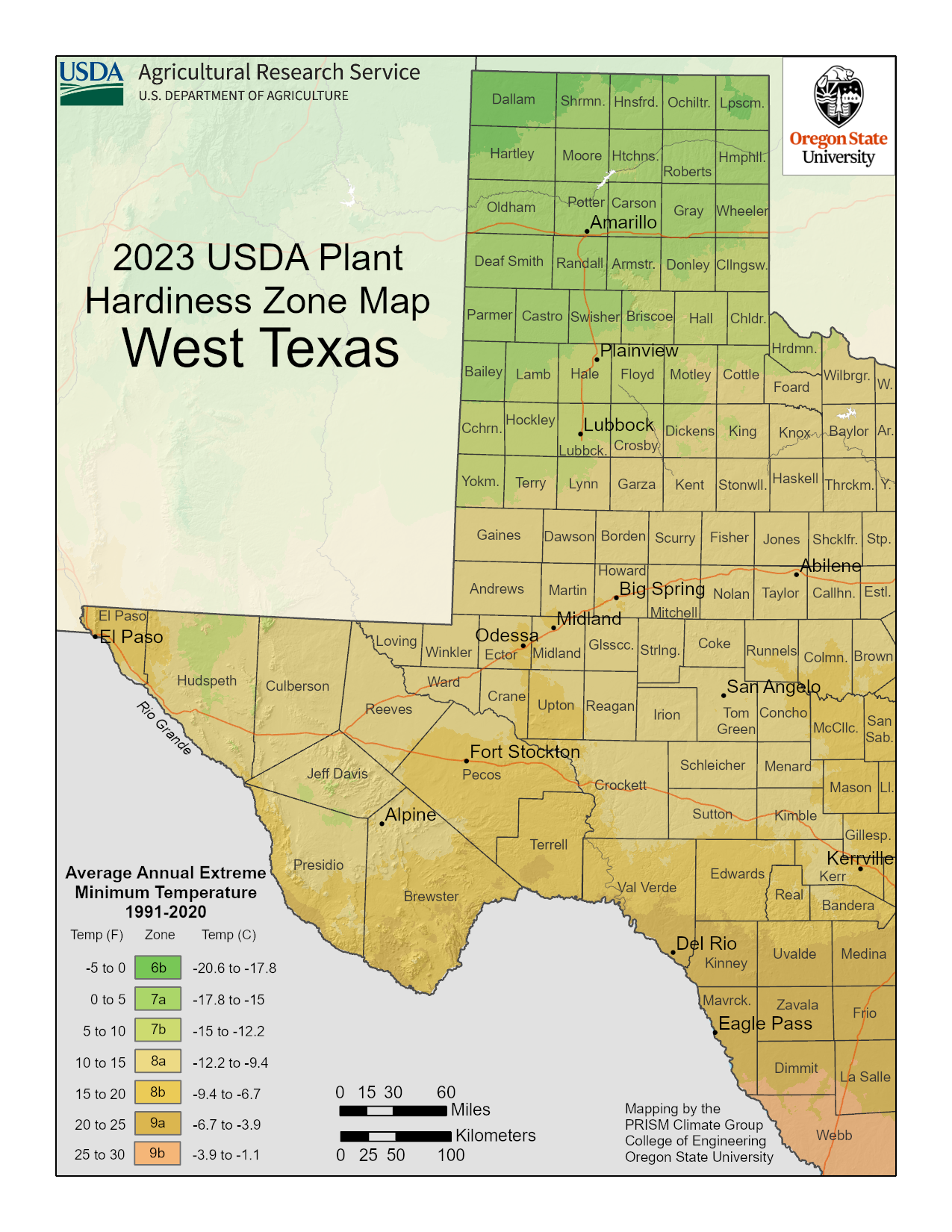
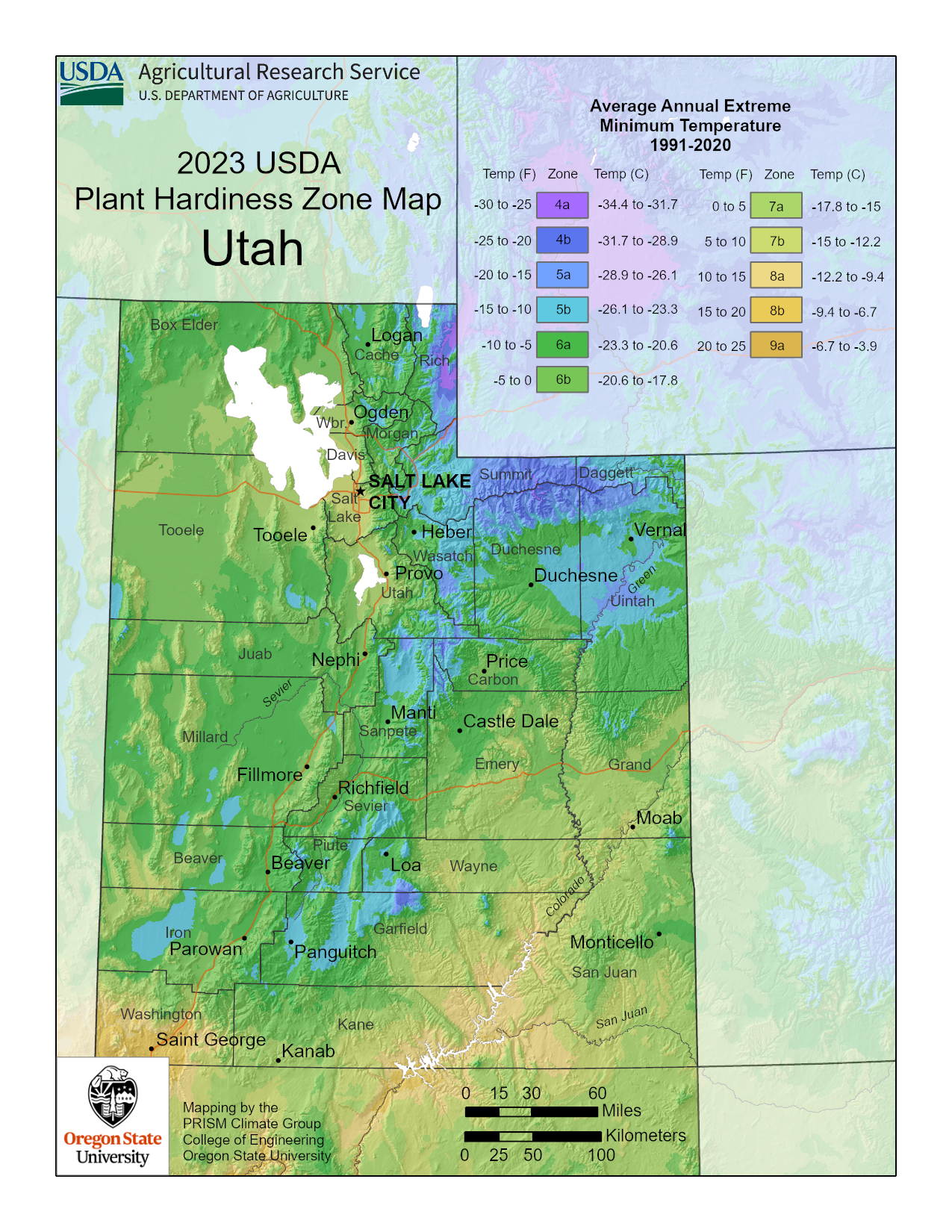
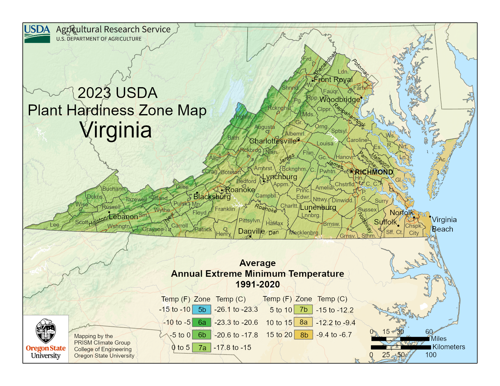
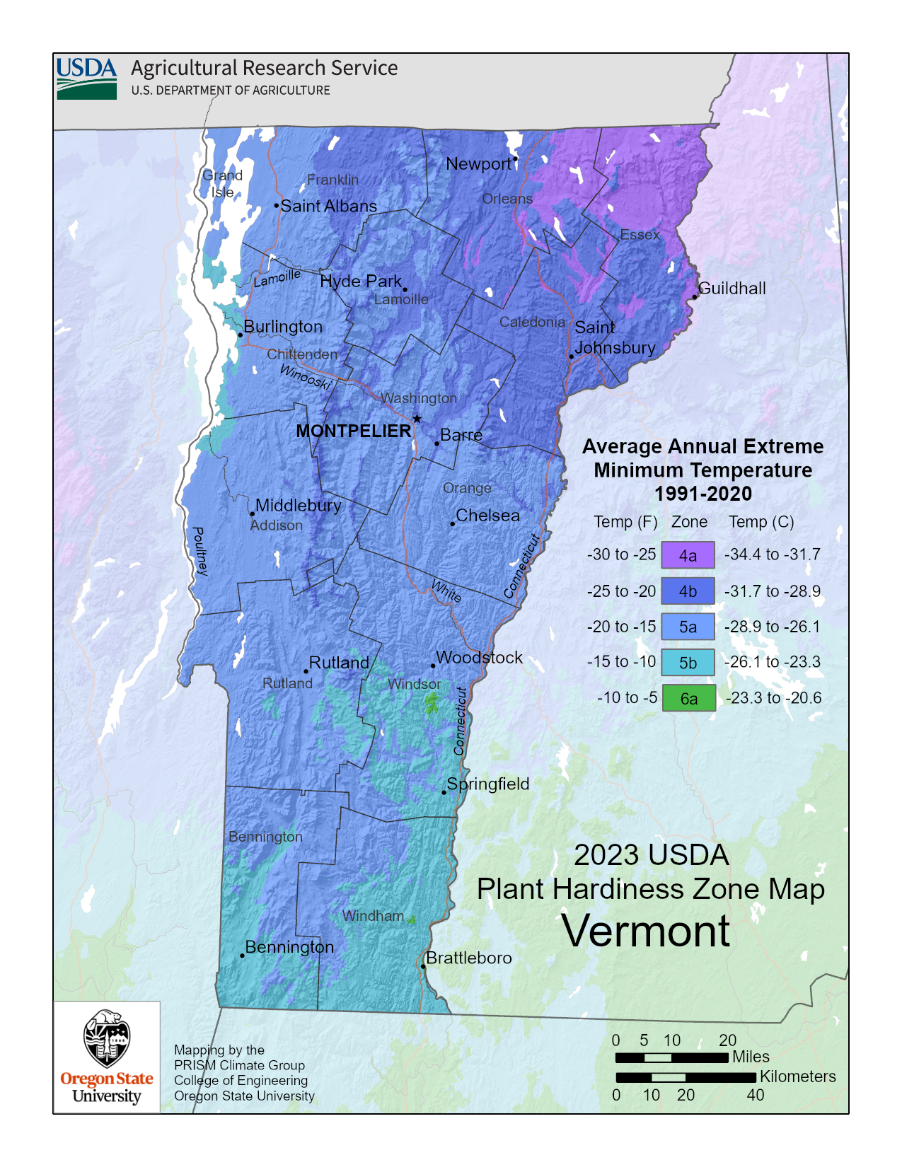
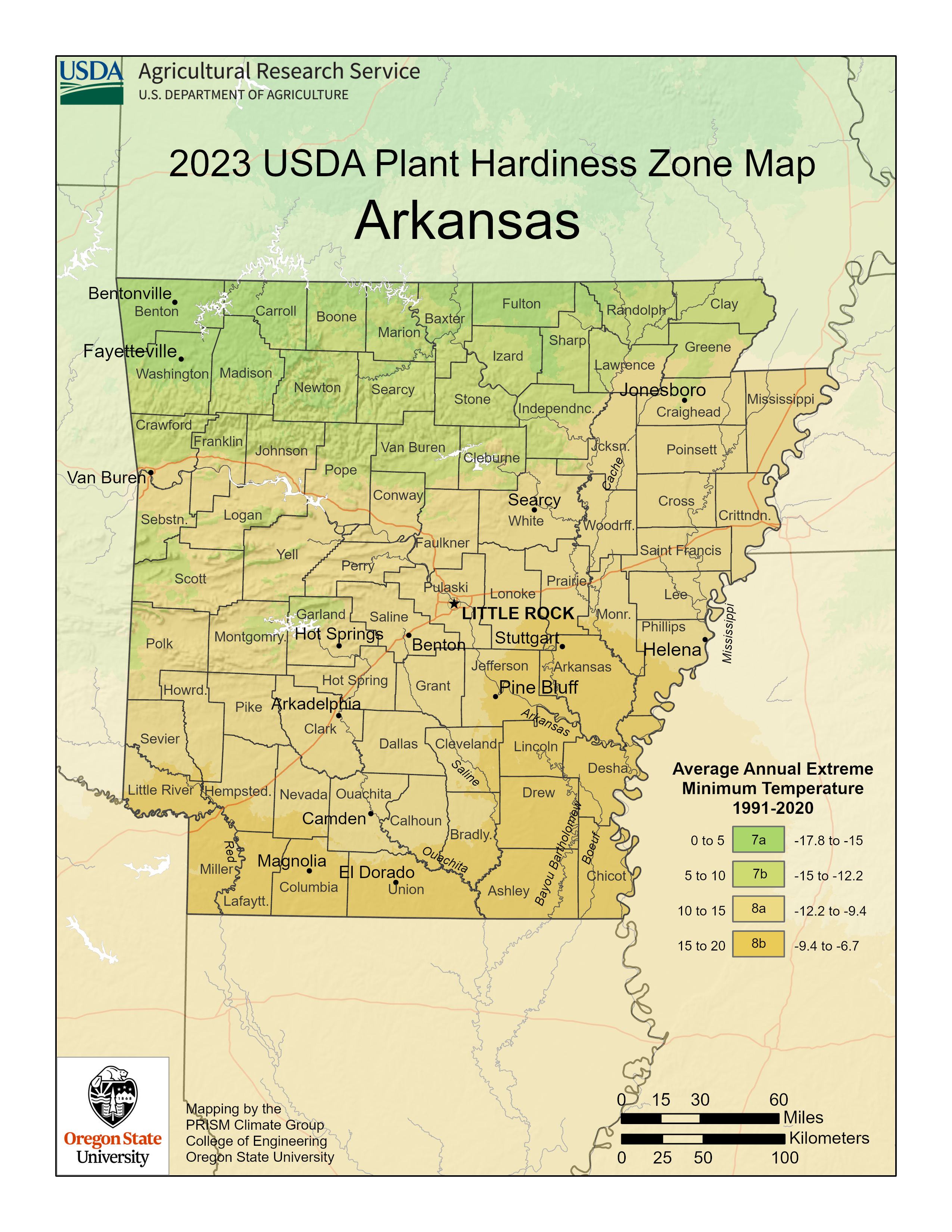
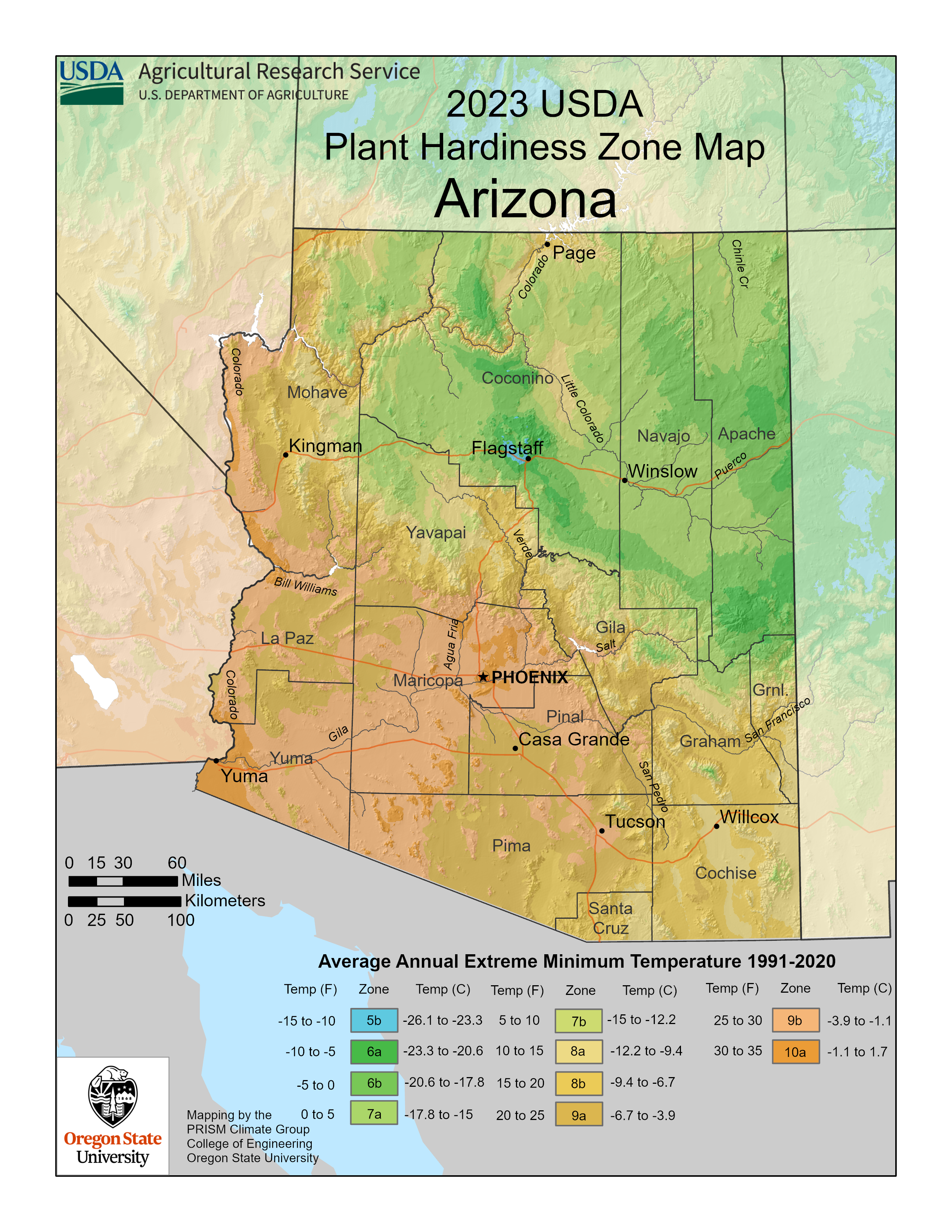
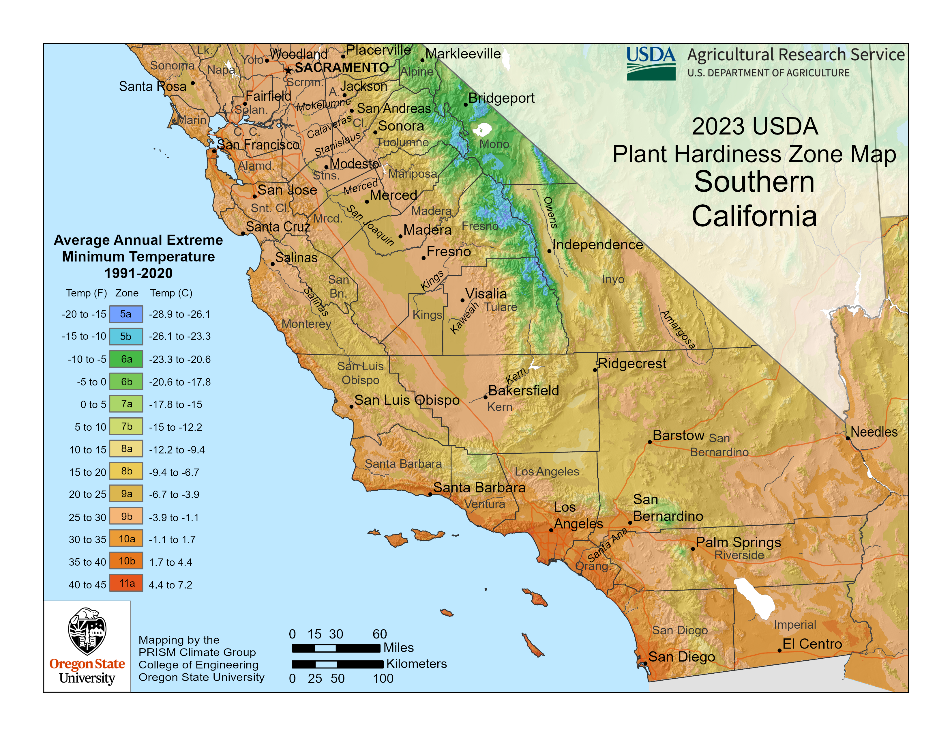
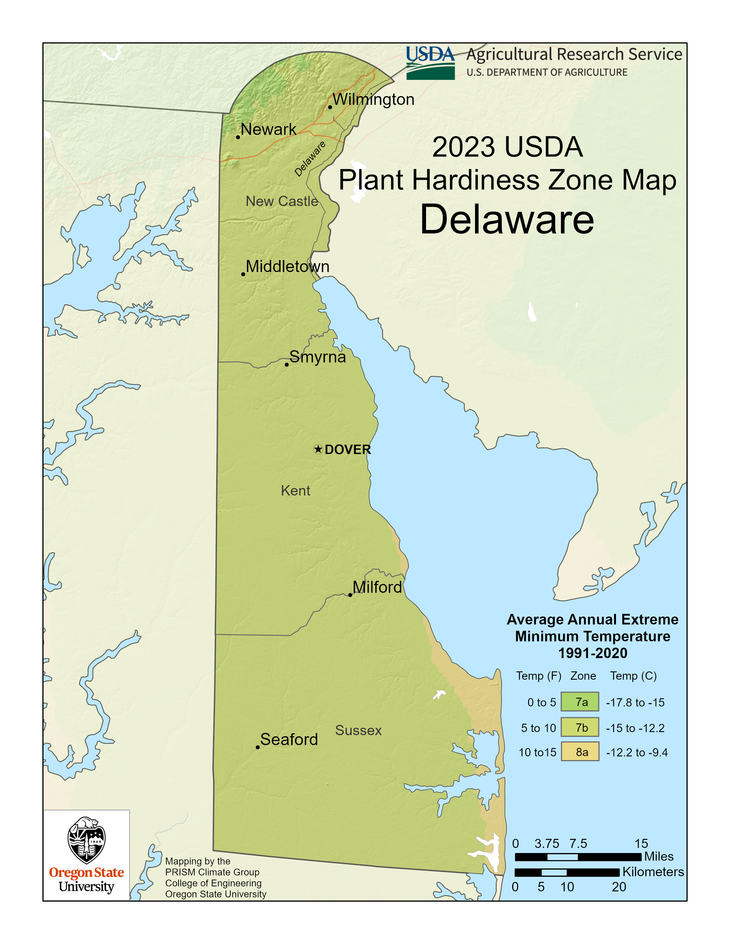
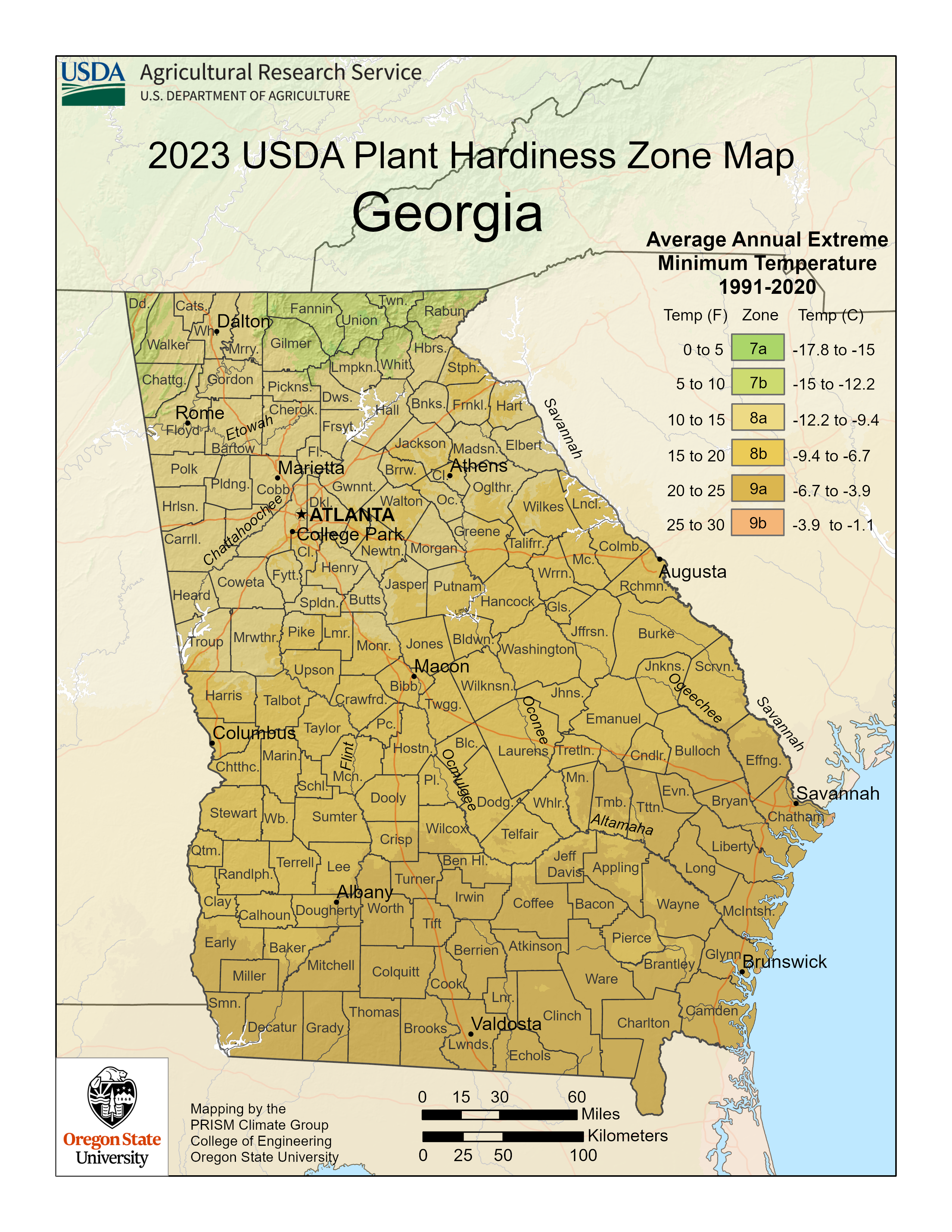
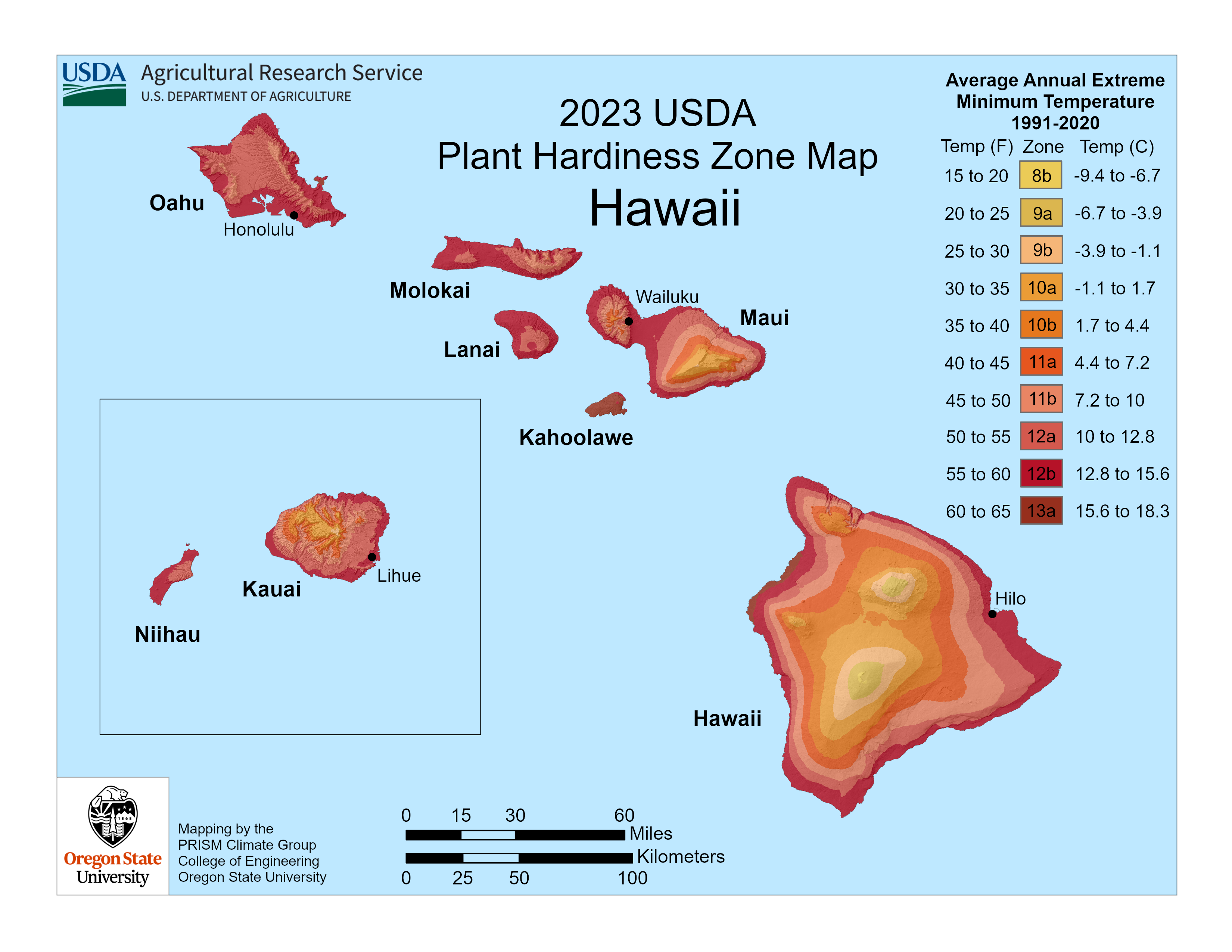
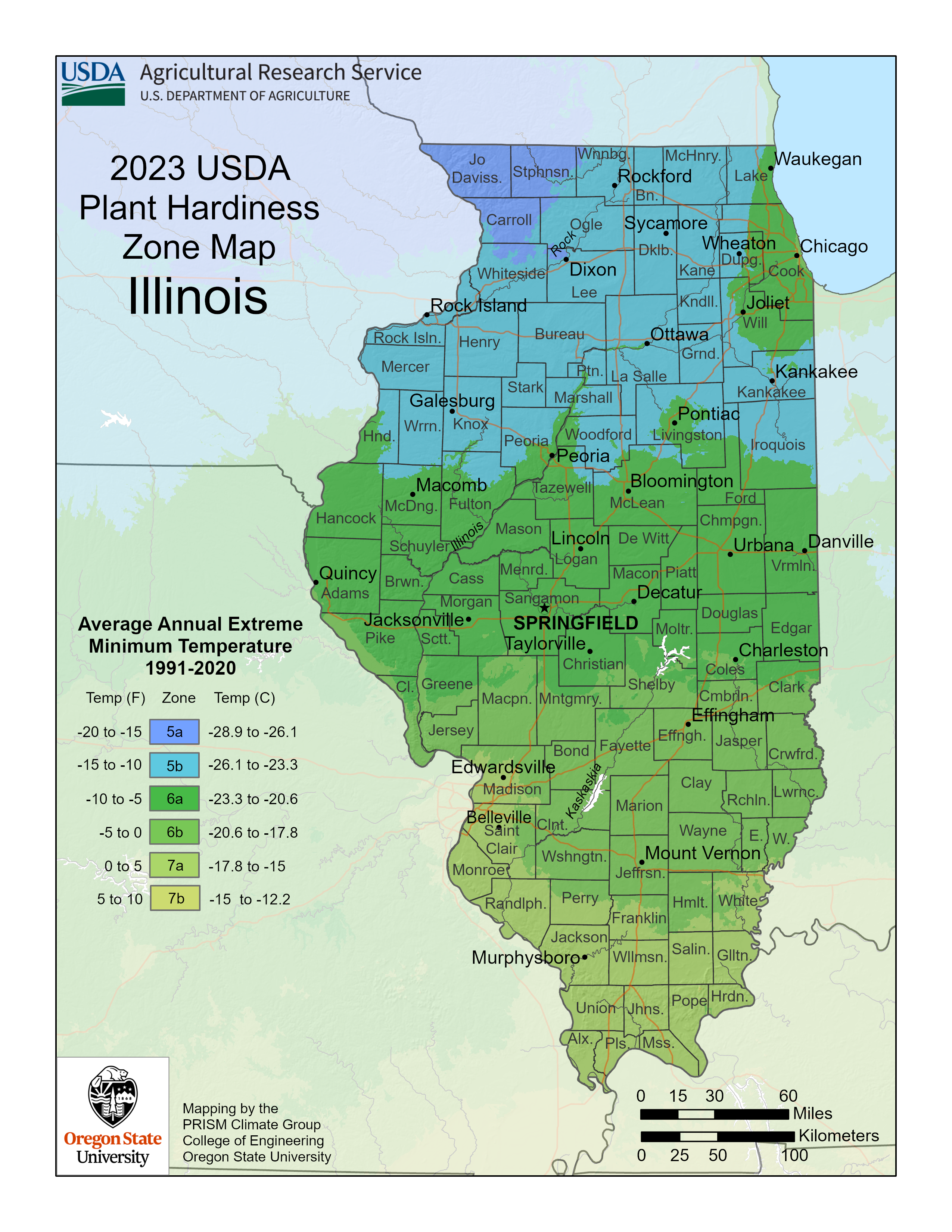
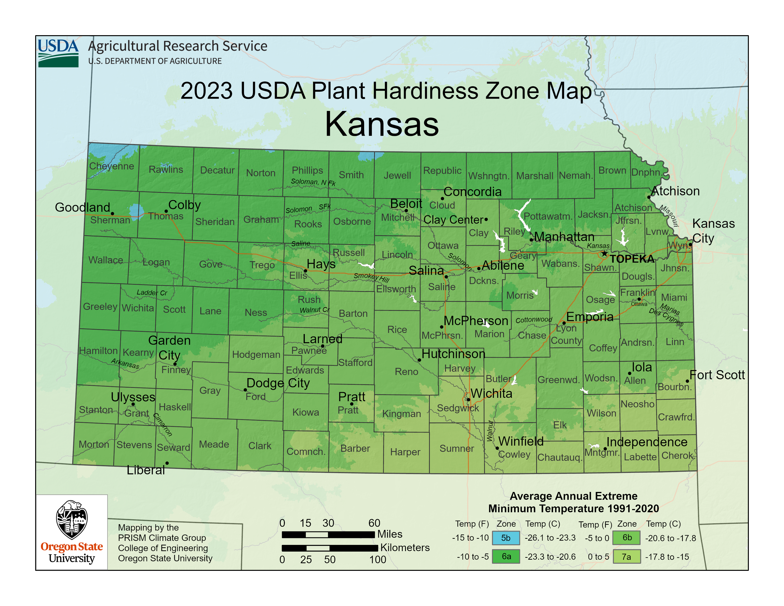
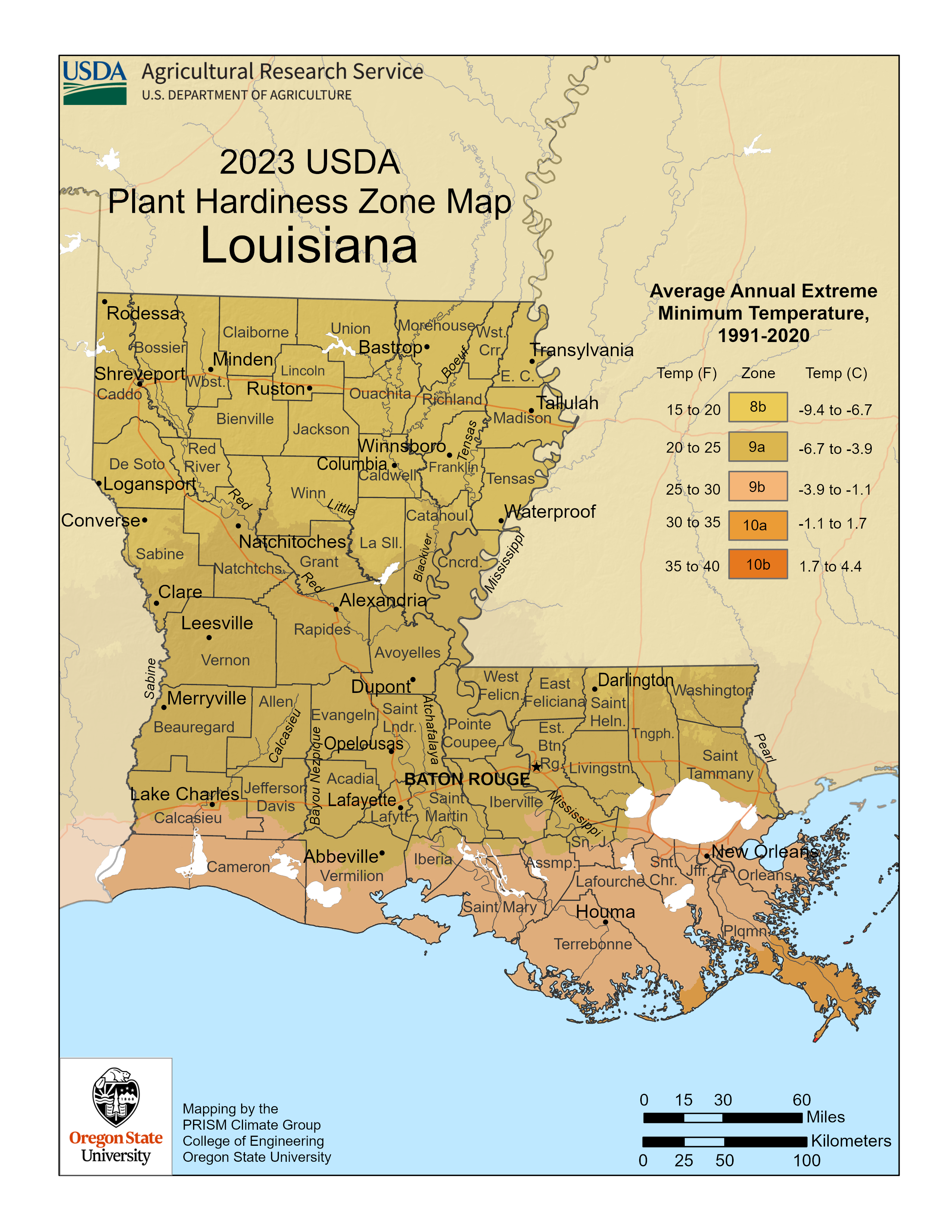
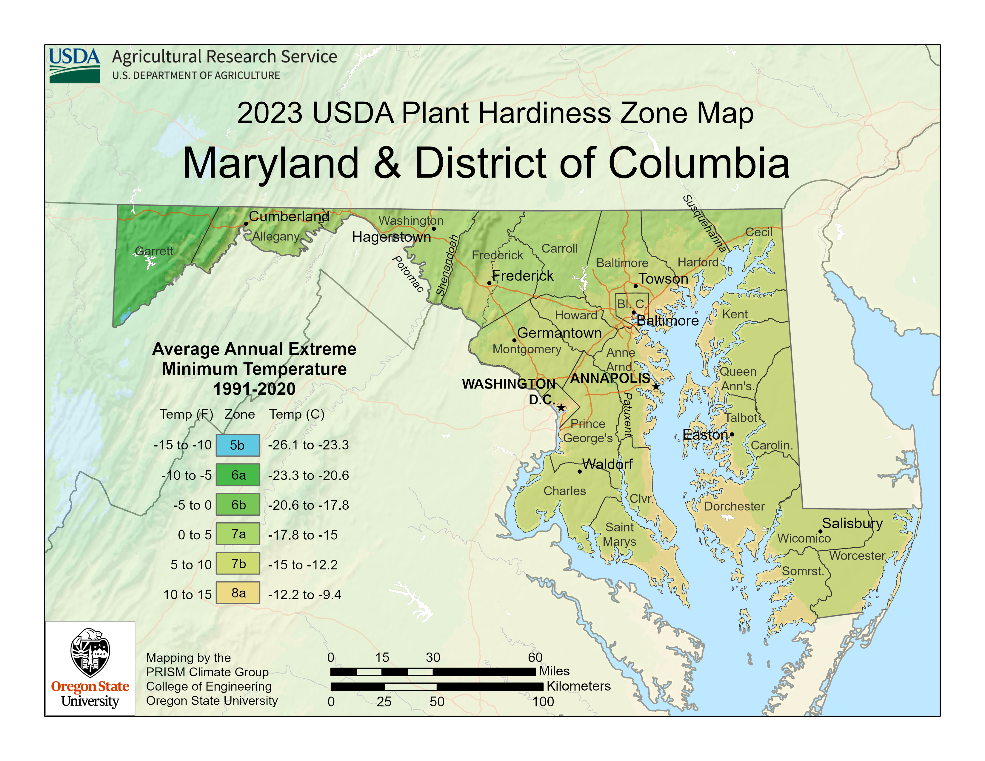
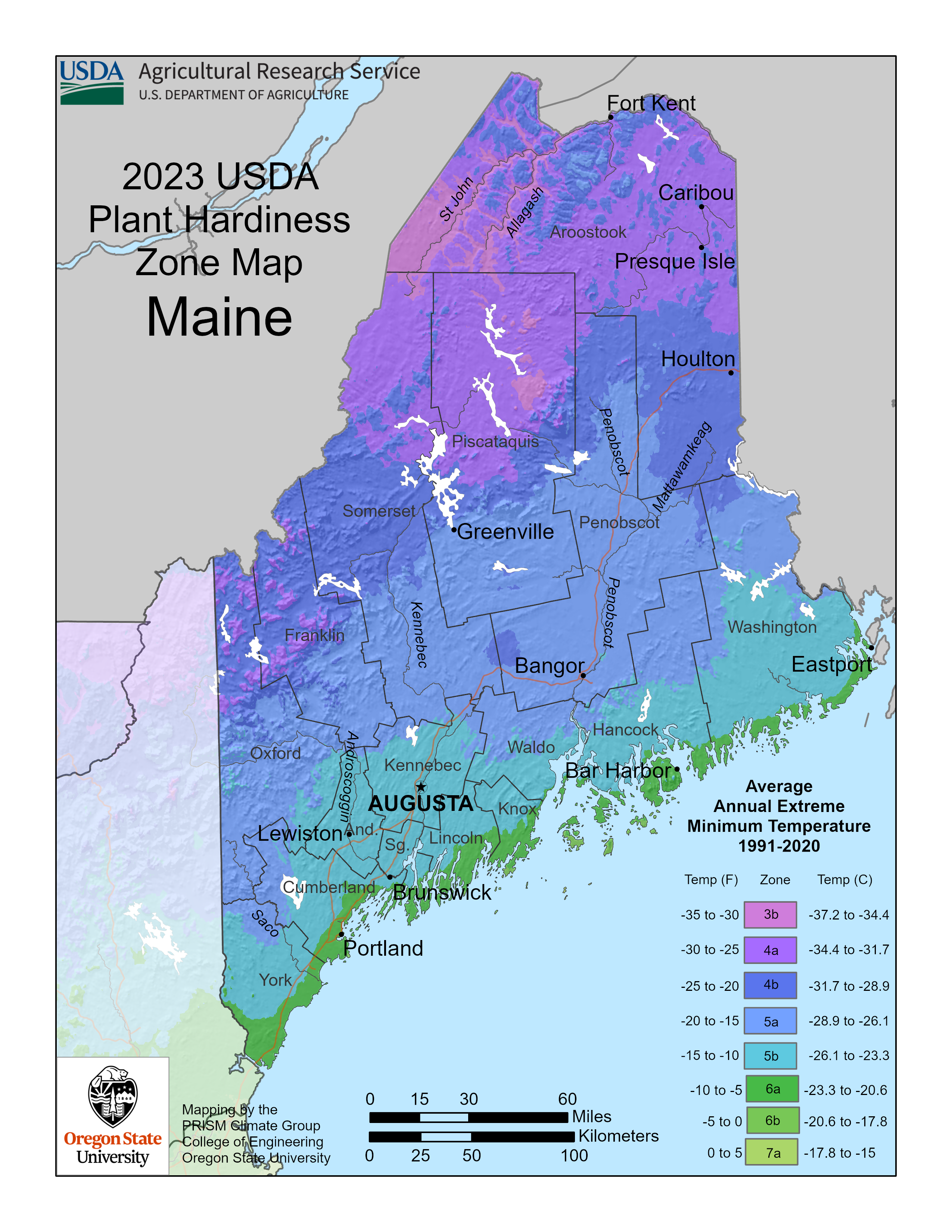
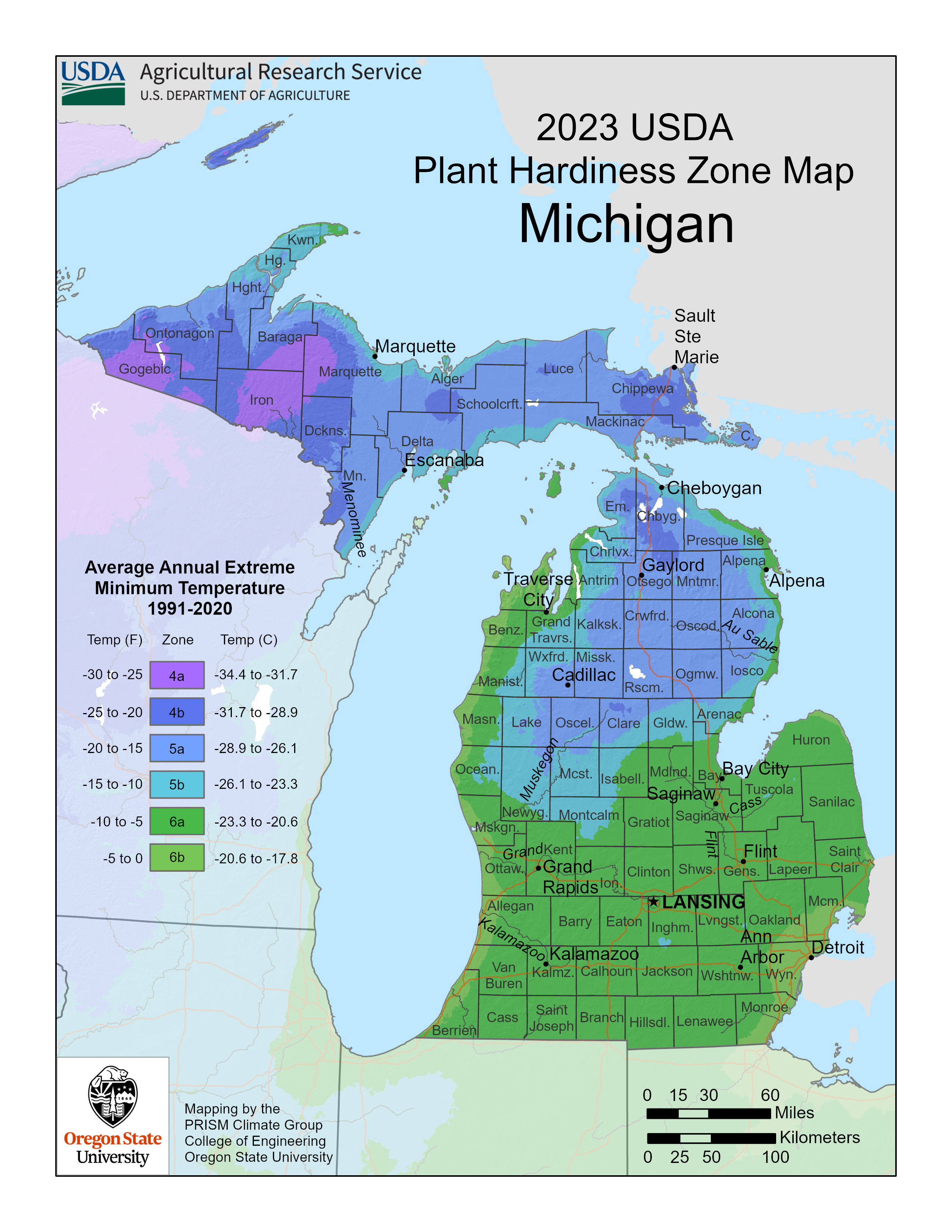
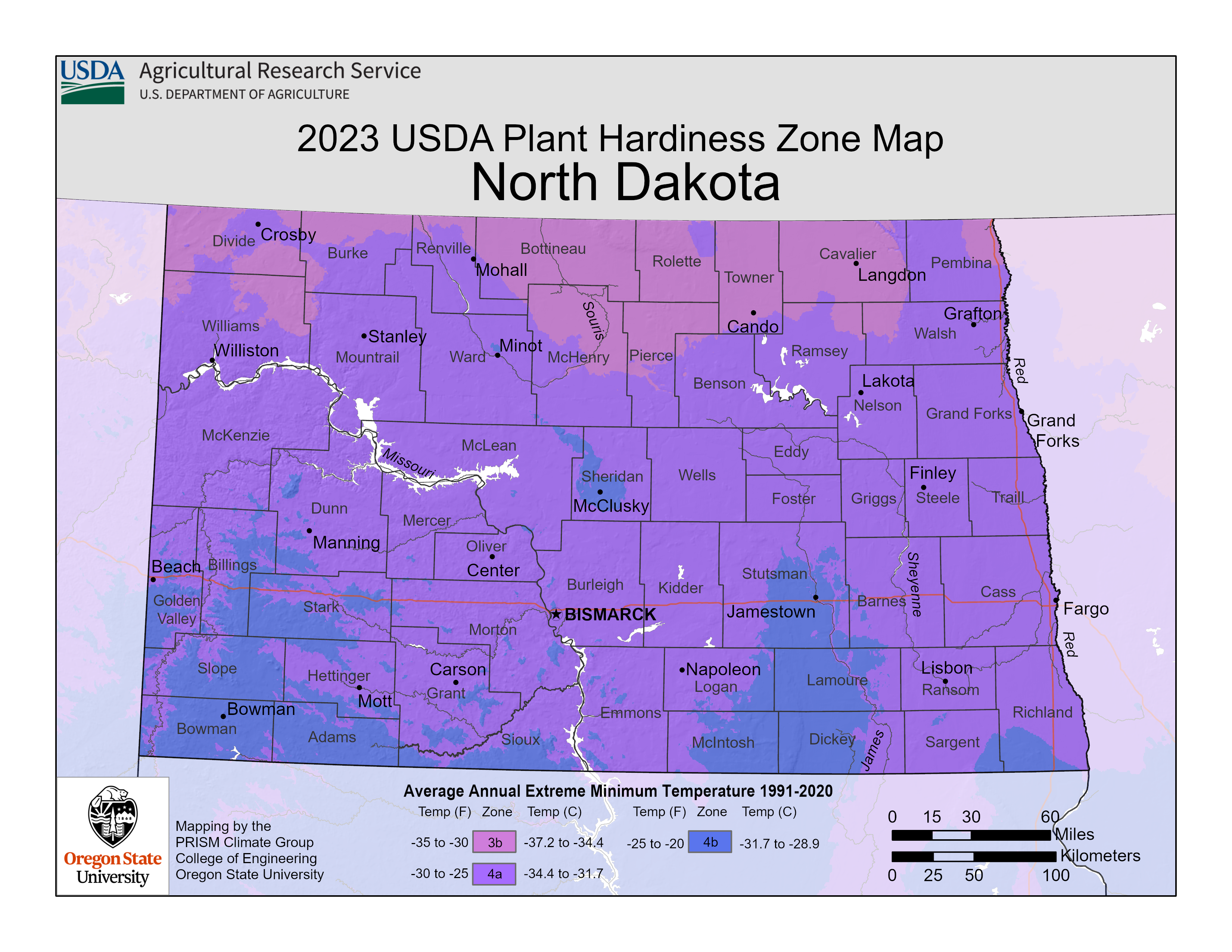
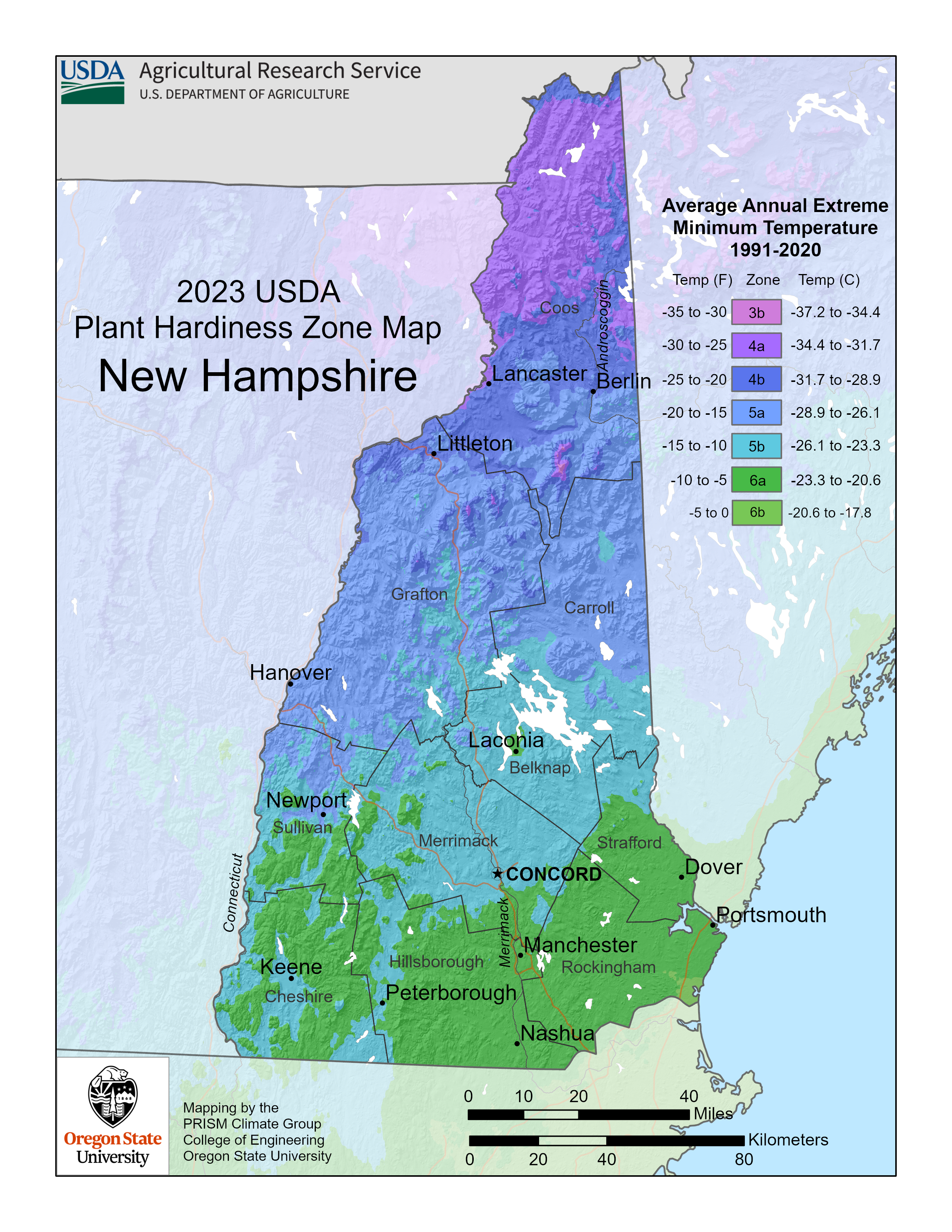
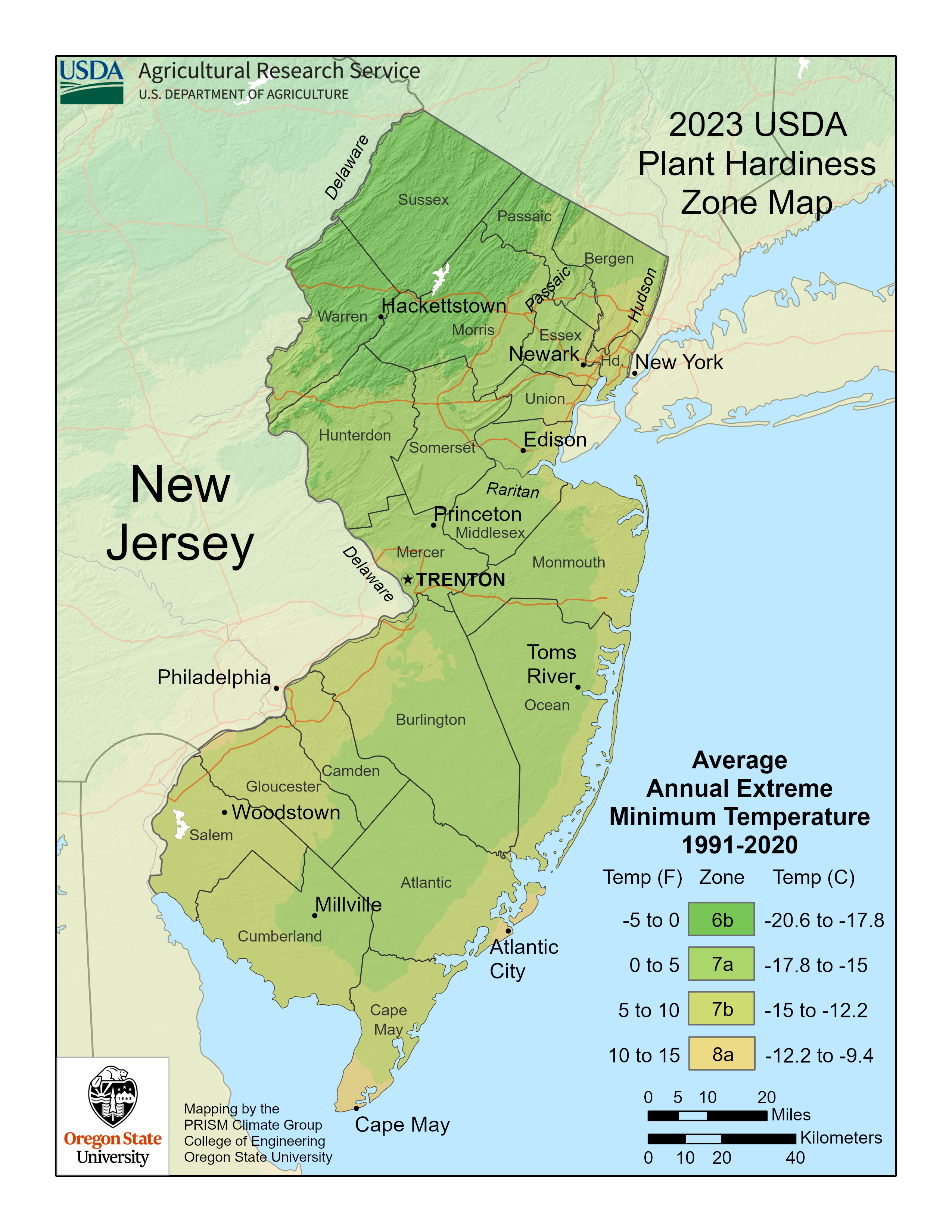
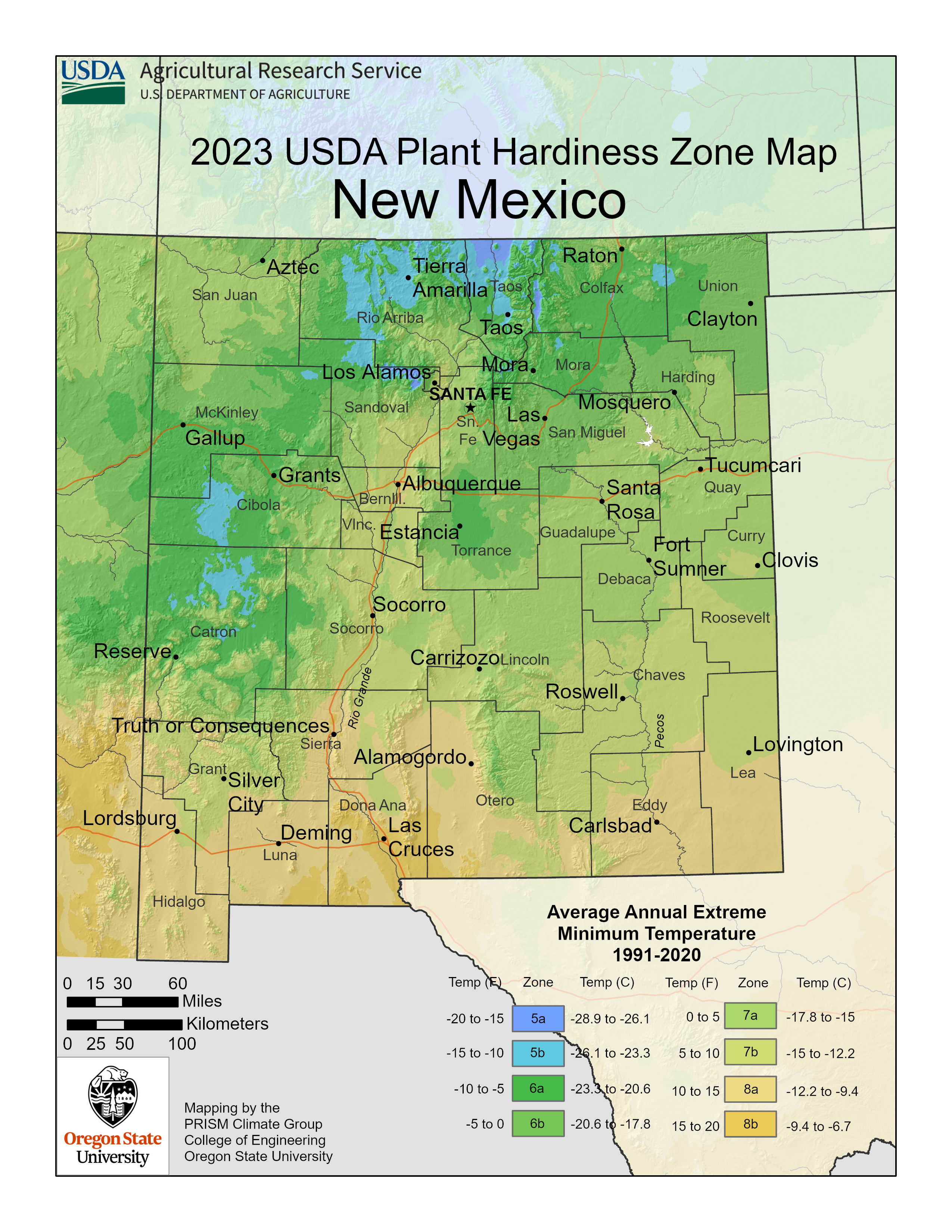
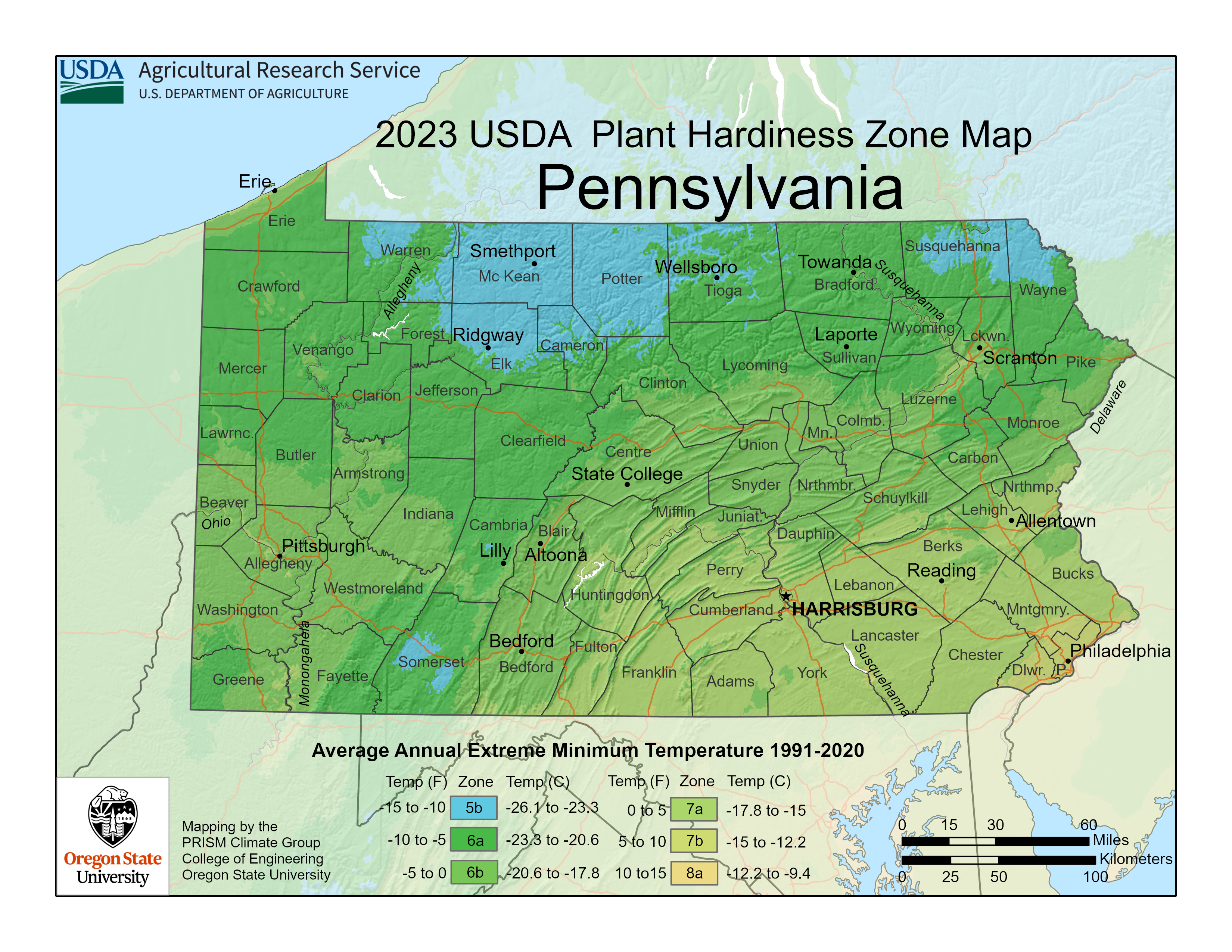
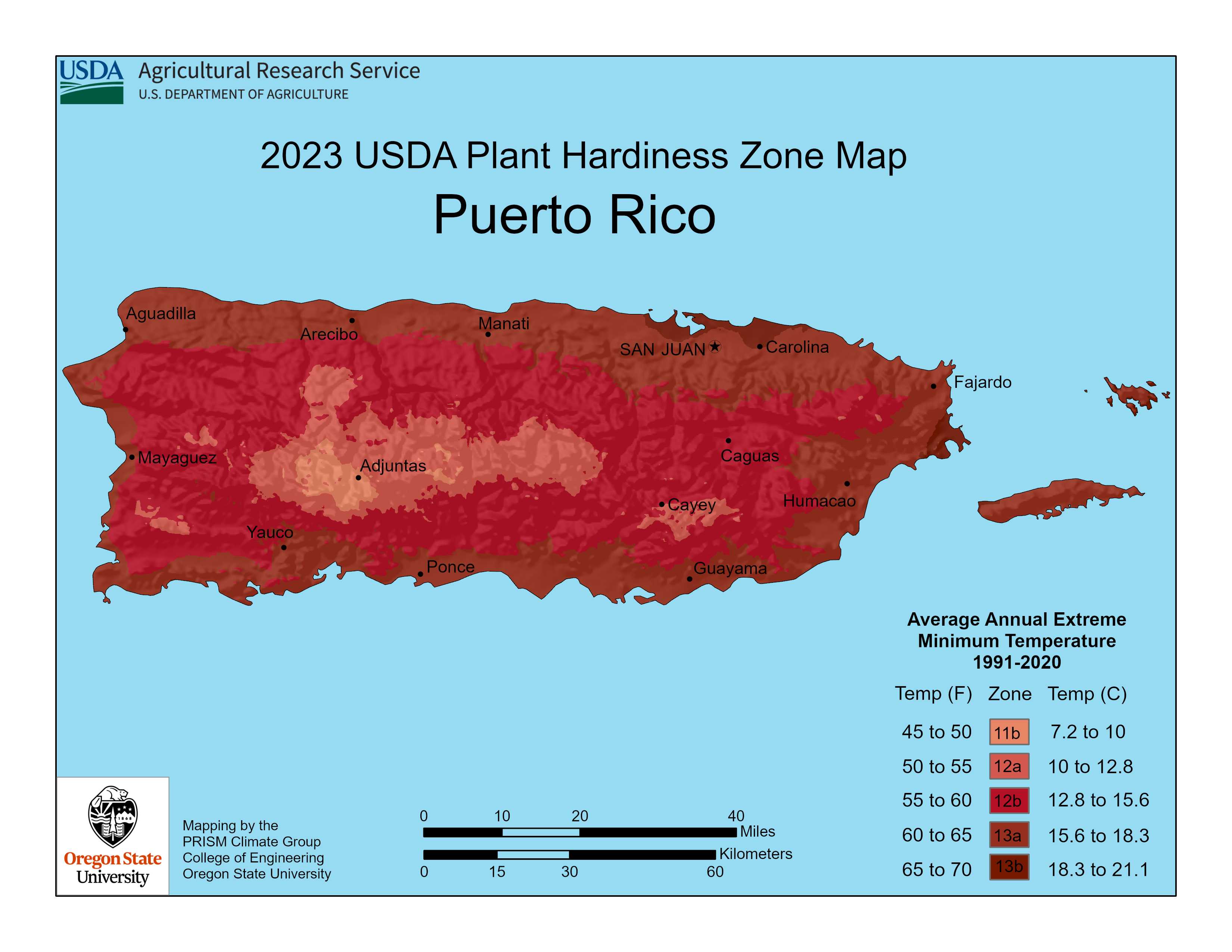
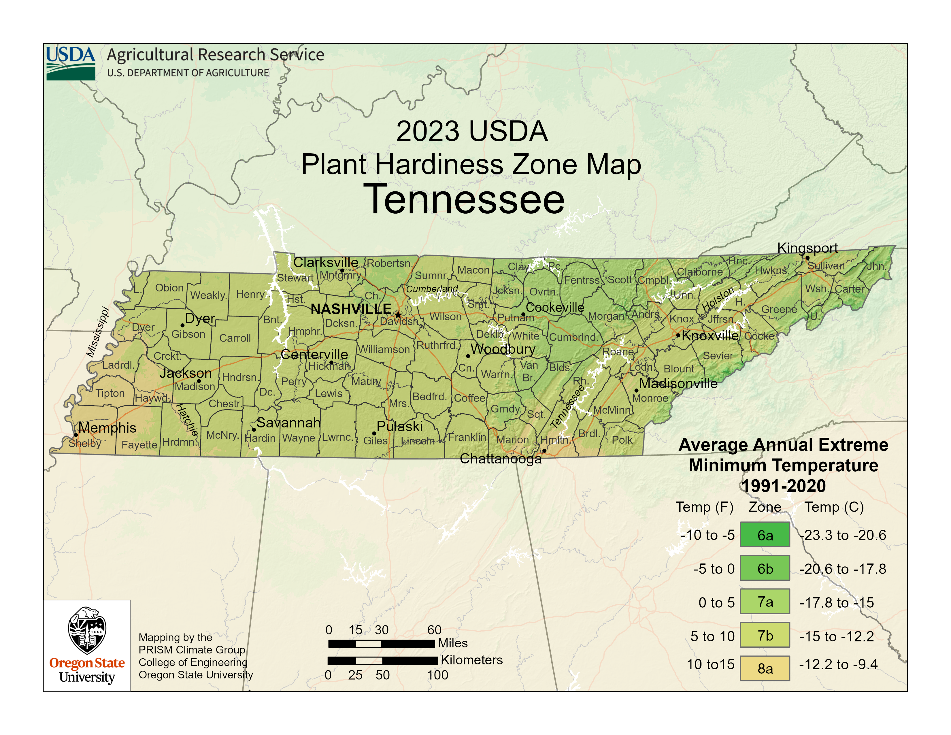
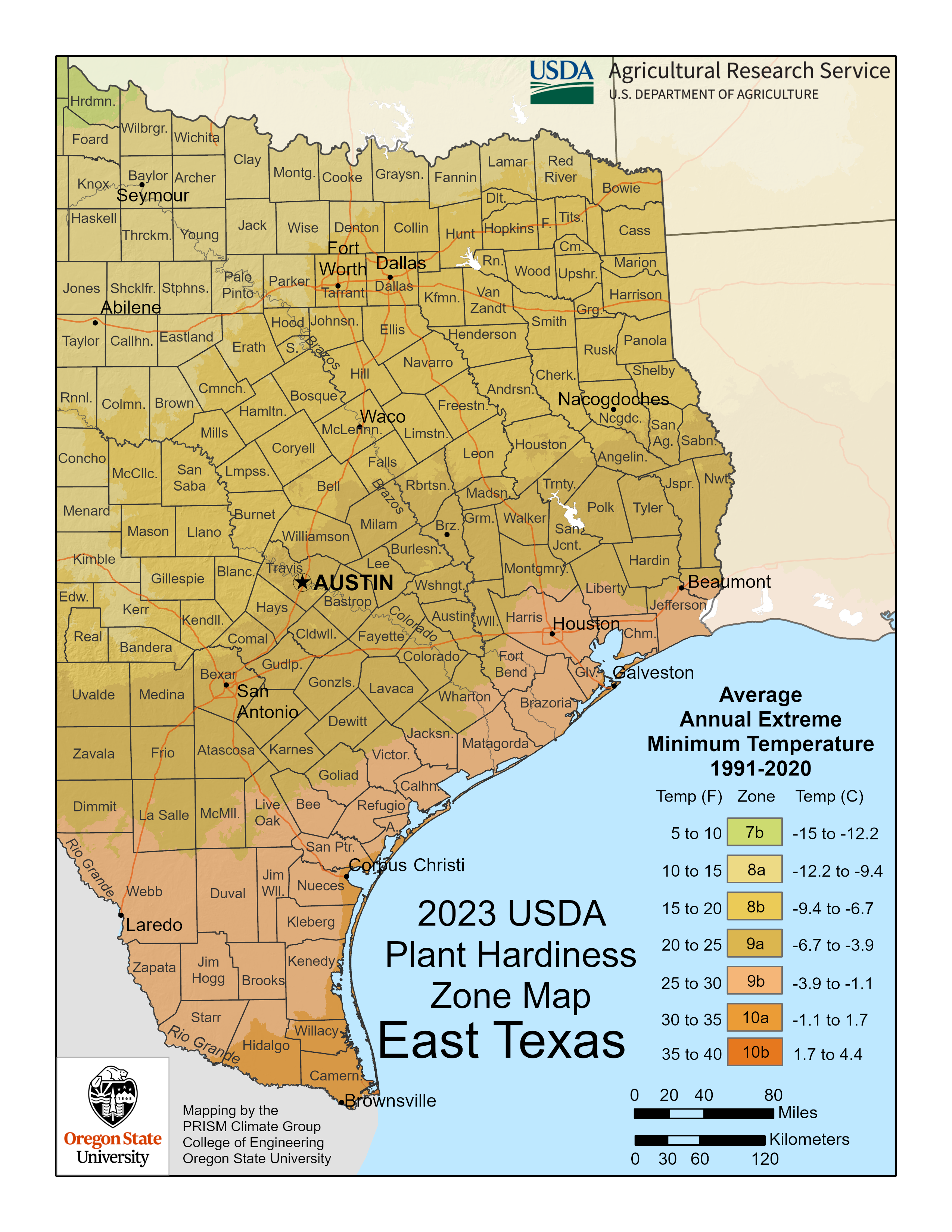
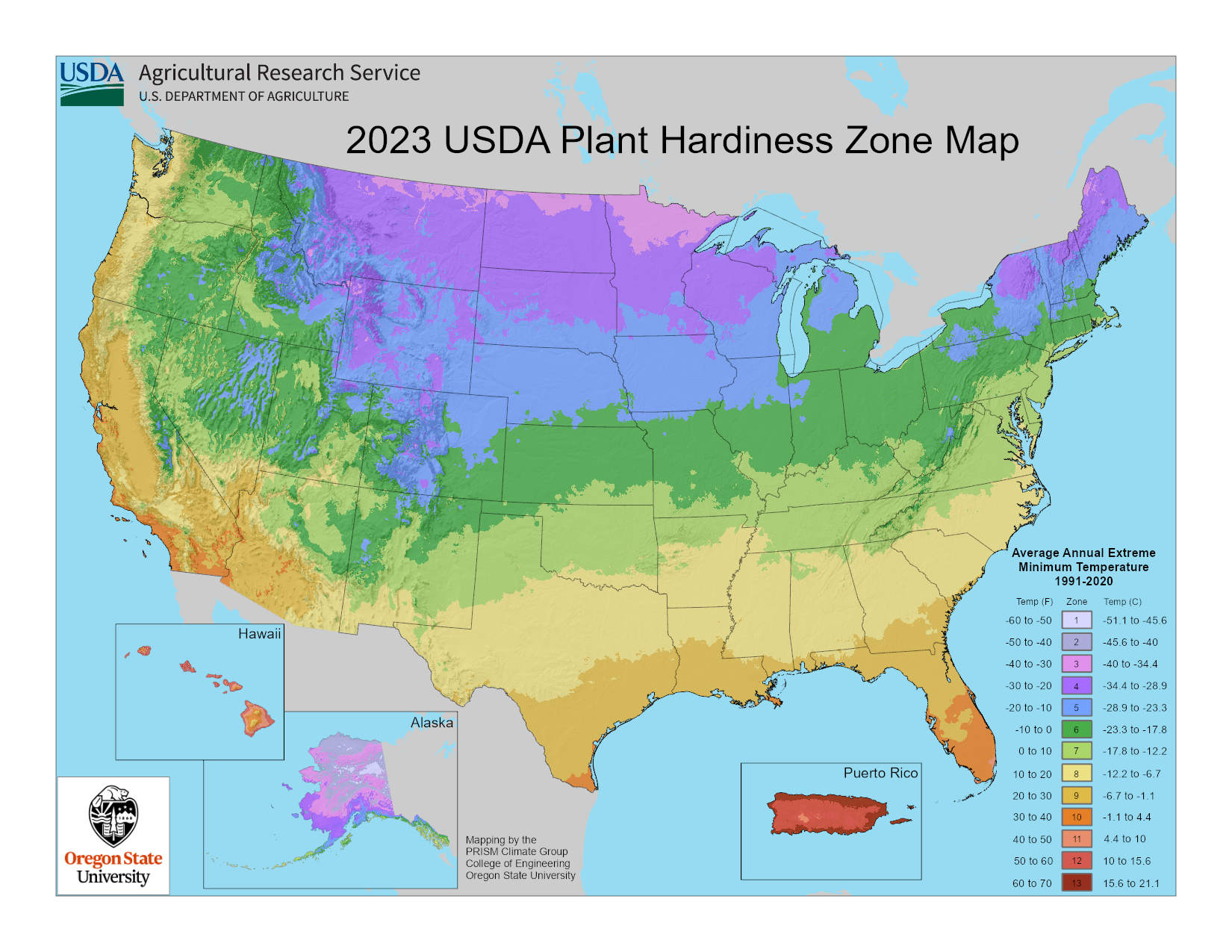
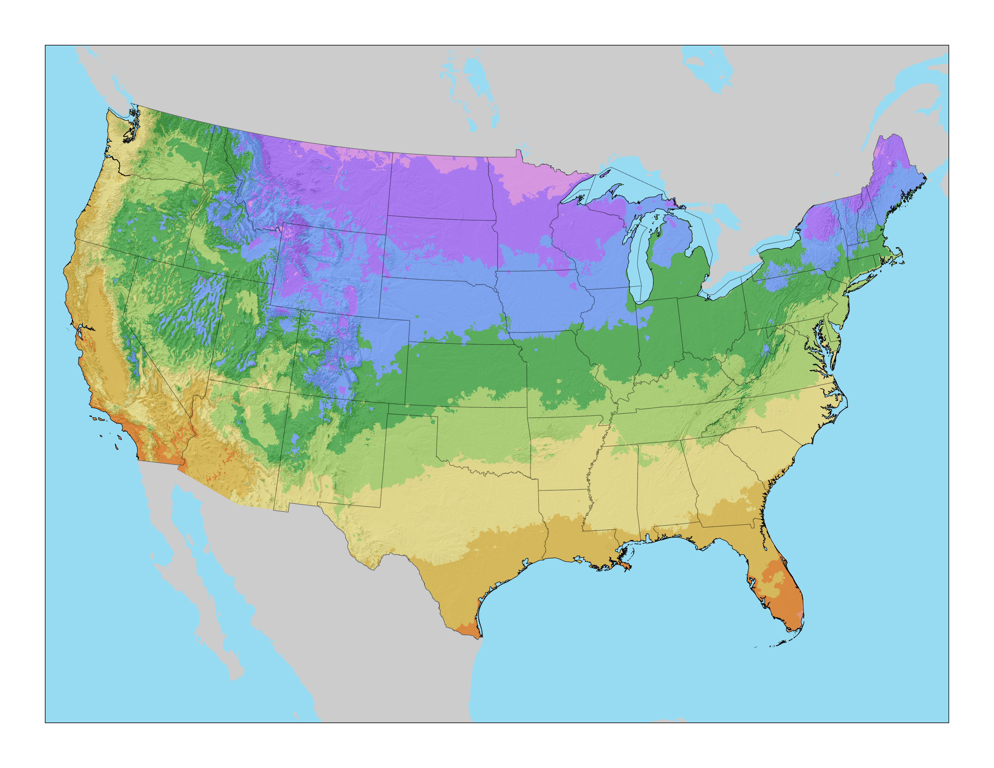
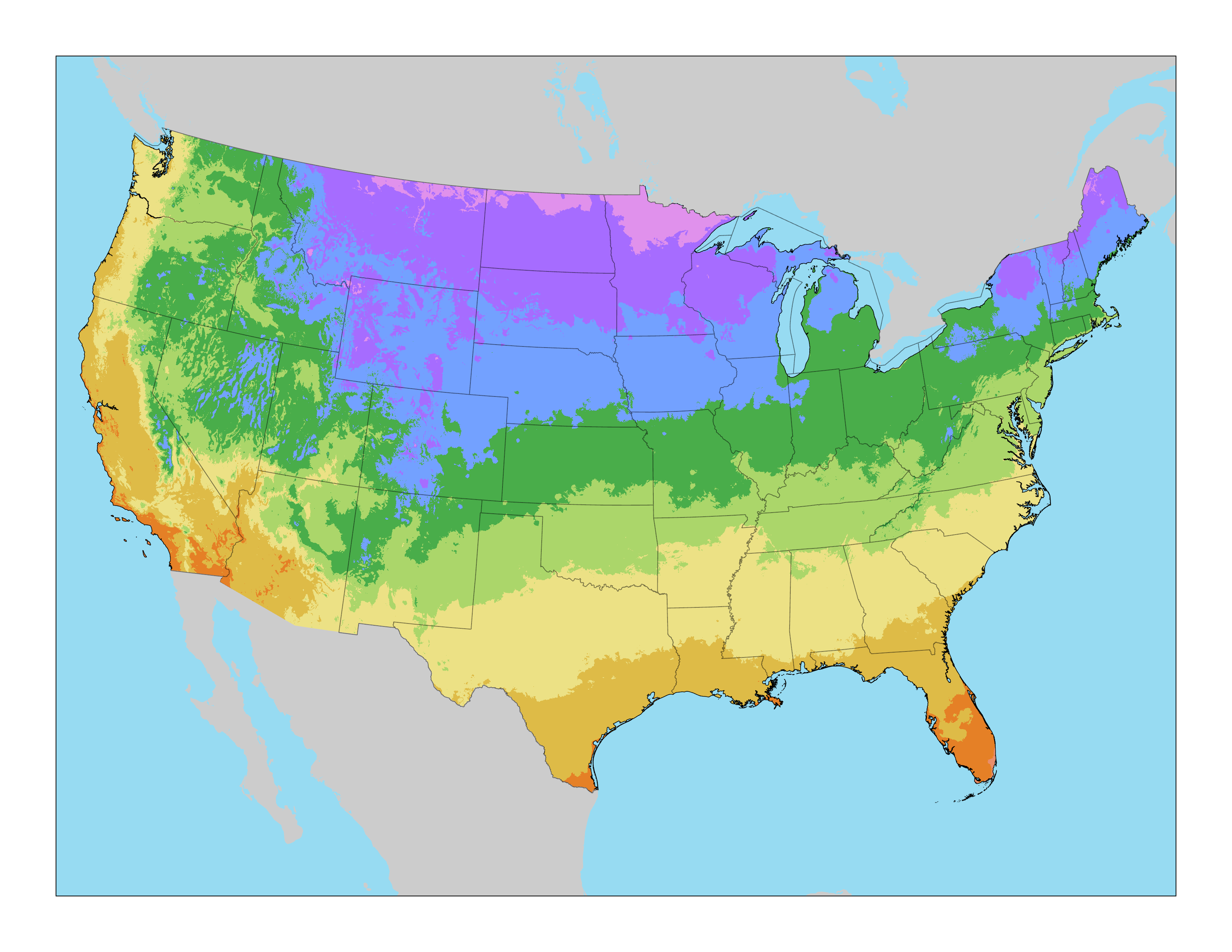
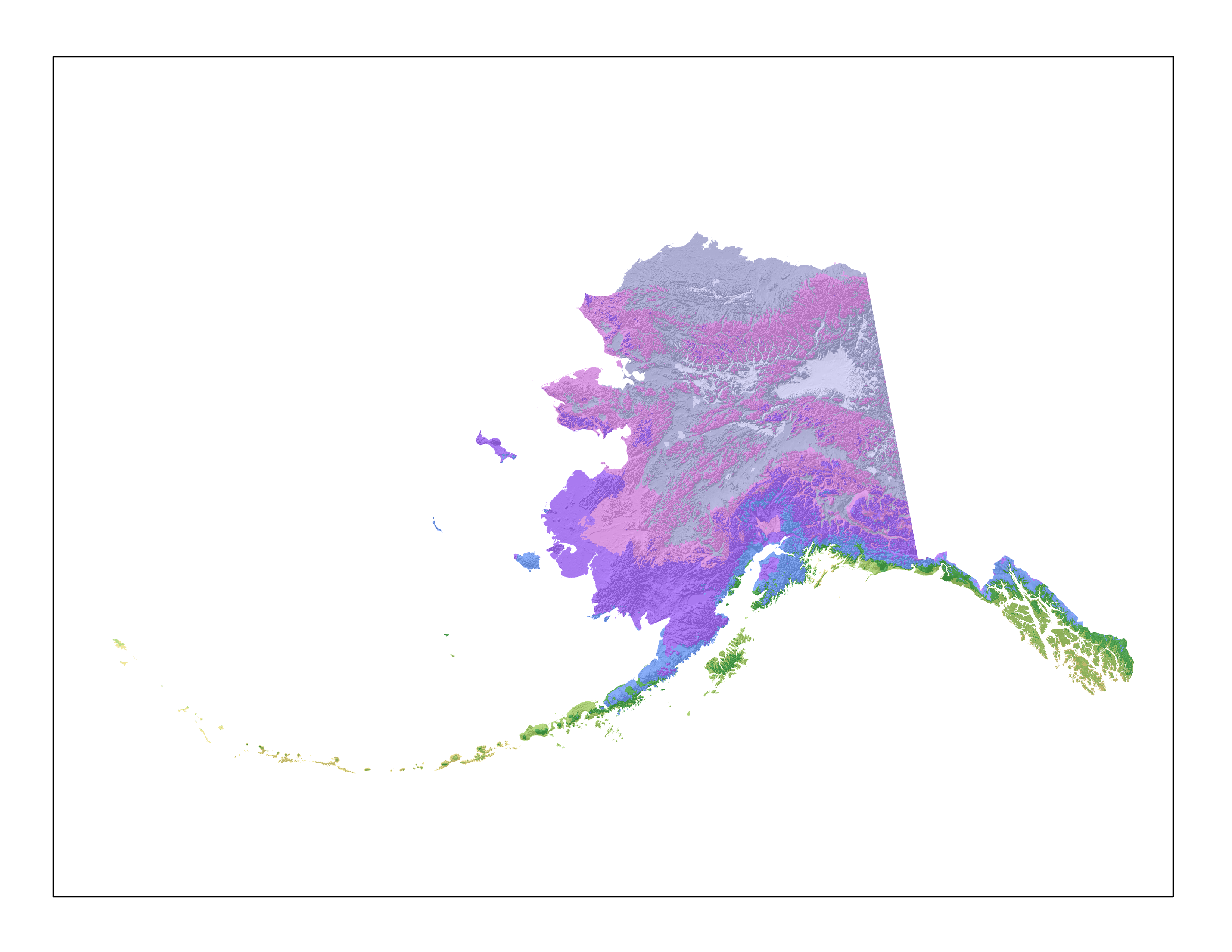
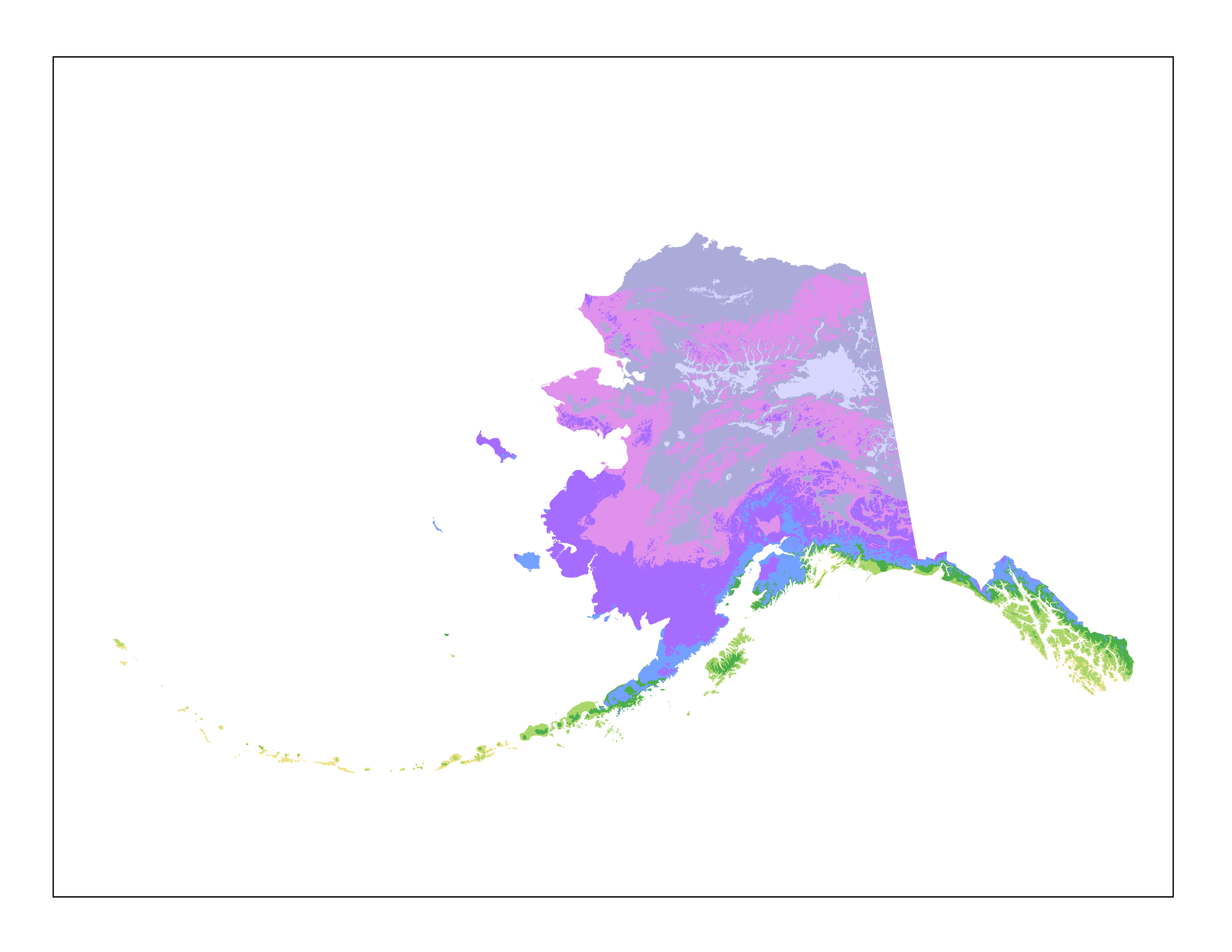
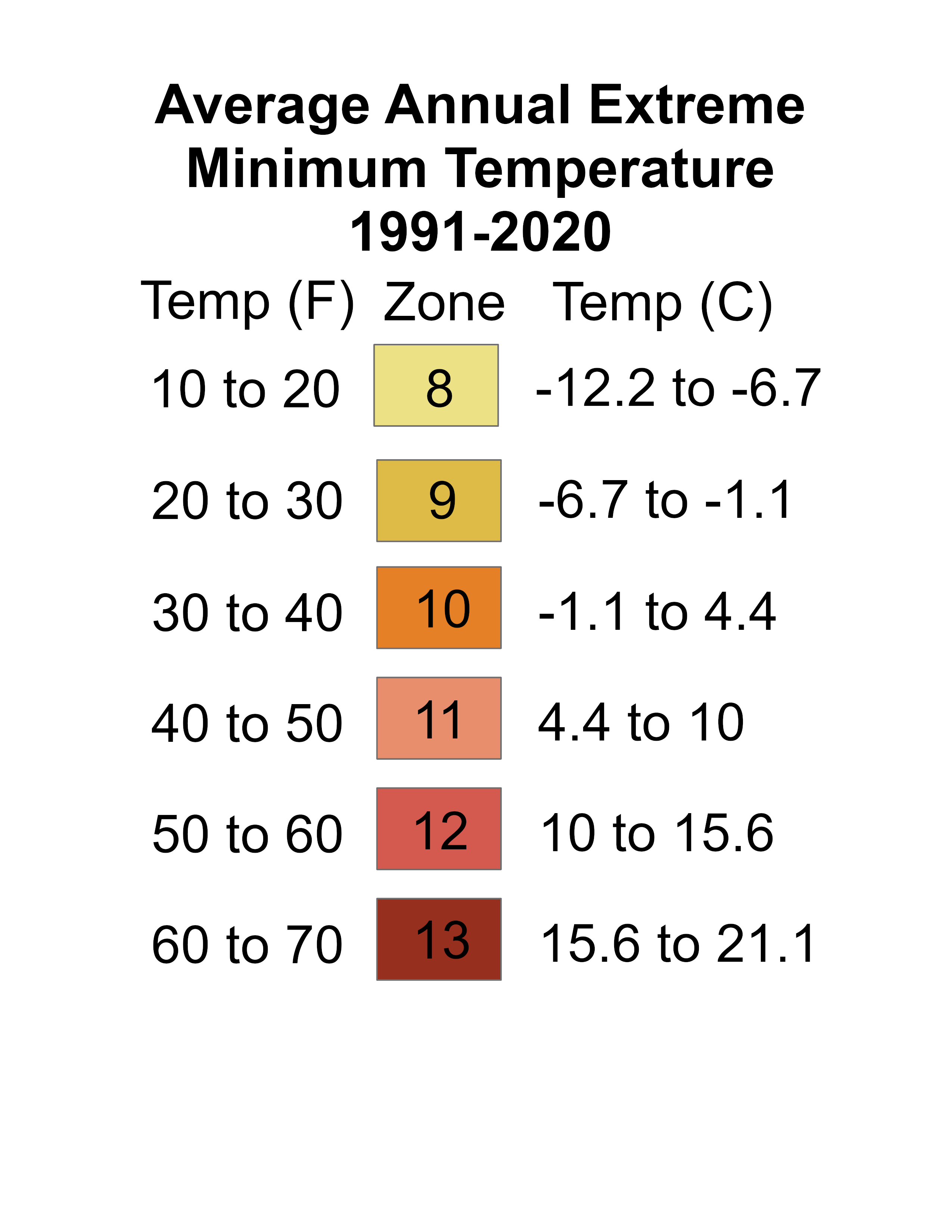
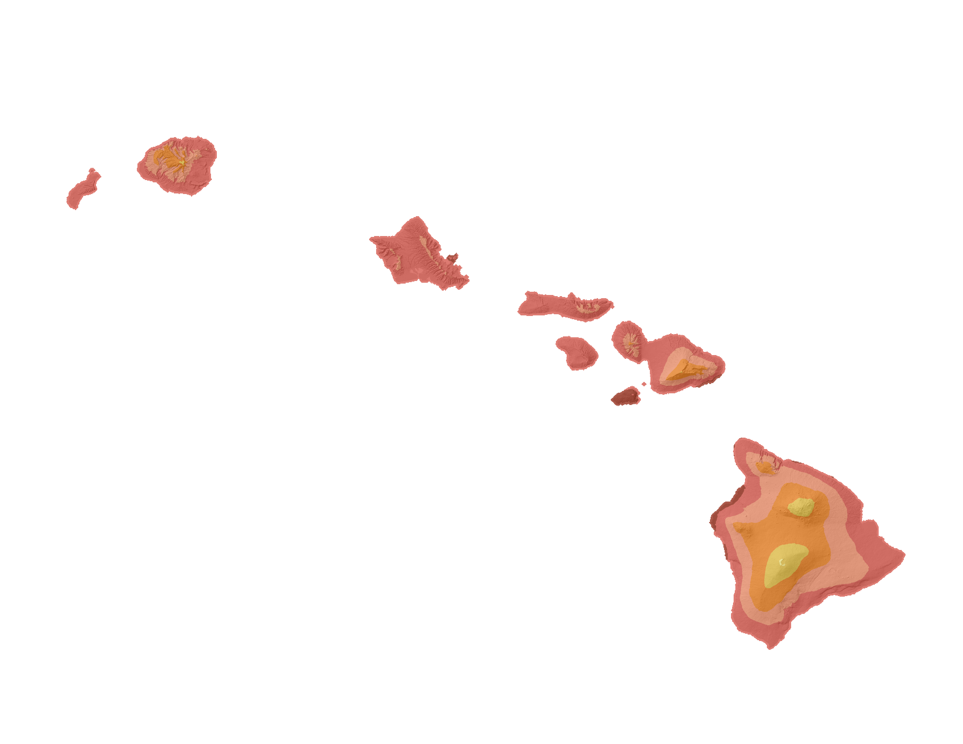
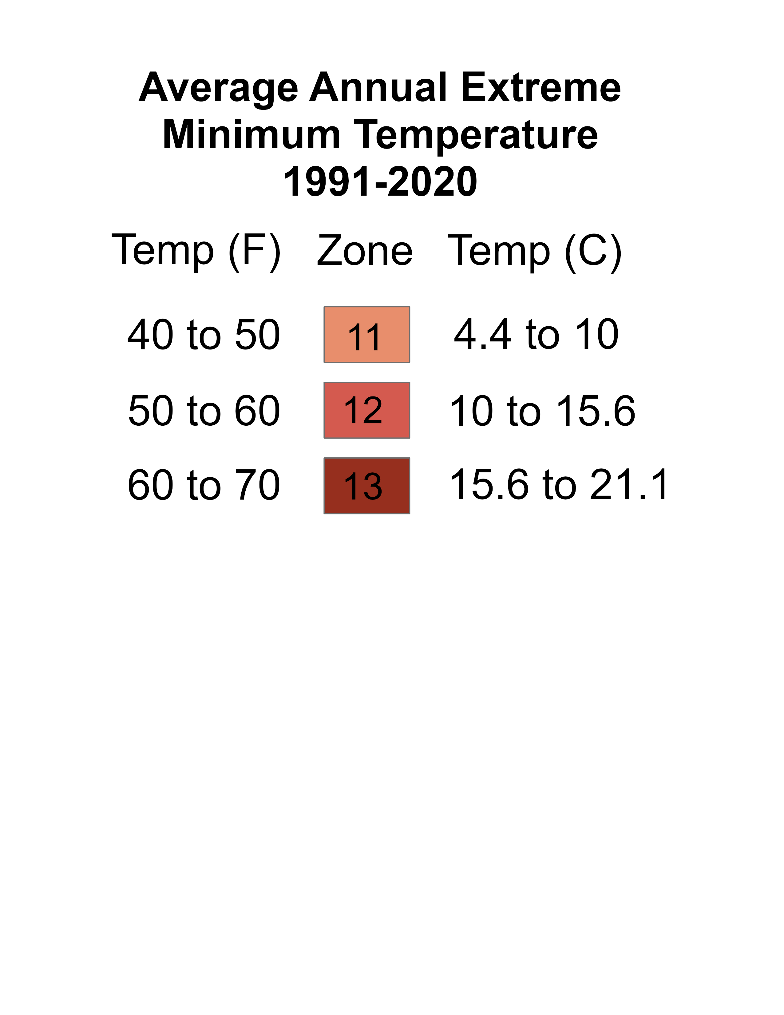
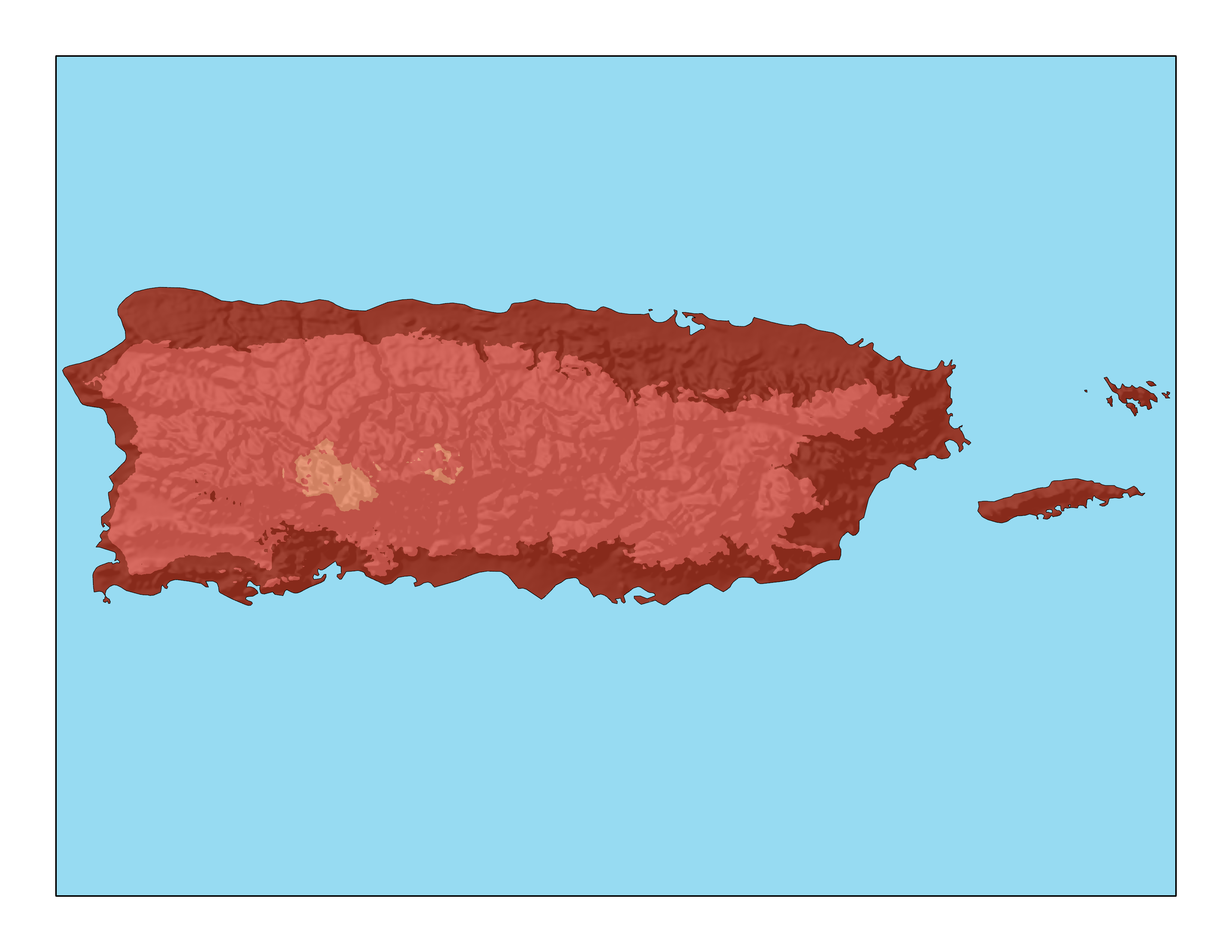
This page allows you to find and download state, regional, and national Plant Hardiness Zone Maps at various resolutions. Click on the map below to download state/territory maps or scroll down to find regional and national maps for download. Poster-sized print quality national maps and simplified map components are also available below.
State/Territory
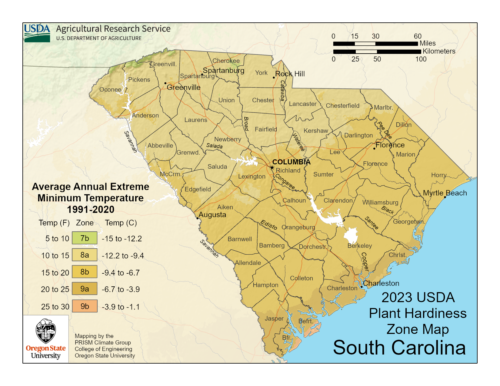
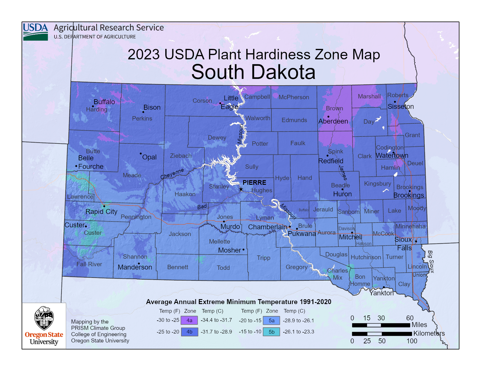
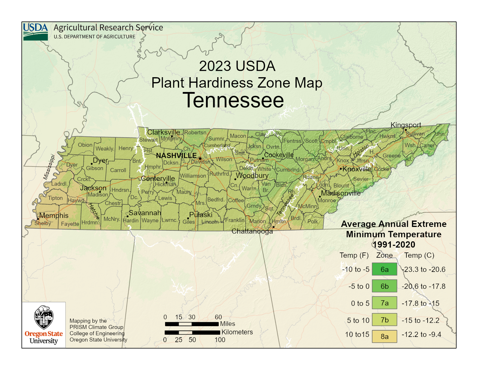
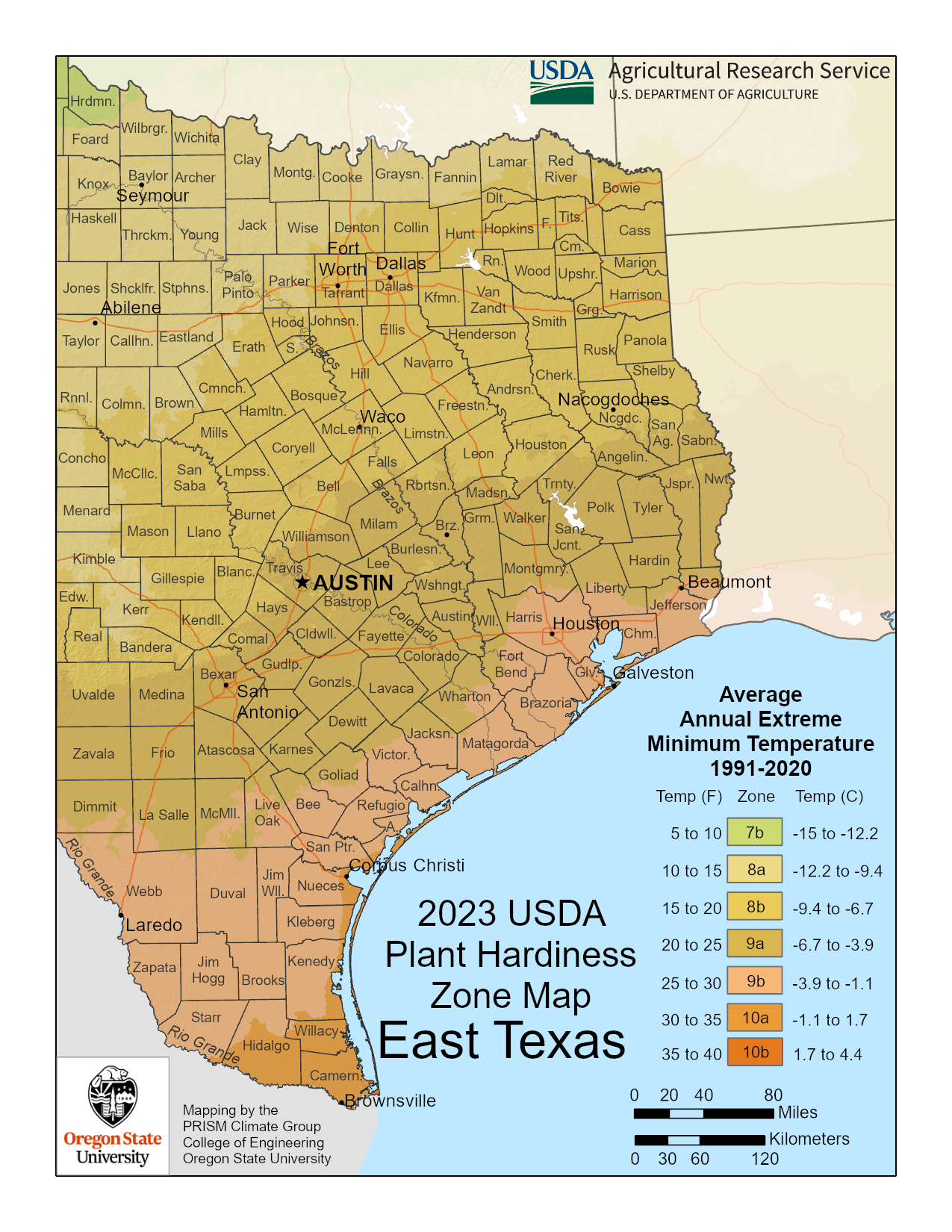
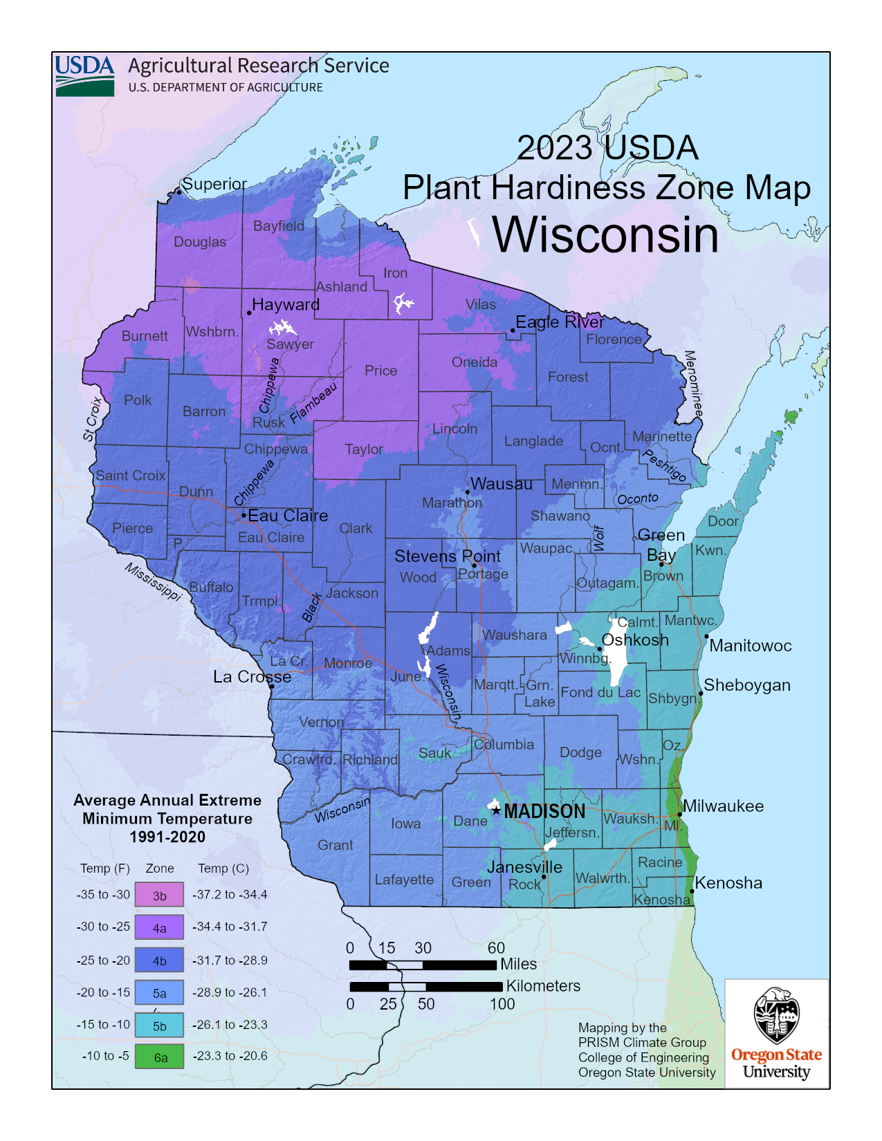
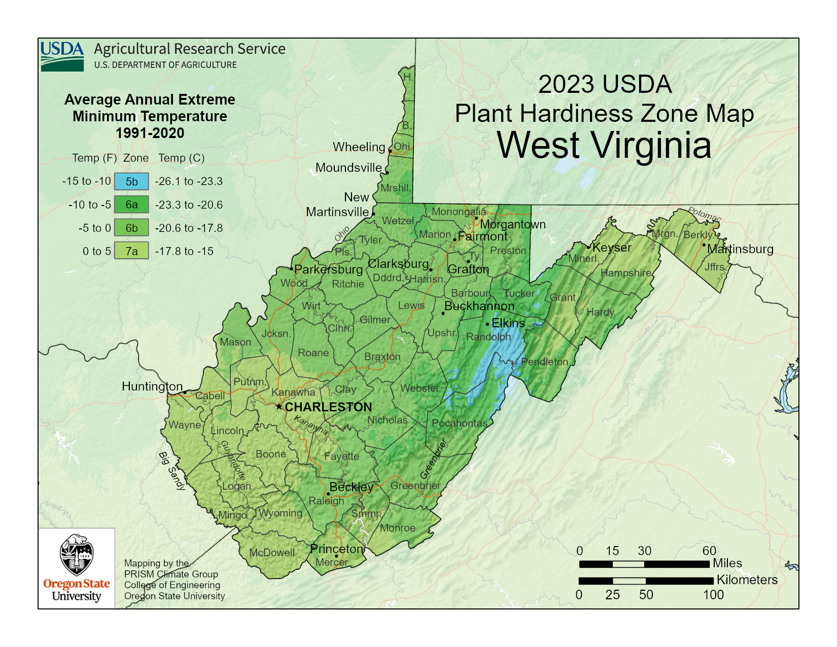
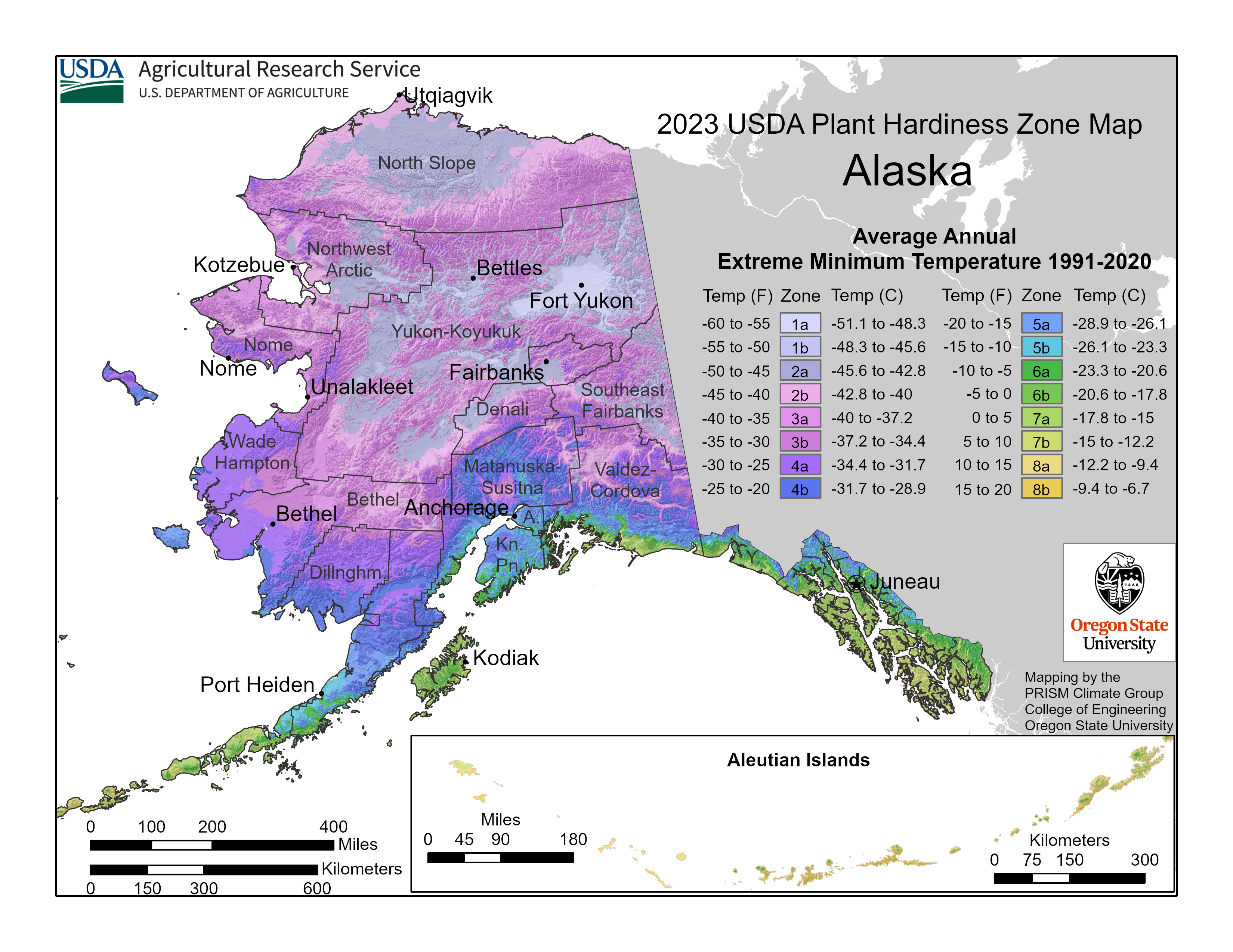
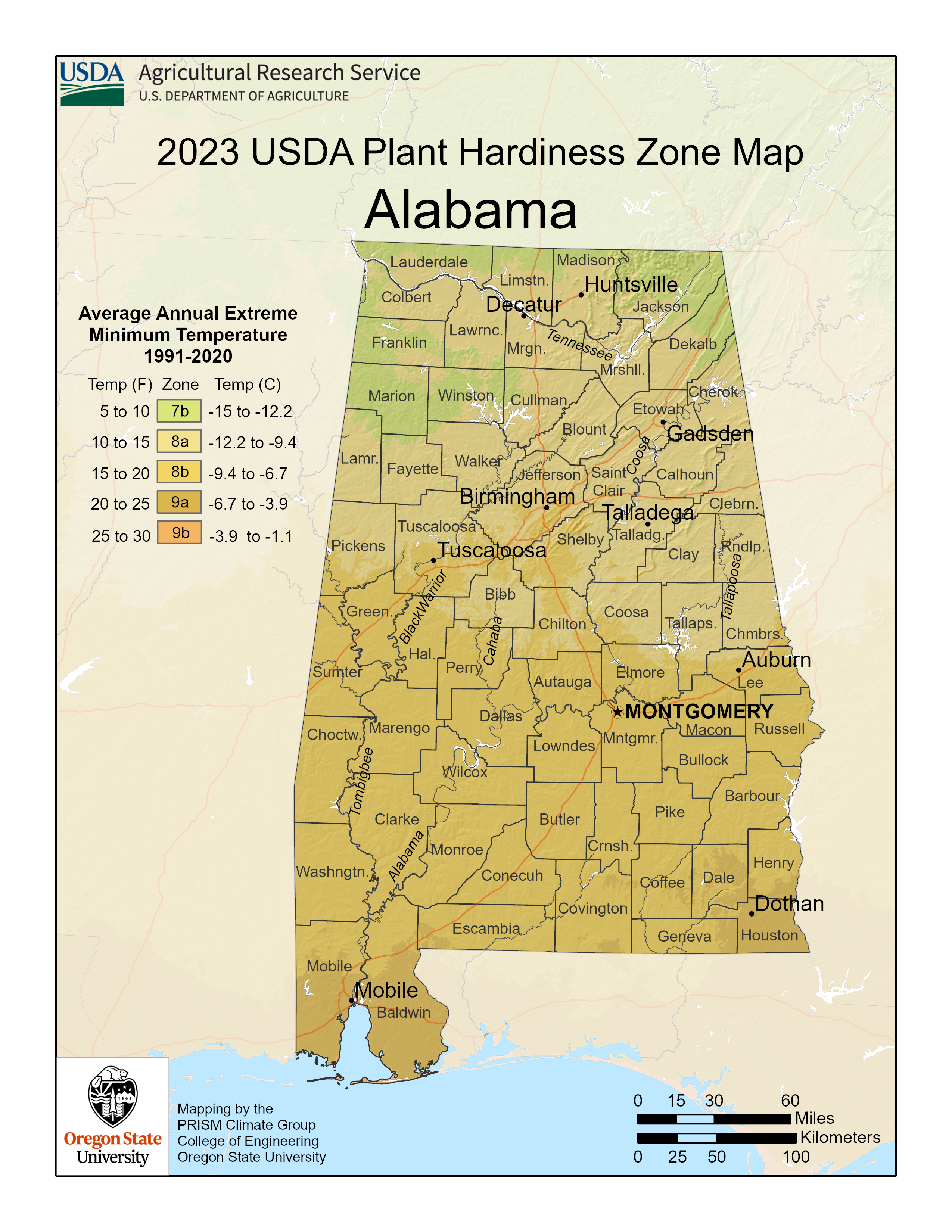
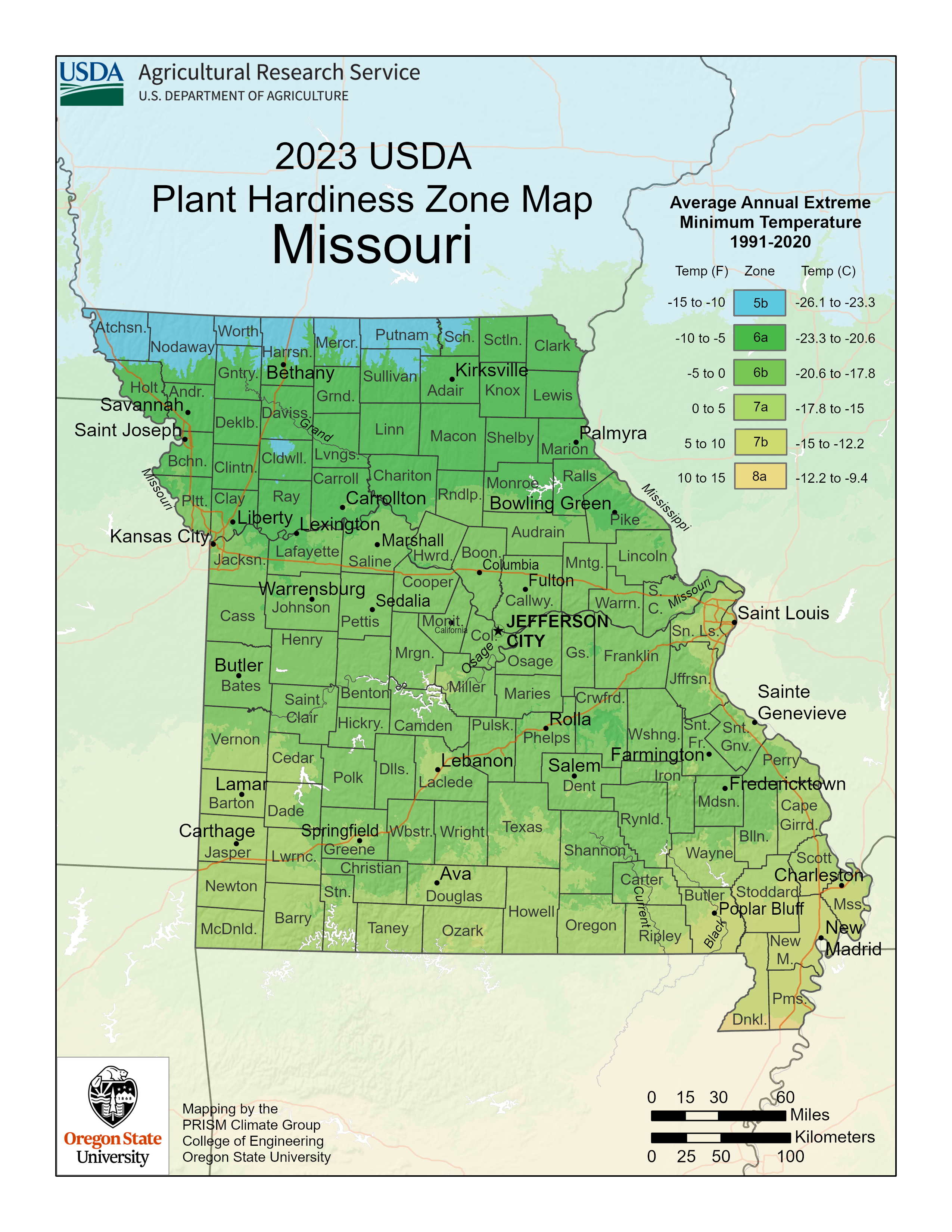
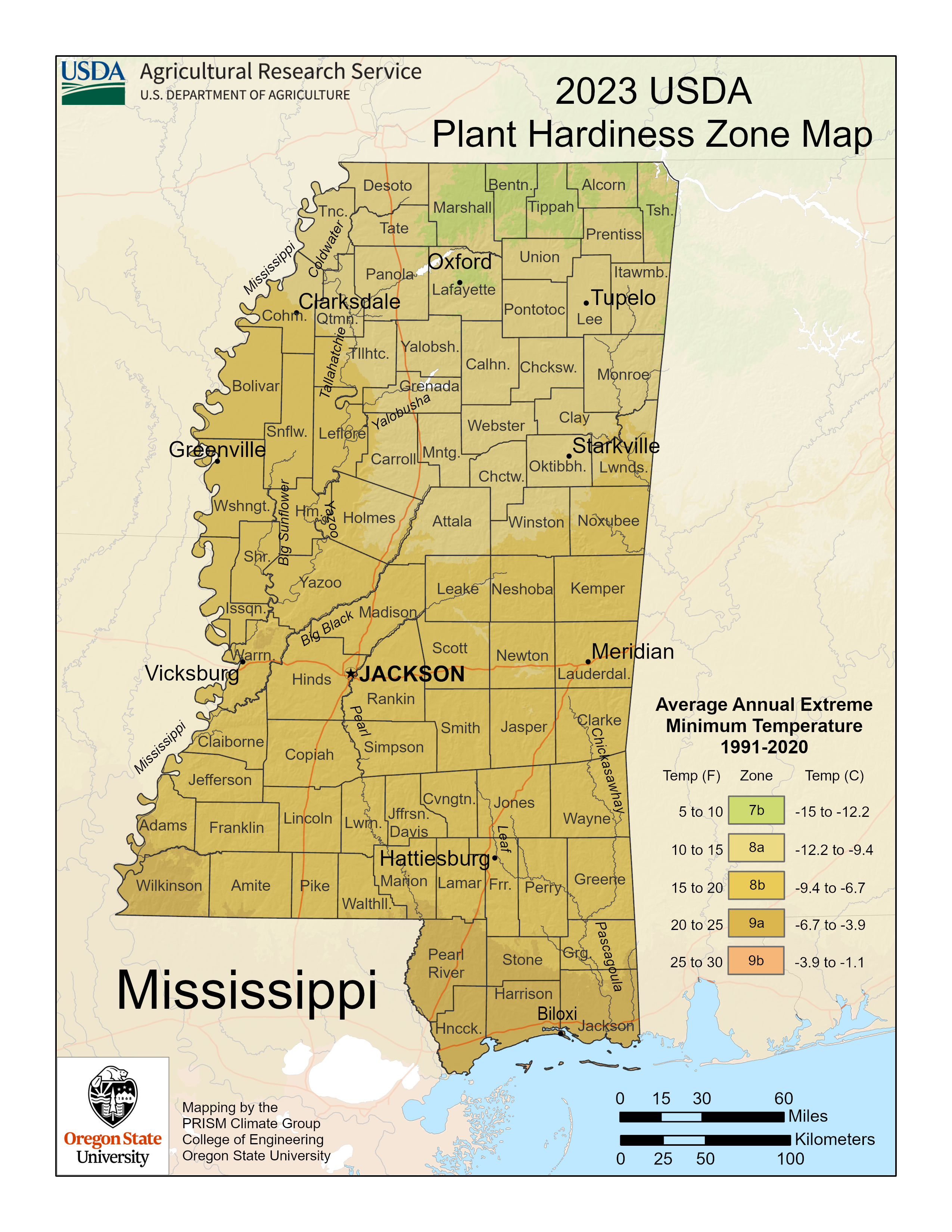
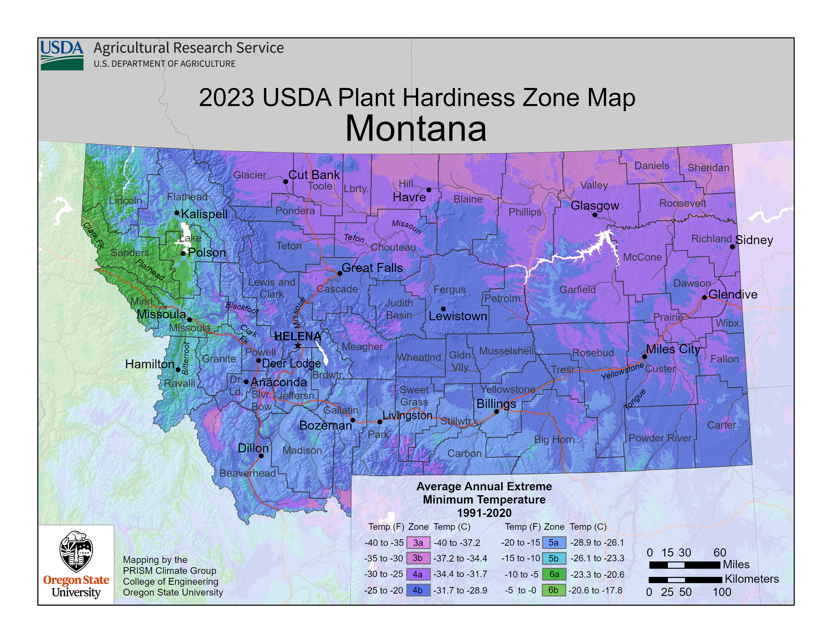
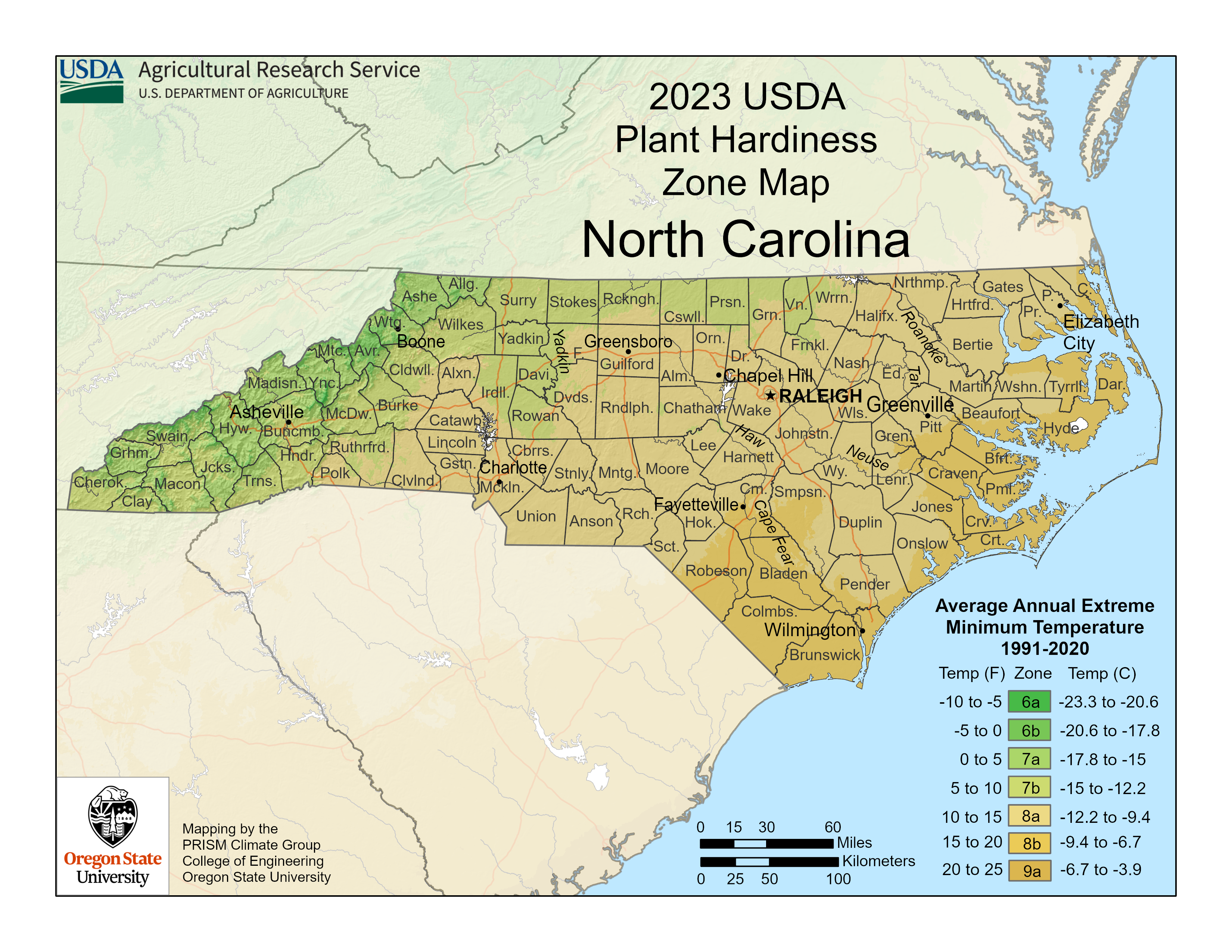
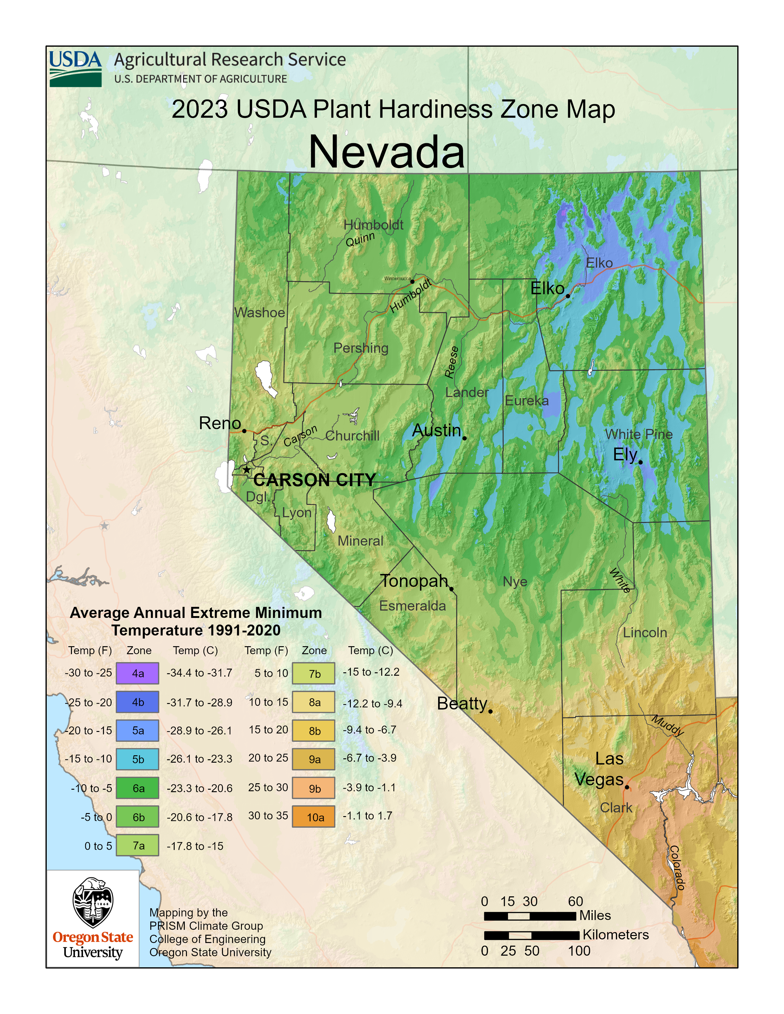
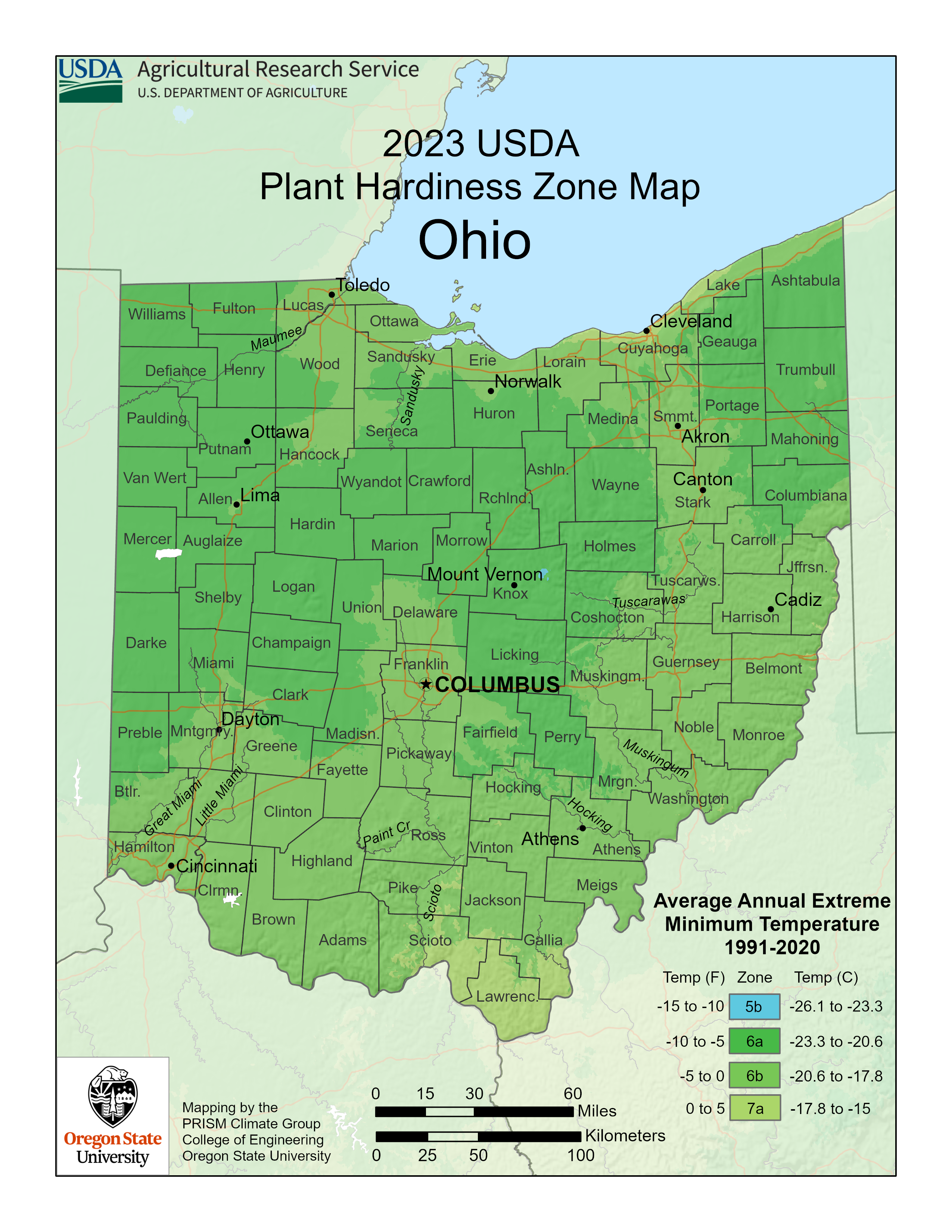
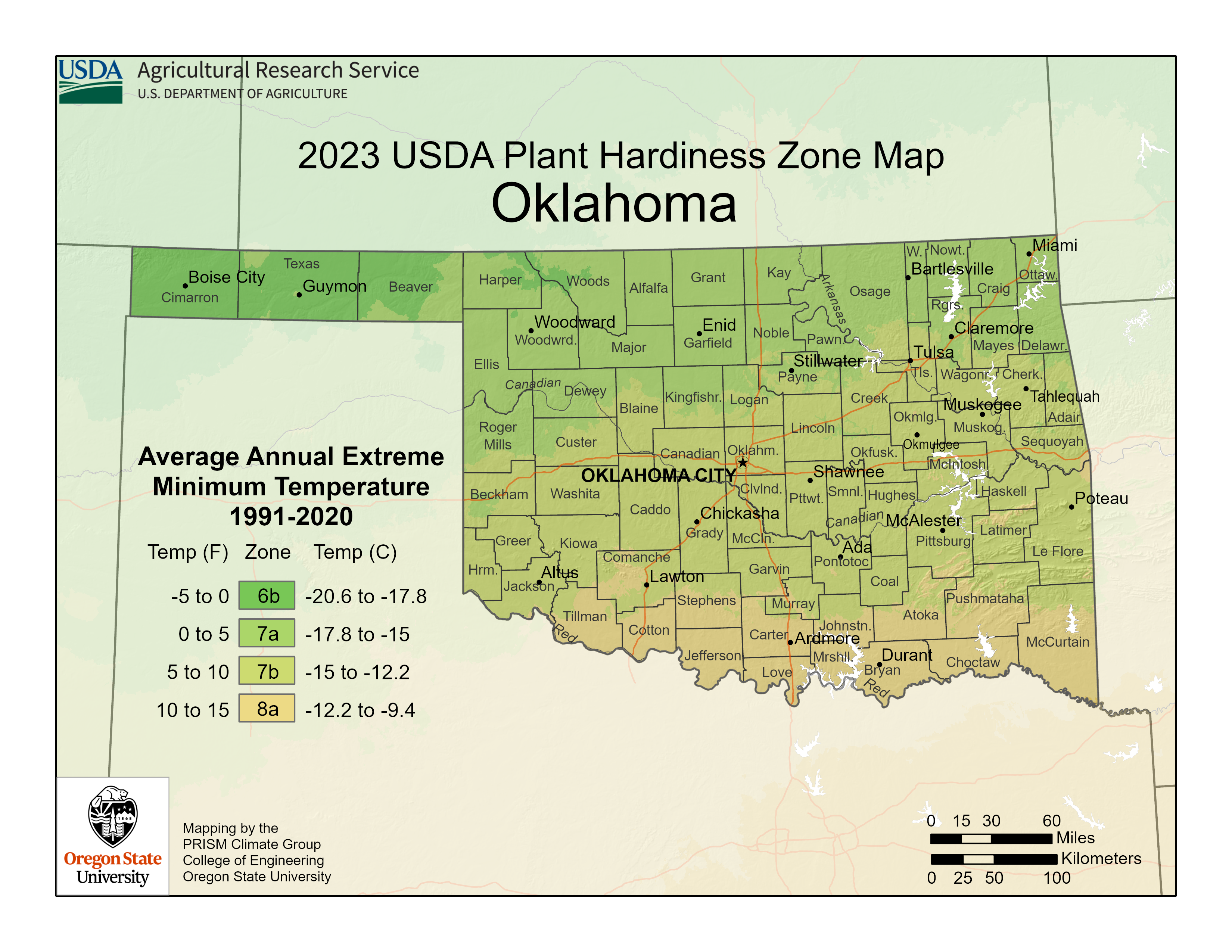
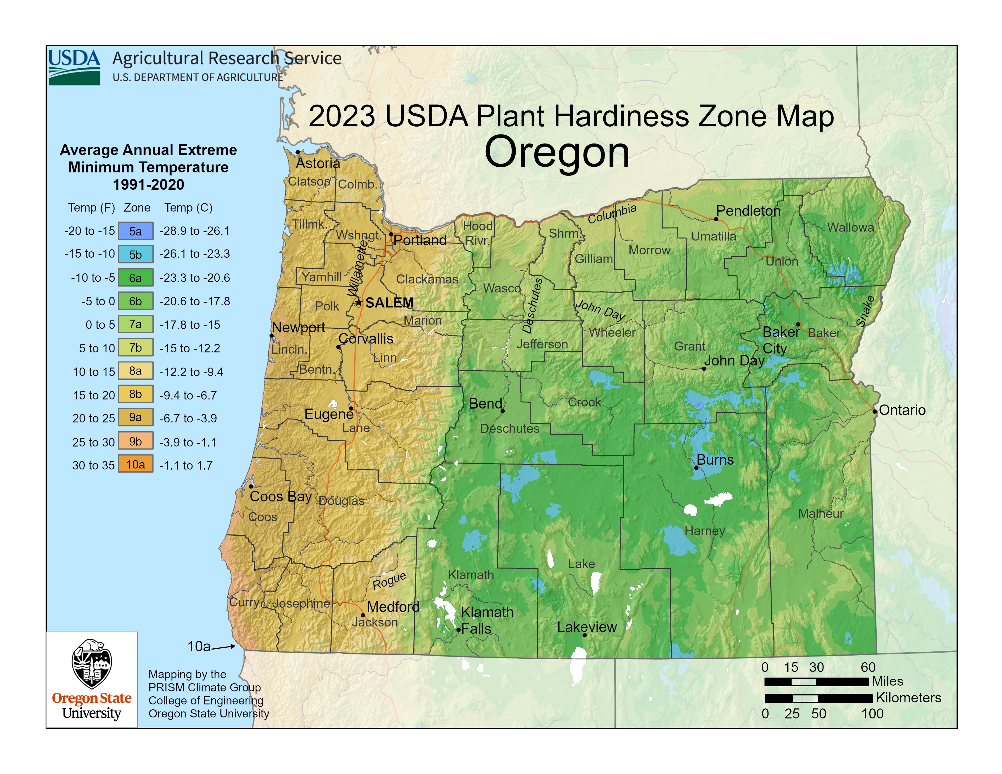
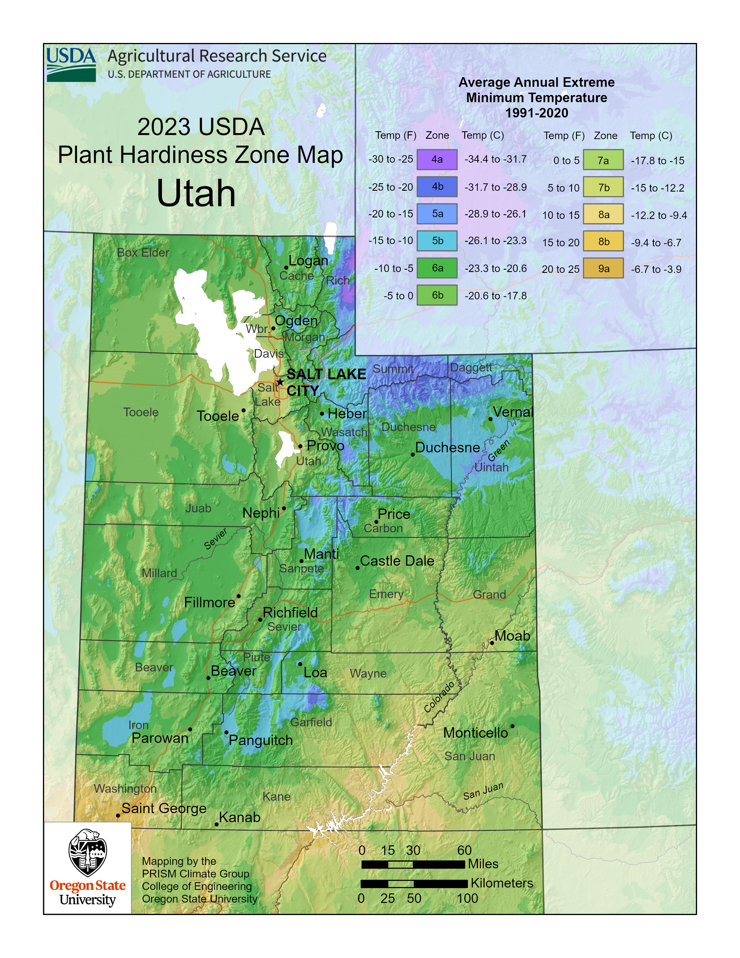
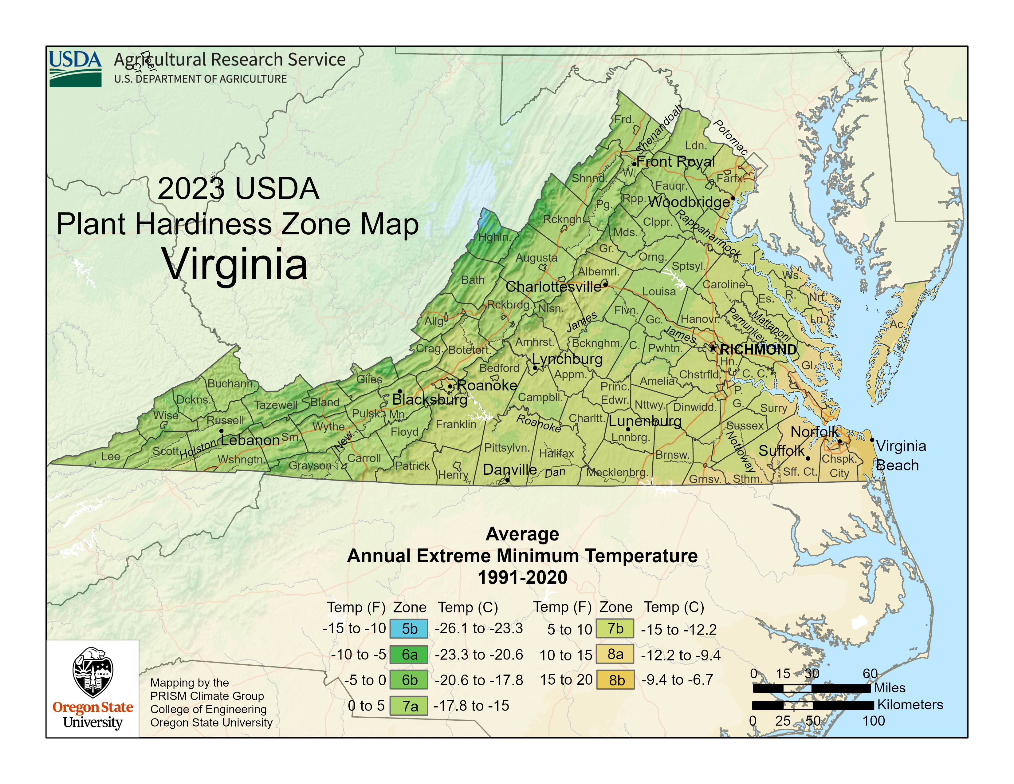
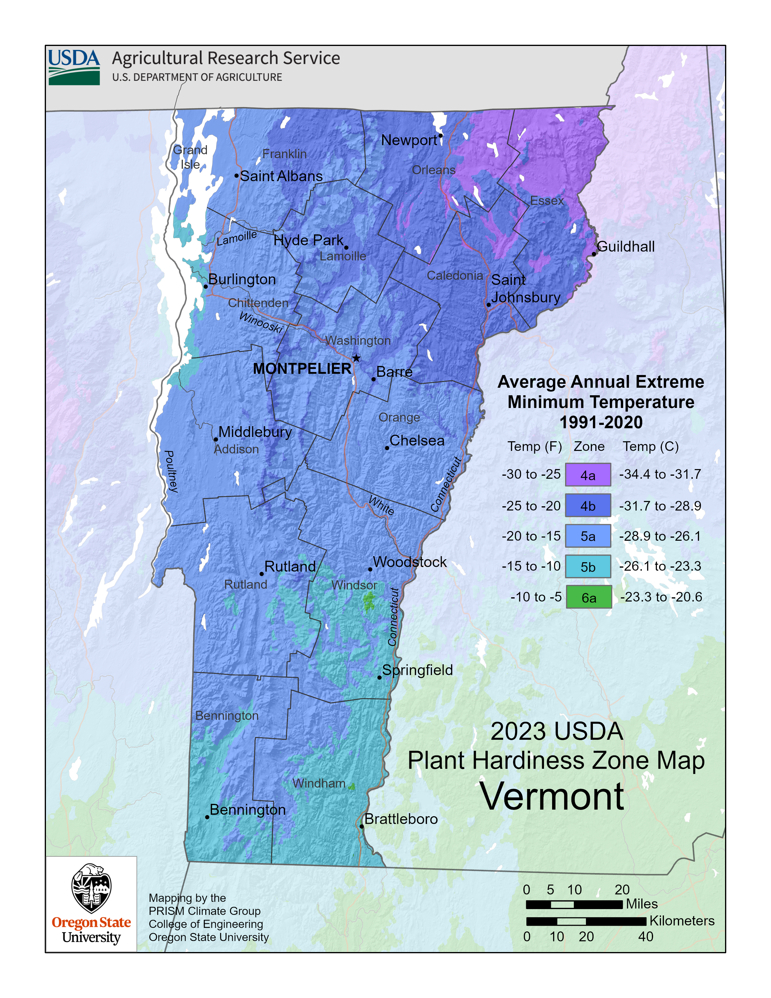
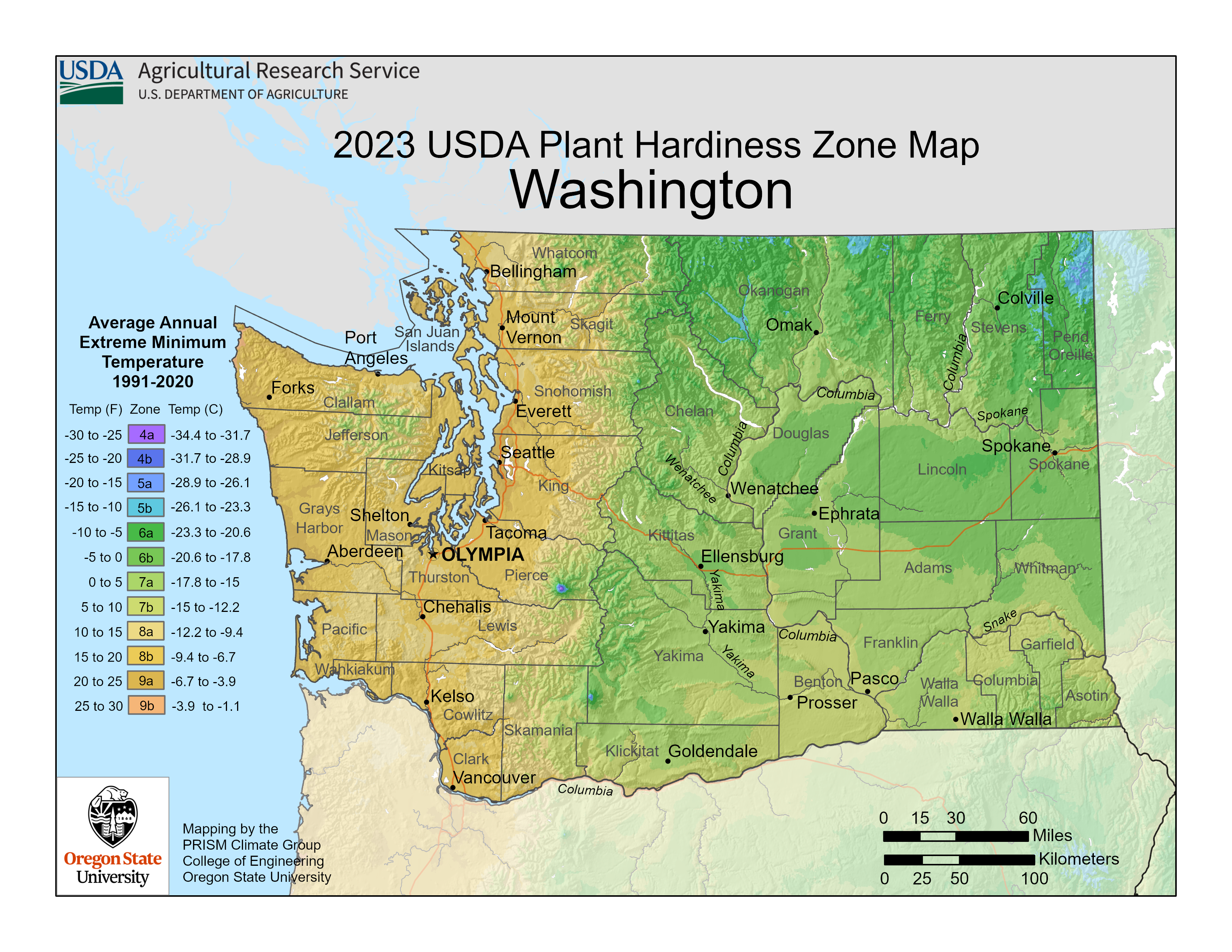
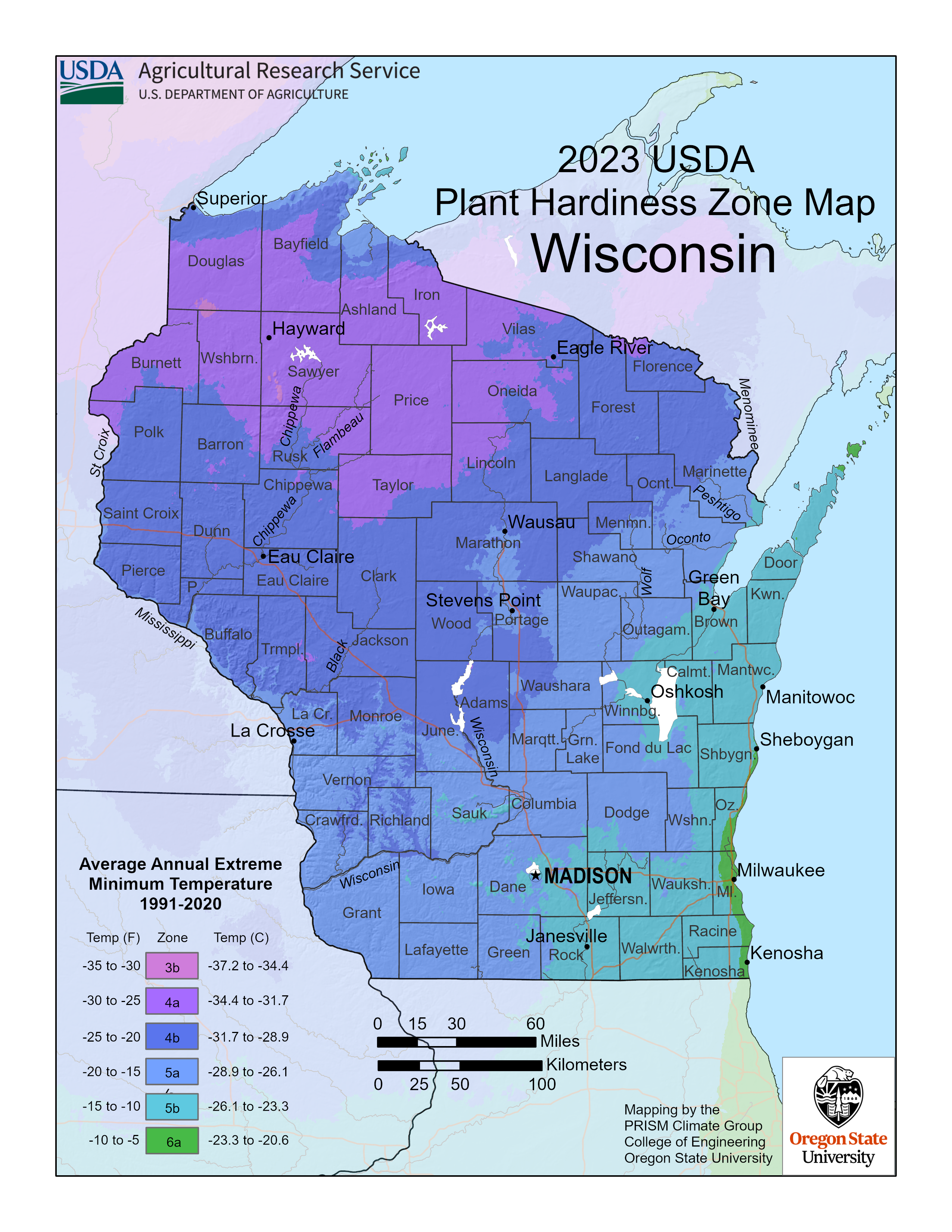
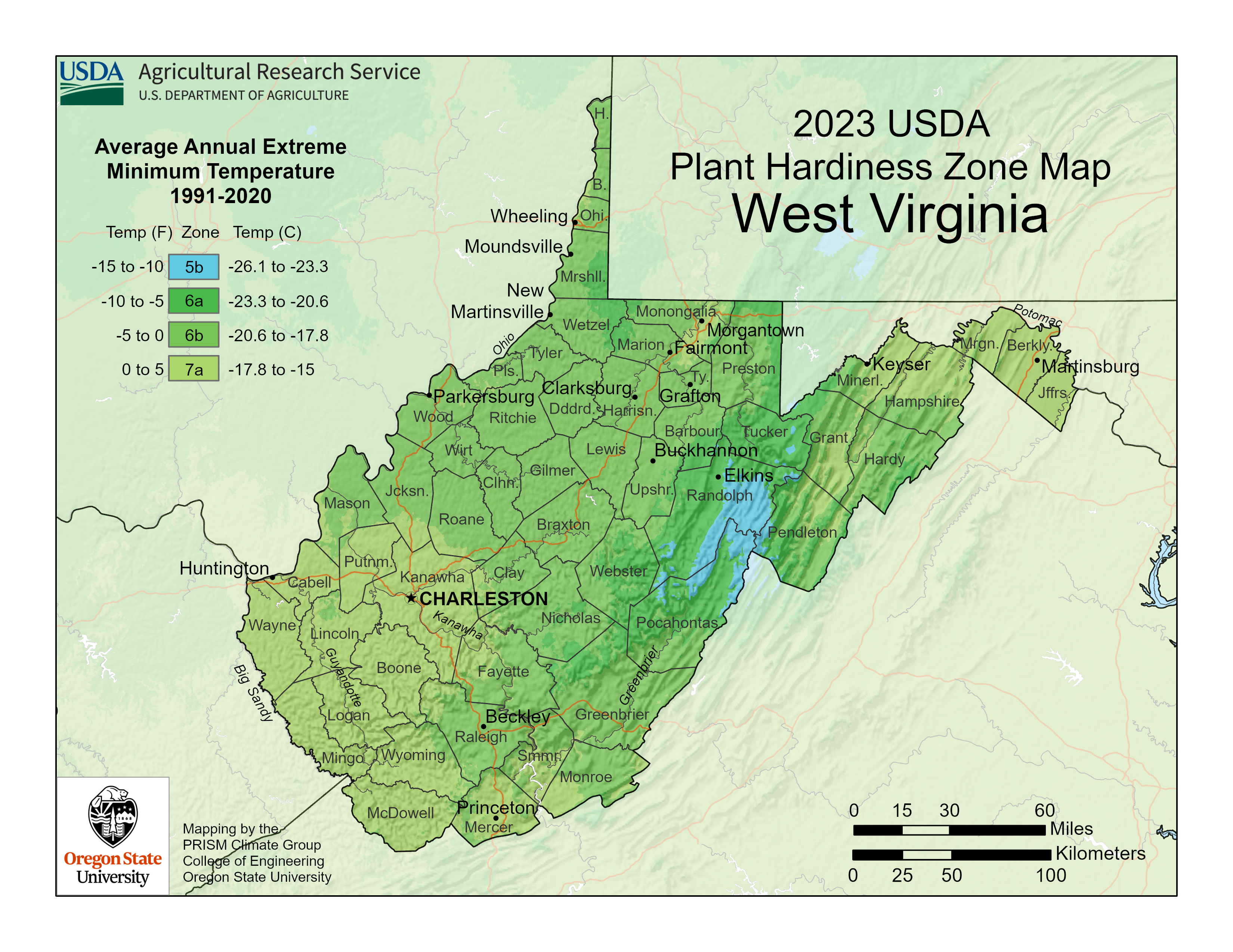
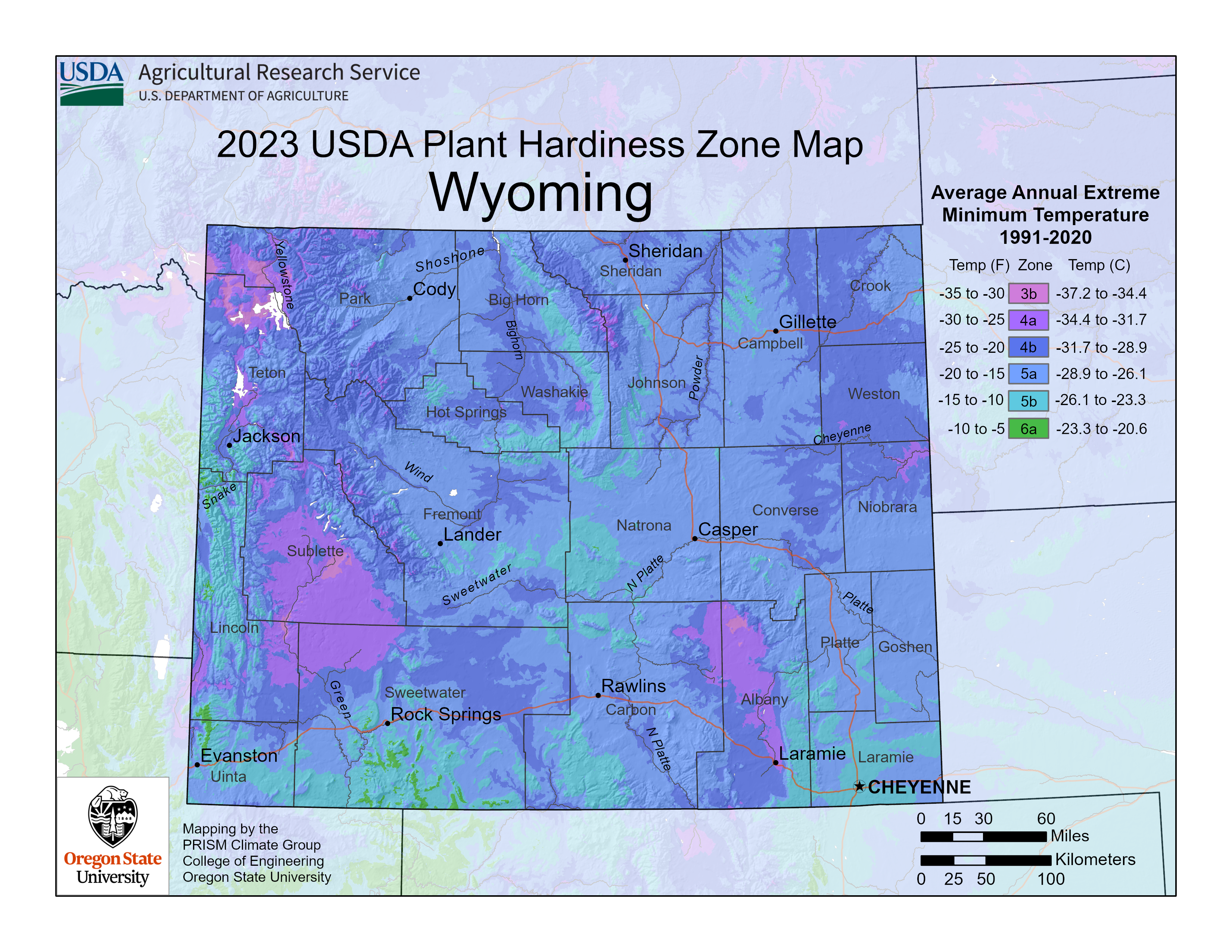
For downloads of state/territory maps, click the state/territory on the map and then select a resolution, or select them from the following dropdown menus. State/Territory maps are available in 150 or 300 dpi, in PNG format.
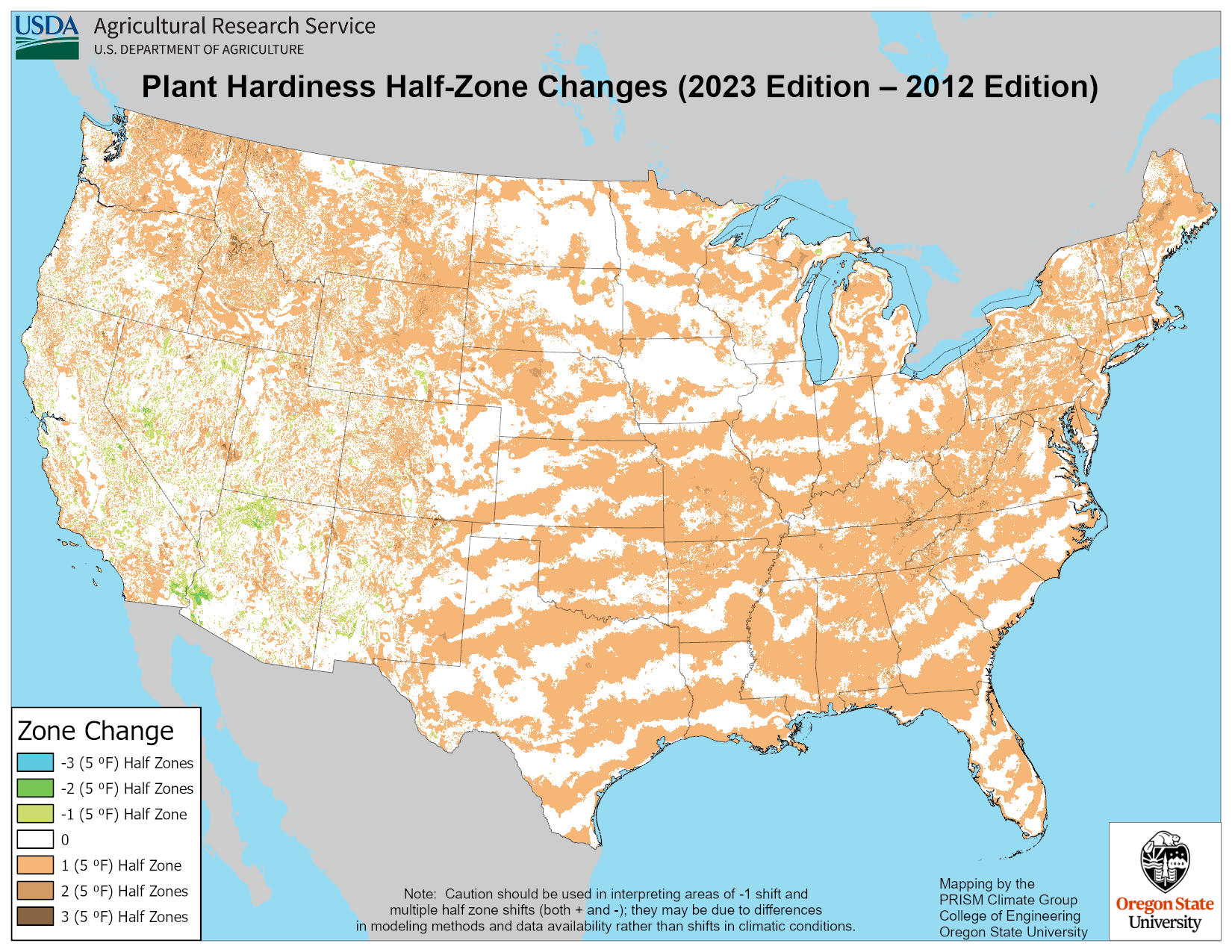
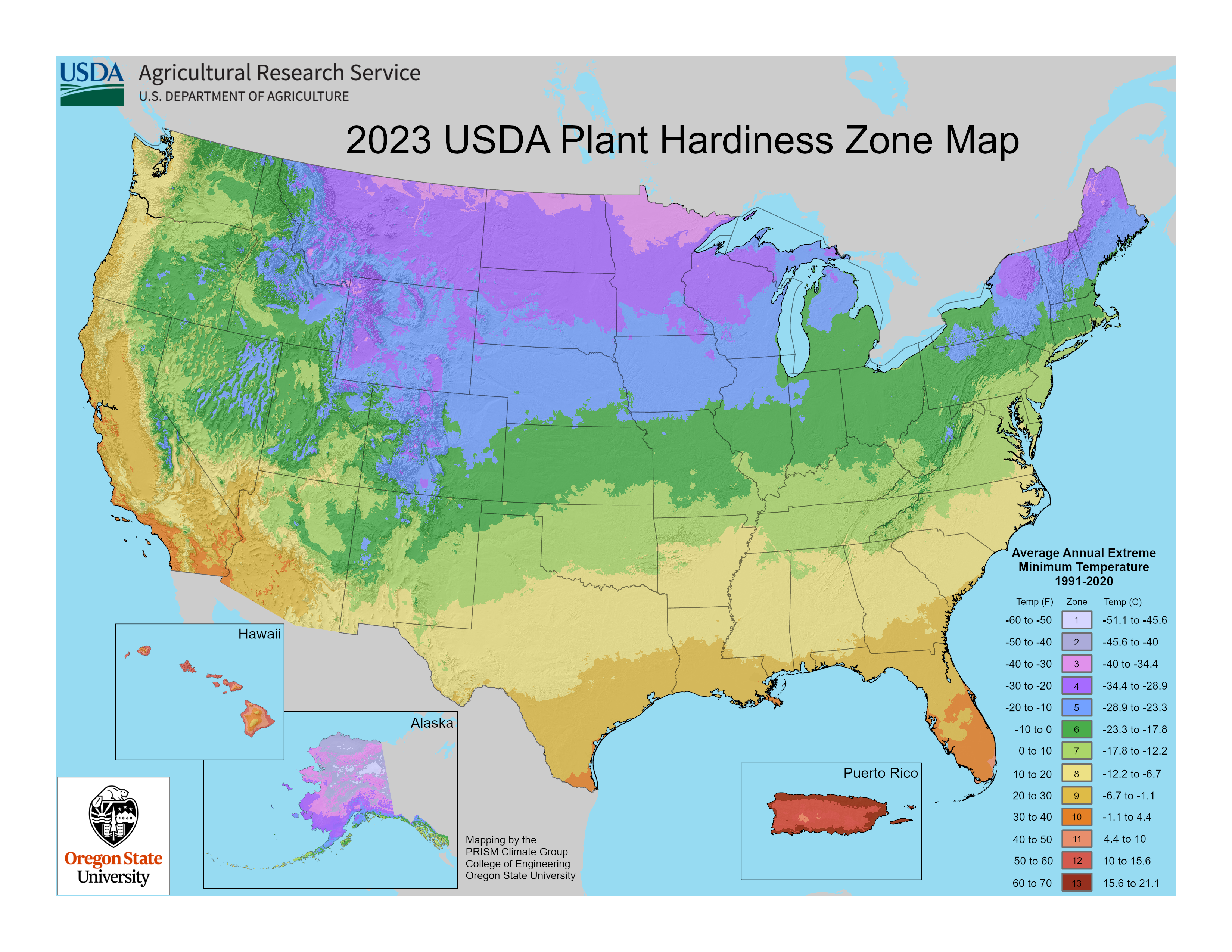
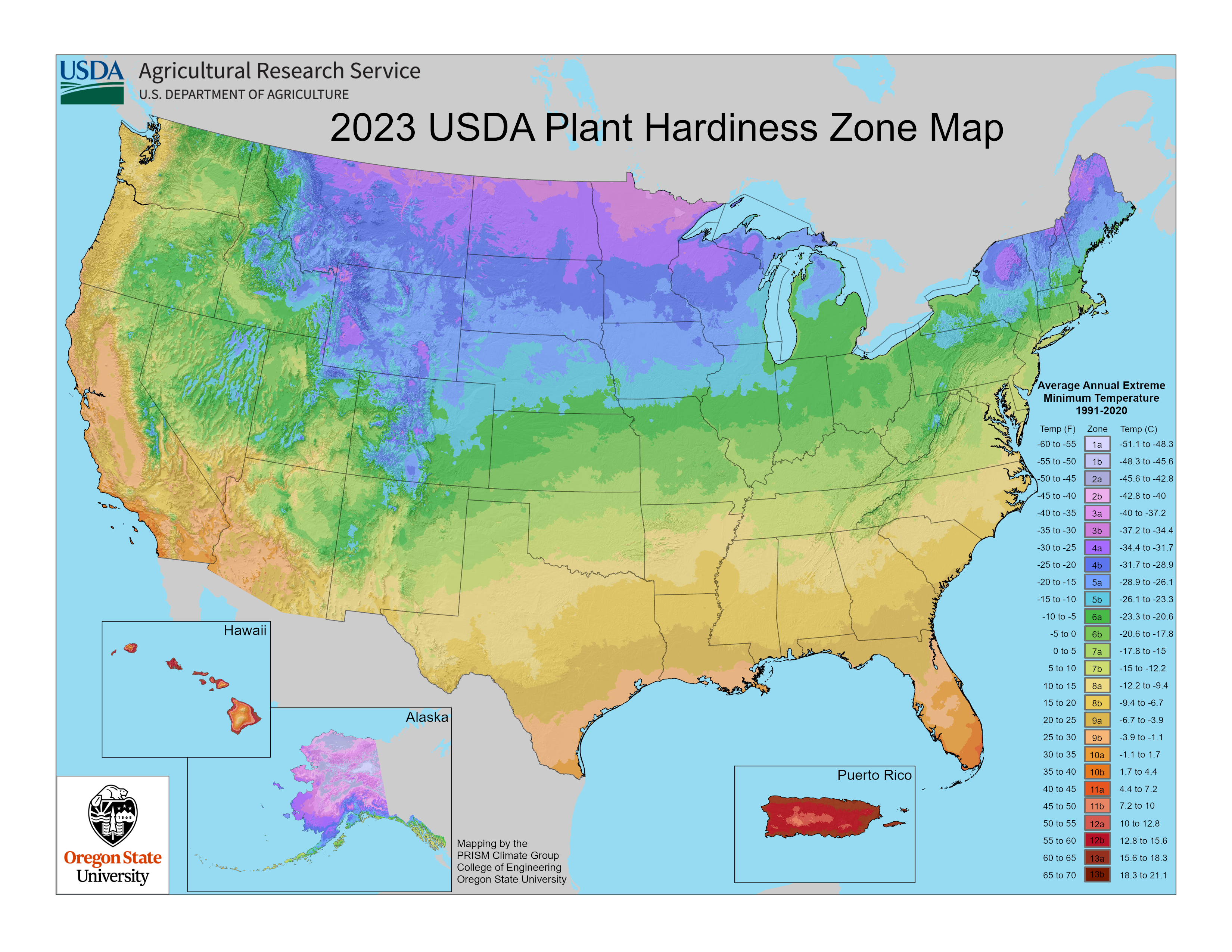
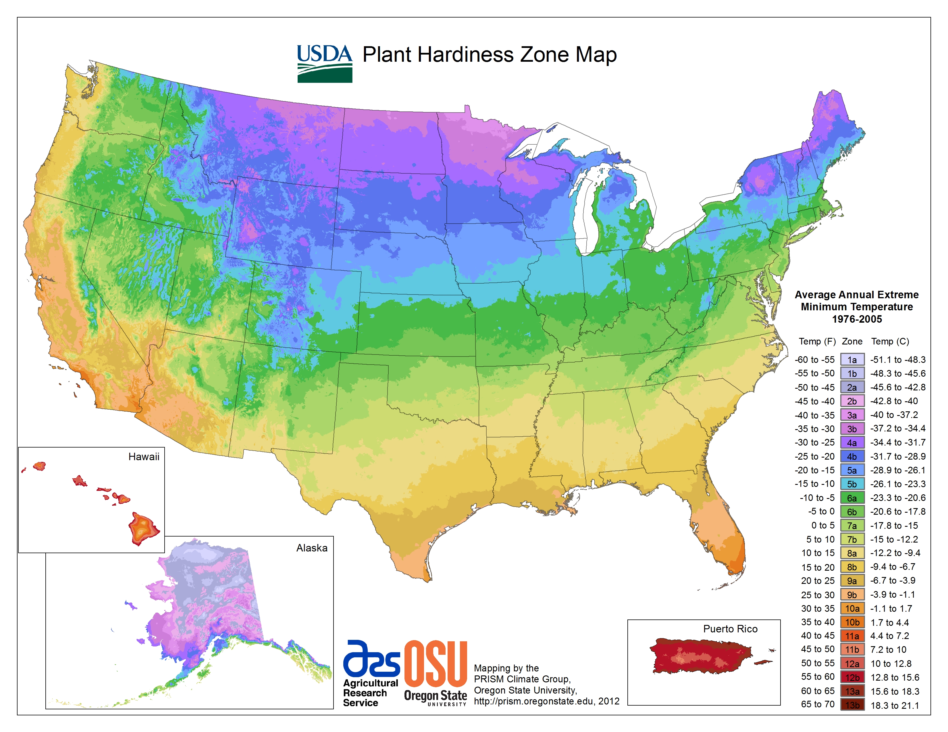
National
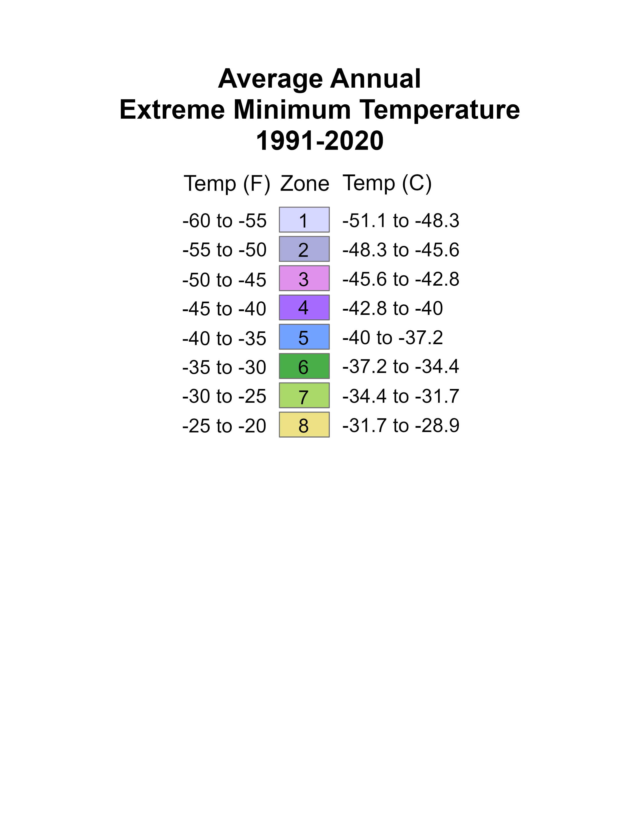
National maps are available in three types: Half Zones, Full Zones, and 2023-2012 Difference. Half Zones include A/B subdivisions, for more specific temperature ranges at a location. Full Zones do not include these subdivisions, and are thus broader indications of temperatures. 2023-2012 Difference maps show the change in half zones between the 2023 and 2012 editions of the map. National maps are available in 150 or 300 dpi, in PNG format. For downloads of national maps select them from the following dropdown menus.
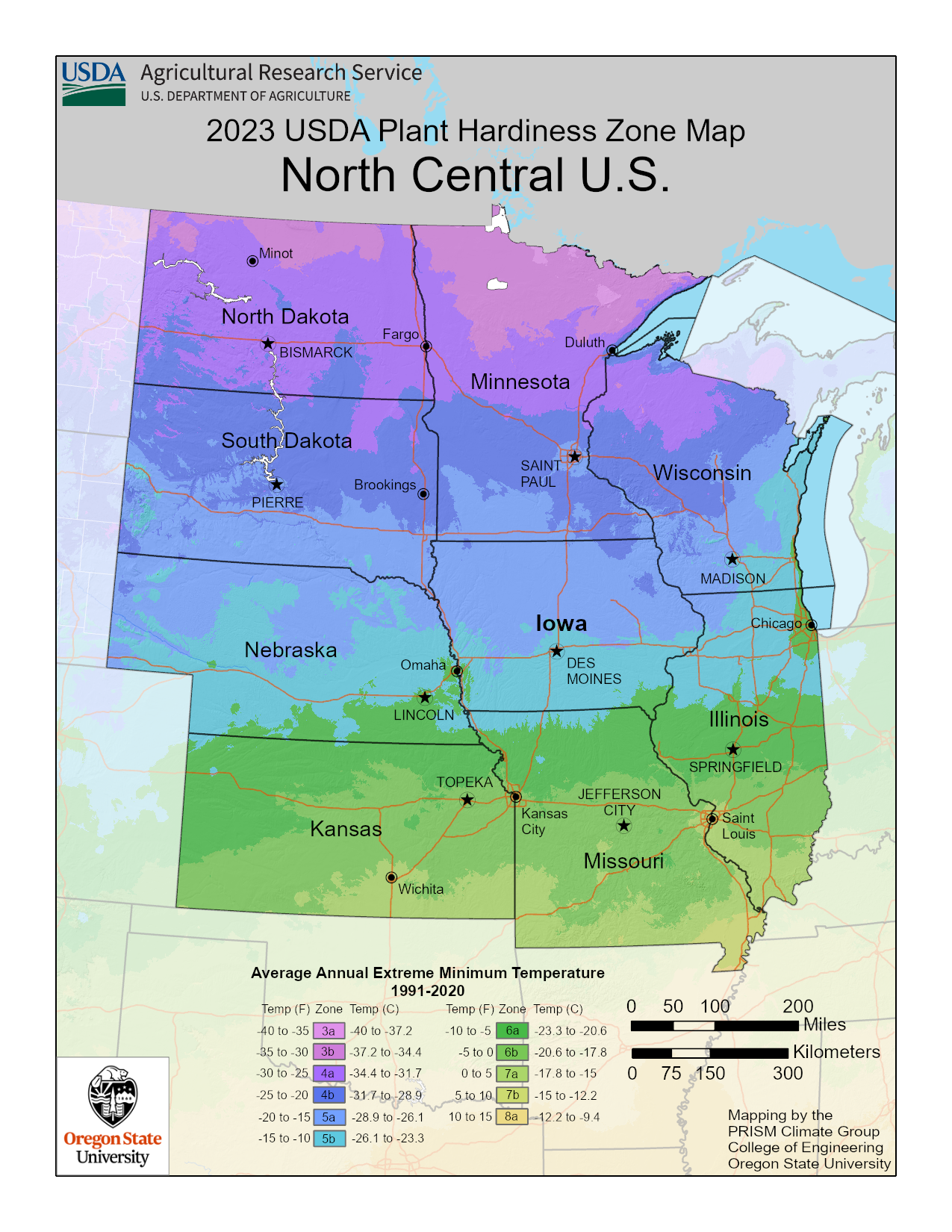
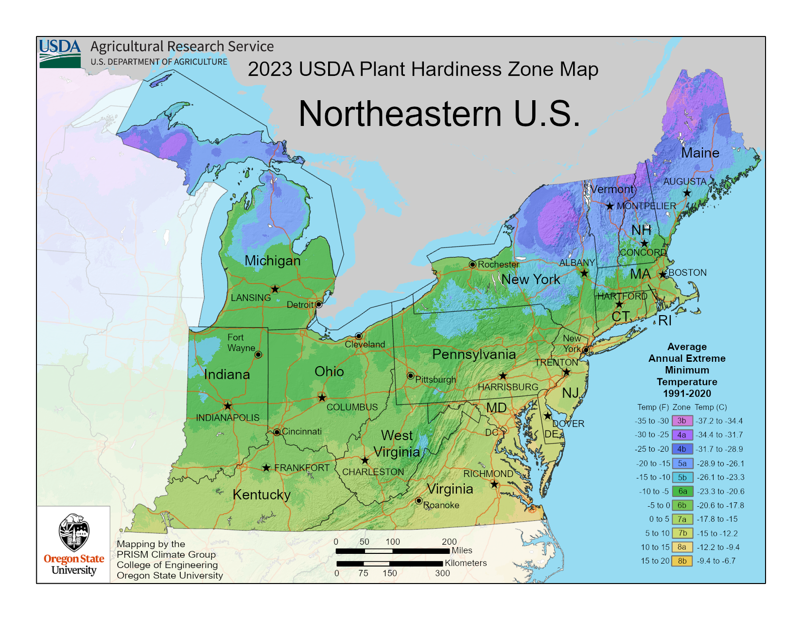
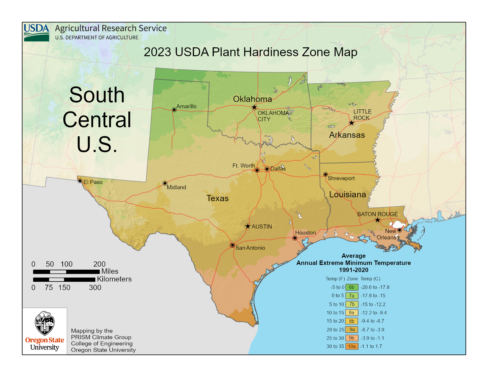
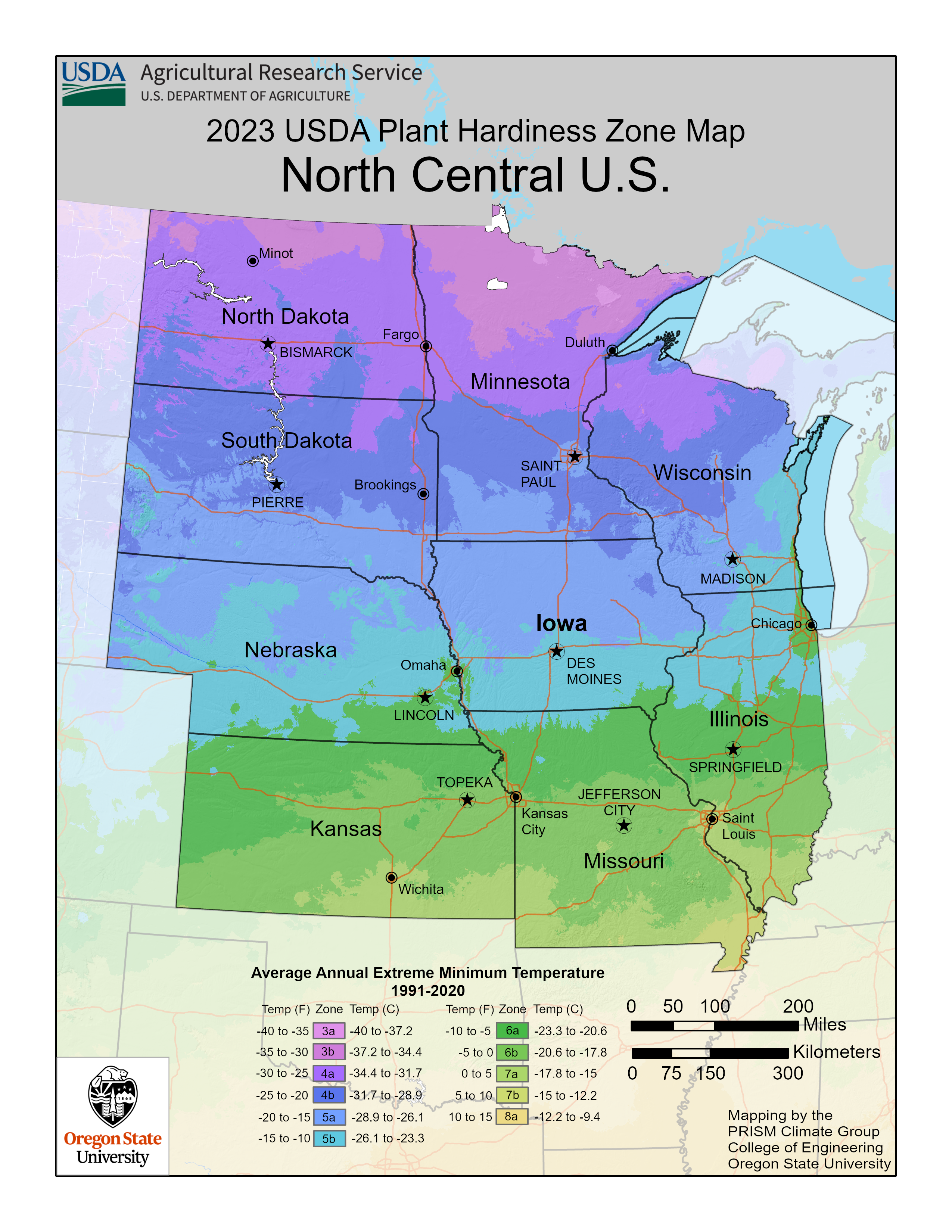
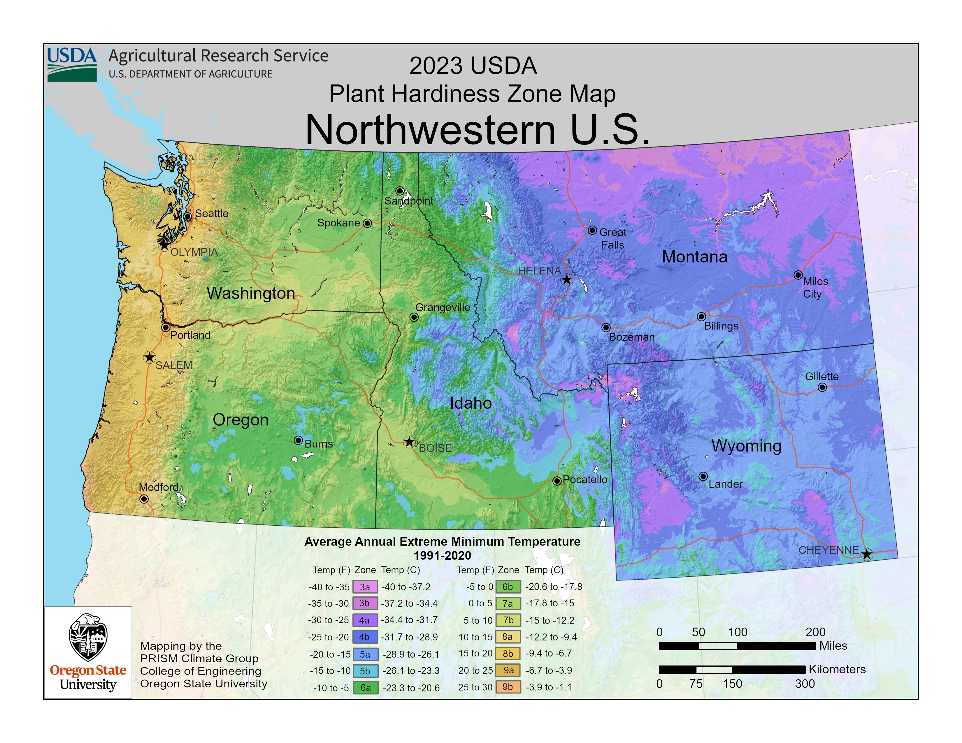
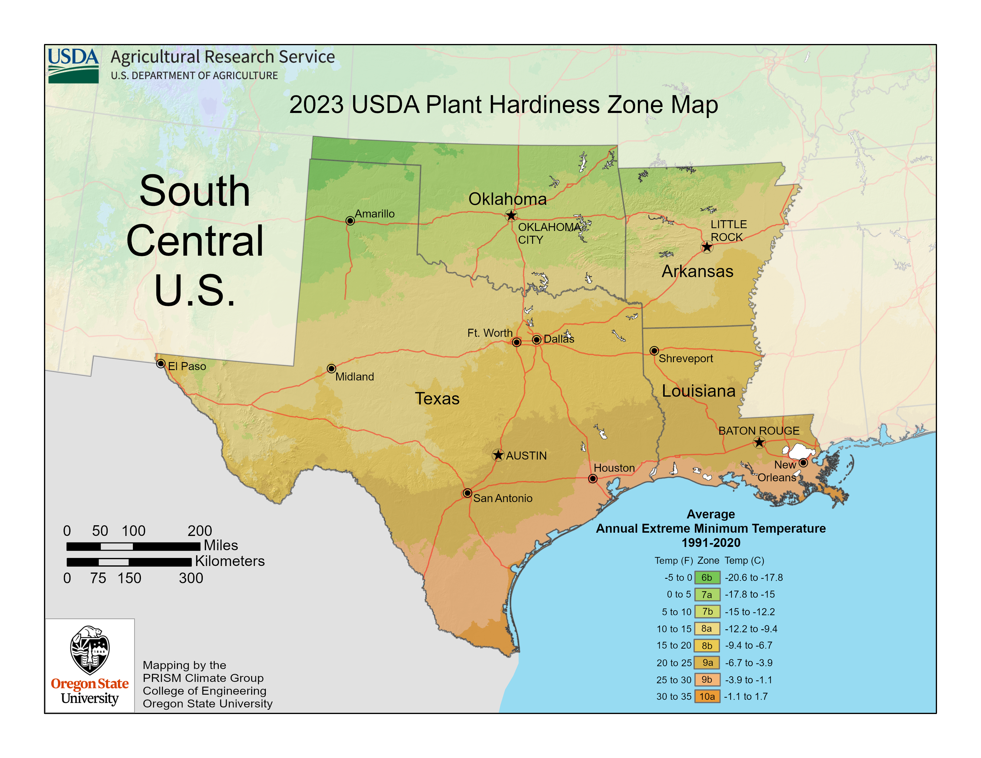
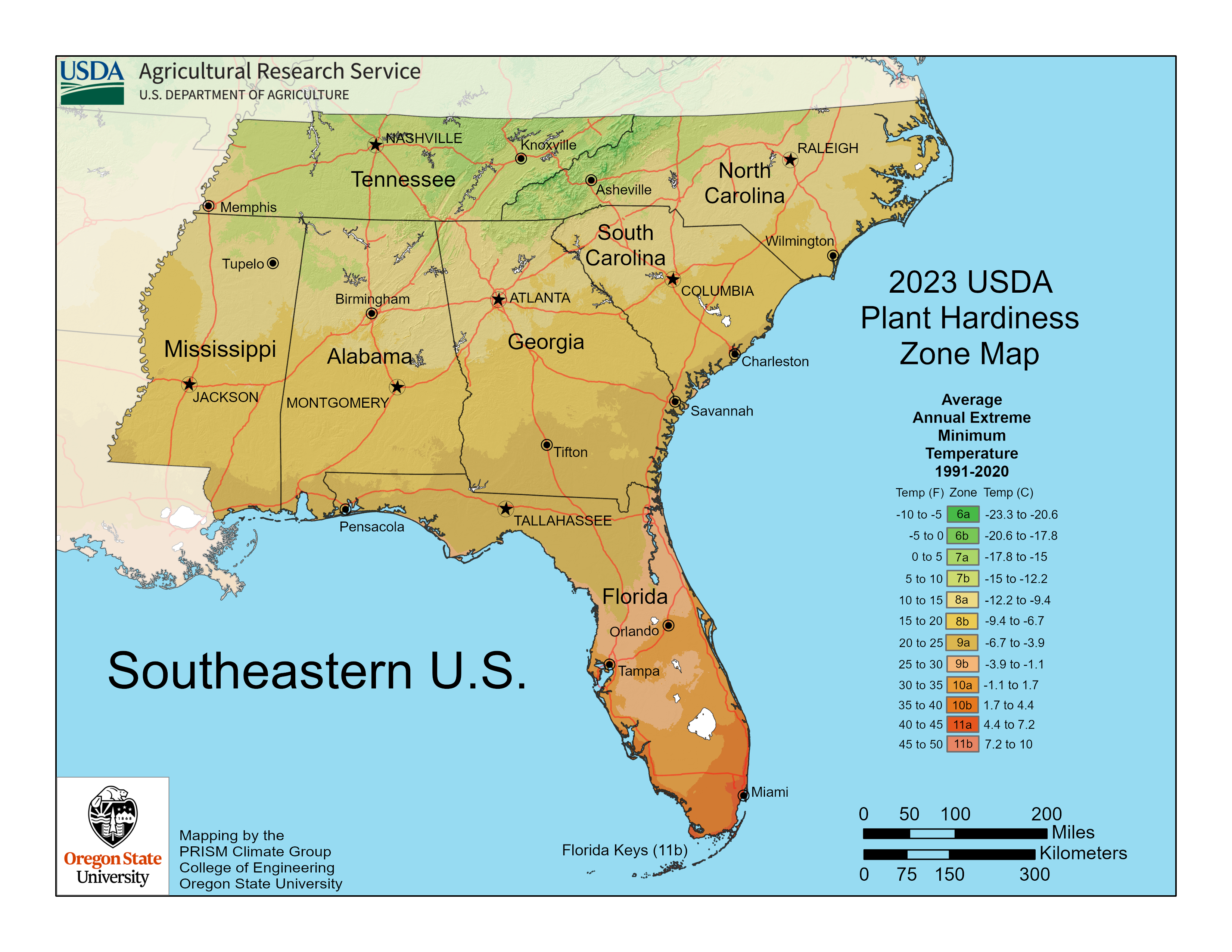
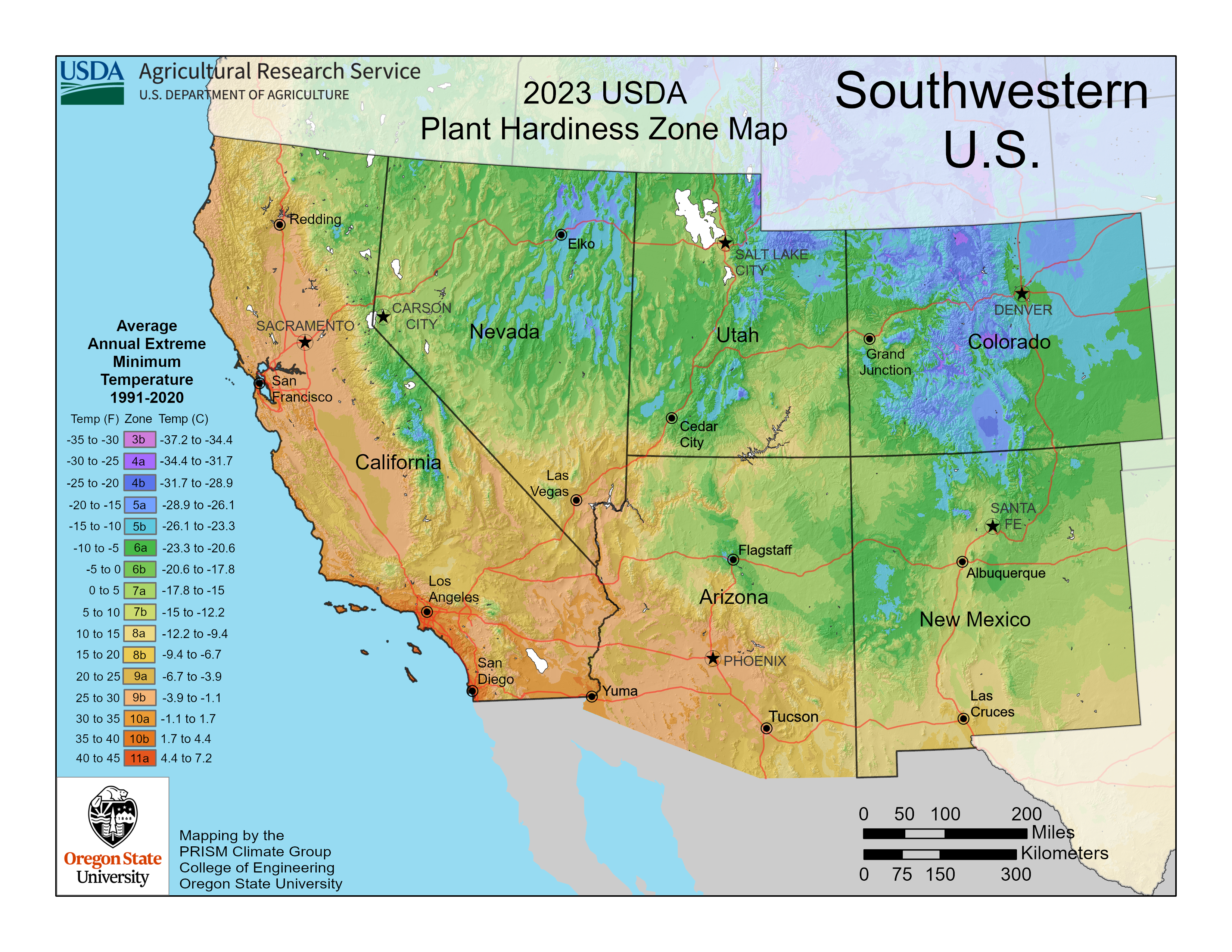
Regional
Regional maps are available 150 or 300 dpi, in PNG format. For downloads of regional maps use the following dropdown menus.
Print Quality Map Downloads
The Plant Hardiness Zone Map is available in a number of sizes and resolutions to meet the needs of graphic artists, printers, and others needing higher resolution or simpler formats.
| File Link | File Type | File Size |
|---|---|---|
| National Map | EPS | 45 MB |
| National Map | JPG | 37 MB |
| National Map | 16 MB | |
| National Map | PNG | 33 MB |
| National Map | SVG | 78 MB |
| National Map | TIF | 66 MB |
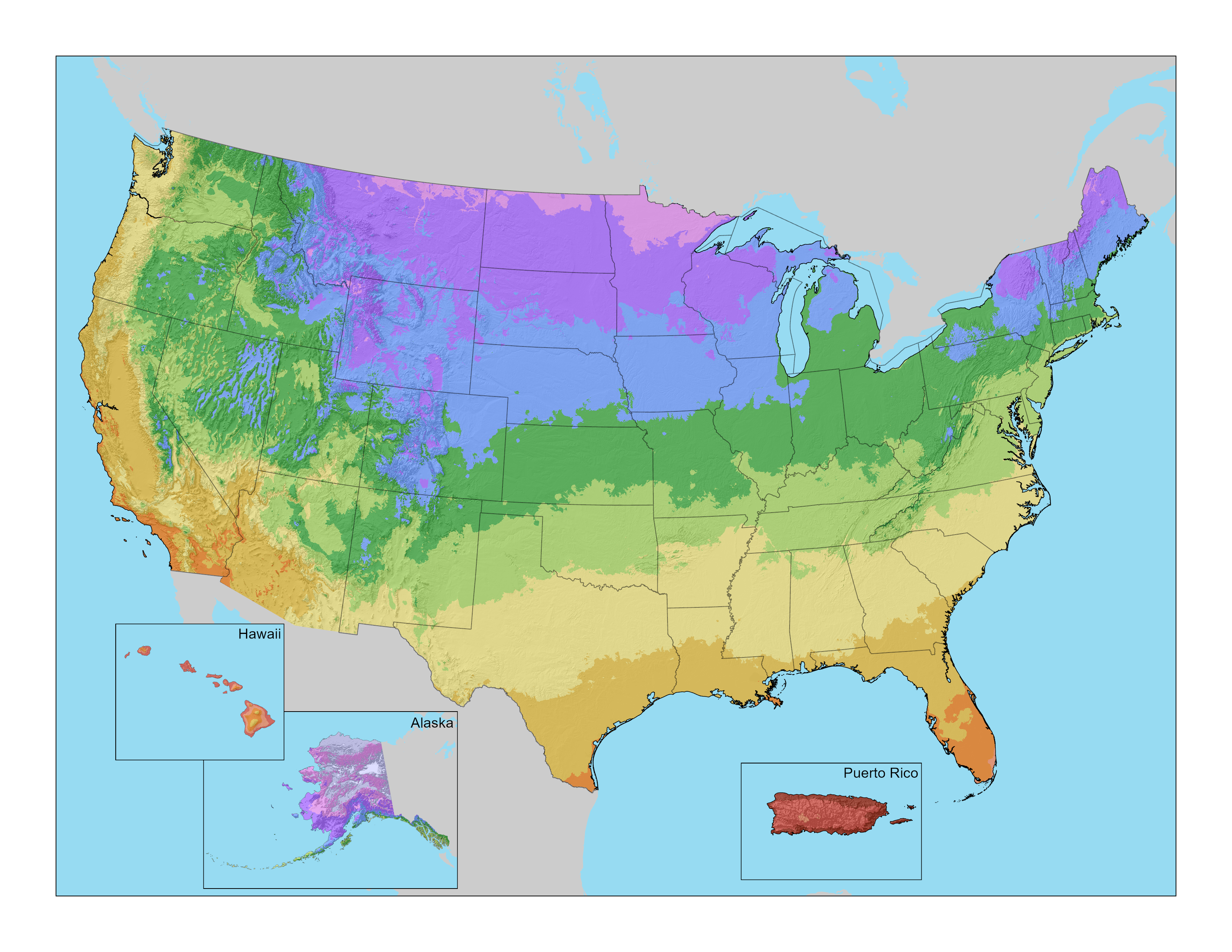
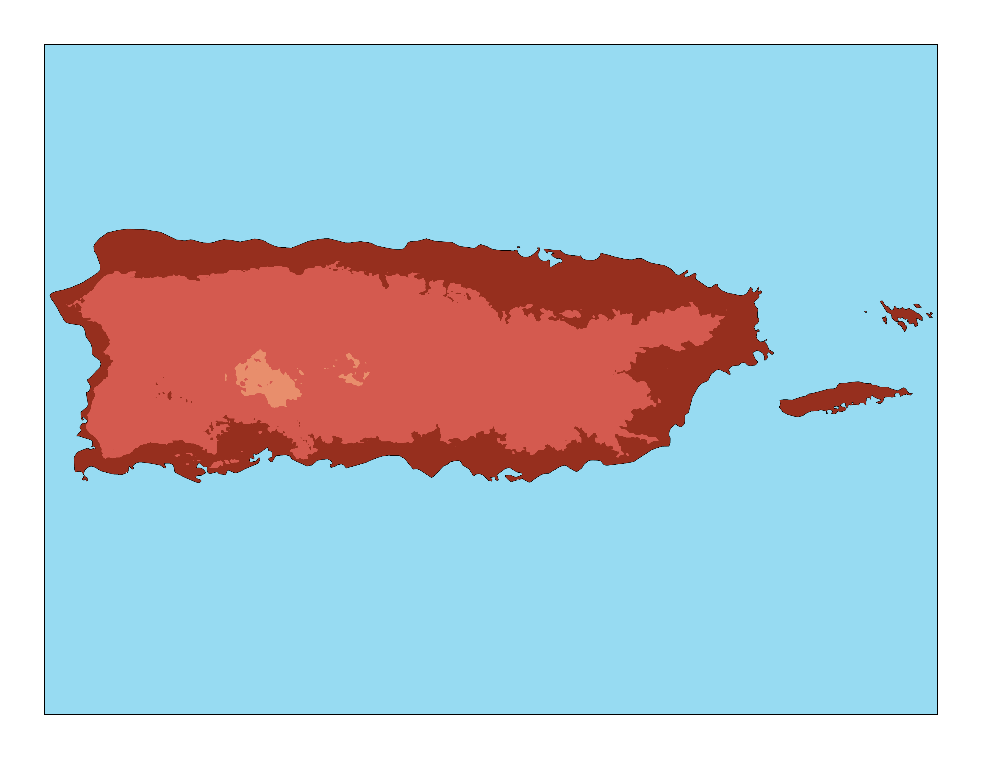
Simplified Map Components
Simplified map components are available as separate maps and legends, without titles, without A/B zone divisions, both with and without a terrain relief background. All map components are 300 dpi and in PNG format.
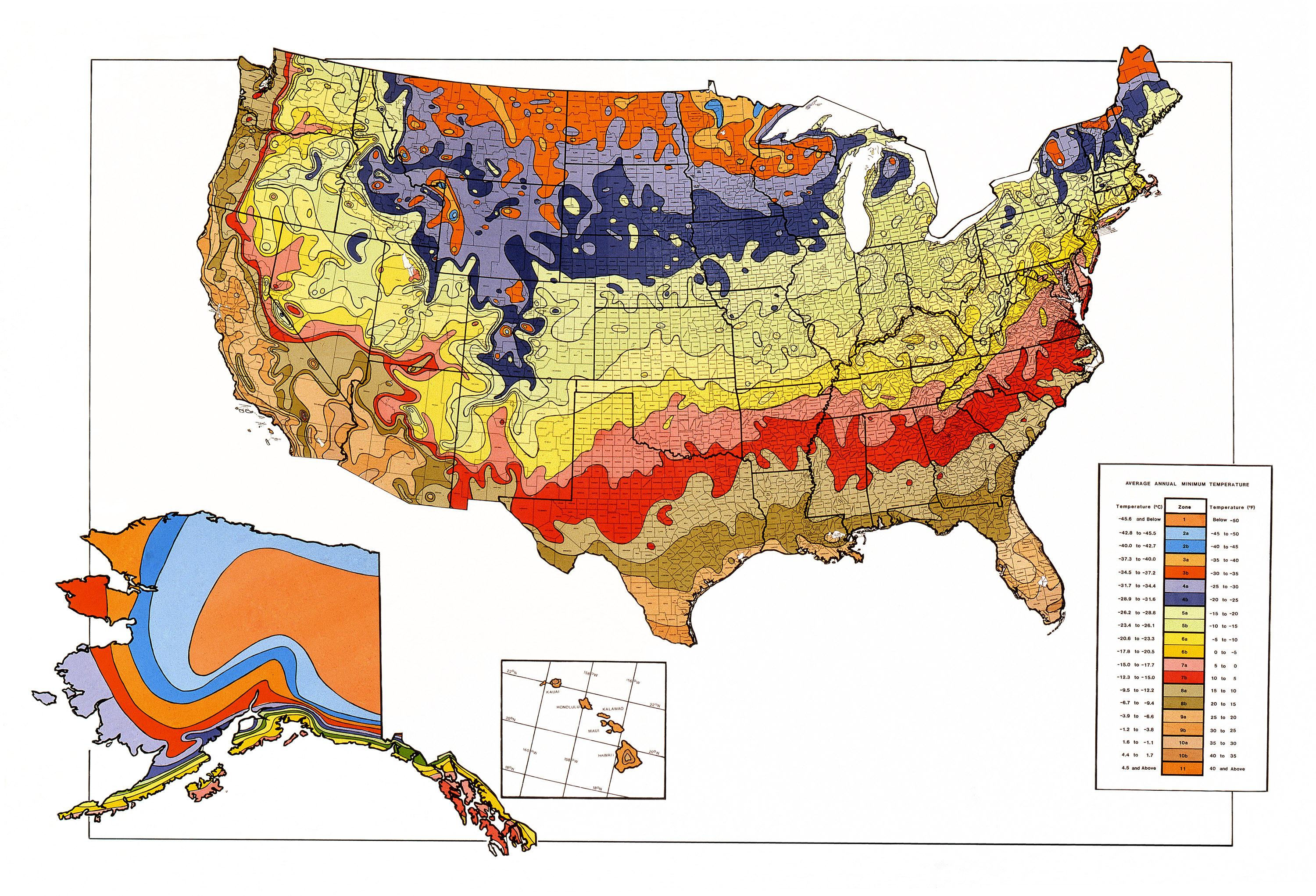
Previous Editions of the Map
| File Link | Year |
|---|---|
| National Map | 1990 |
| National Map | 2012 |
Questions?
For questions about the Plant Hardiness Zone Map, email phzminfo@usda.gov.